Download
1 / 1
10 likes | 102 Views
Impact Of Local Analysis And Prediction System On Coastal/Marine Forecasts from NWS Key West Paul Ruscher , Andrew Devanas , Holly Anderson, John Turner Department of Meteorology | The Florida State University | NWS Key West COMET Partners Program | UCAR Project No. S06-58381. P2.5.

E N D
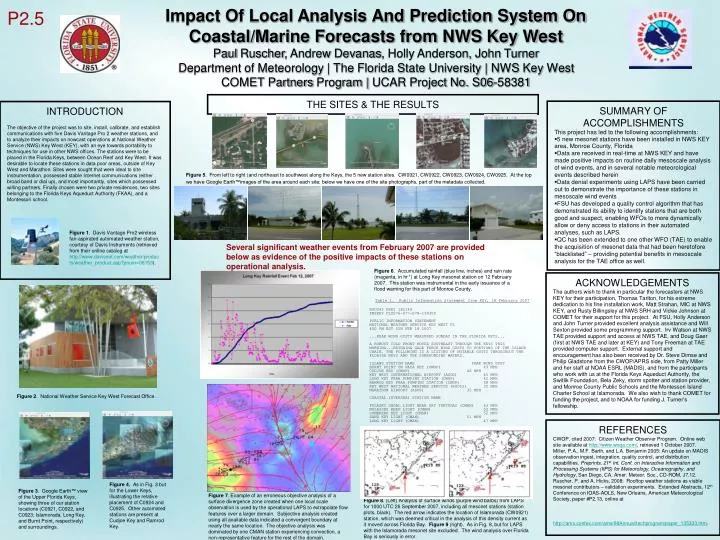
Impact Of Local Analysis And Prediction System On Coastal/Marine Forecasts from NWS Key West Paul Ruscher, Andrew Devanas, Holly Anderson, John Turner Department of Meteorology | The Florida State University | NWS Key West COMET Partners Program | UCAR Project No. S06-58381 P2.5 THE SITES & THE RESULTS SUMMARY OF ACCOMPLISHMENTS This project has led to the following accomplishments: • 5 new mesonet stations have been installed in NWS KEY area, Monroe County, Florida • Data are received in real-time at NWS KEY and have made positive impacts on routine daily mesoscale analysis of wind events, and in several notable meteorological events described herein • Data denial experiments using LAPS have been carried out to demonstrate the importance of these stations in mesoscale wind events • FSU has developed a quality control algorithm that has demonstrated its ability to identify stations that are both good and suspect, enabling WFOs to more dynamically allow or deny access to stations in their automated analyses, such as LAPS. • QC has been extended to one other WFO (TAE) to enable the acquisition of mesonet data that had been heretofore “blacklisted” – providing potential benefits in mesoscale analysis for the TAE office as well. INTRODUCTION The objective of the project was to site, install, calibrate, and establish communications with five Davis Vantage Pro 2 weather stations, and to analyze their impacts on nowcast operations at National Weather Service (NWS) Key West (KEY), with an eye towards portability to techniques for use in other NWS offices. The stations were to be placed in the Florida Keys, between Ocean Reef and Key West. It was desirable to locate these stations in data poor areas, outside of Key West and Marathon. Sites were sought that were ideal to site instrumentation, possessed stable Internet communications (either broad band or dial up), and most importantly, sites which possessed willing partners. Finally chosen were two private residences, two sites belonging to the Florida Keys Aqueduct Authority (FKAA), and a Montessori school. Figure 5. From left to right (and northeast to southwest along the Keys, the 5 new station sites. CW0921, CW0922, CW0923, CW0924, CW0925. At the top we have Google Earth™images of the area around each site; below we have one of the site photographs, part of the metadata collected. Figure 1. Davis Vantage Pro2 wireless fan-aspirated automated weather station, courtesy of Davis Instruments (retrieved from their online catalog at http://www.davisnet.com/weather/products/weather_product.asp?pnum=06153). Several significant weather events from February 2007 are provided below as evidence of the positive impacts of these stations on operational analysis. Figure 6. Accumulated rainfall (blue line, inches) and rain rate (magenta, in hr-1) at Long Key mesonet station on 12 February 2007. This station was instrumental in the early issuance of a flood warning for this part of Monroe County. ACKNOWLEDGEMENTS The authors wish to thank in particular the forecasters at NWS KEY for their participation, Thomas Tarlton, for his extreme dedication to his fine installation work, Matt Strahan, MIC at NWS KEY, and Rusty Billingsley at NWS SRH and Vickie Johnson at COMET for their support for this project. At FSU, Holly Anderson and John Turner provided excellent analysis assistance and Will Sexton provided some programming support. Irv Watson at NWS TAE provided support and access at NWS TAE, and Doug Gaer (first at NWS TAE and later at KEY) and Tony Freeman at TAE provided computer support. External support and encouragement has also been received by Dr. Steve Dimse and Philip Gladstone from the CWOP/APRS side, from Patty Miller and her staff at NOAA ESRL (MADIS), and from the participants who work with us at the Florida Keys Aqueduct Authority, the Switlik Foundation, BelaZeky, storm spotter and station provider, and Monroe County Public Schools and the Montessori Island Charter School at Islamorada. We also wish to thank COMET for funding the project, and to NOAA for funding J. Turner’s fellowship. Table 1. Public Information Statement from KEY, 18 February 2007 NOUS42 KKEY 182149 PNSKEY FLZ076-077-078-190300 PUBLIC INFORMATION STATEMENT NATIONAL WEATHER SERVICE KEY WEST FL 450 PM EST SUN FEB 18 2007 ...PEAK WIND GUSTS MEASURED SUNDAY IN THE FLORIDA KEYS... A ROBUST COLD FRONT MOVED SOUTHEAST THROUGH THE KEYS THIS MORNING...BRINGING GALE FORCE WIND GUSTS TO PORTIONS OF THE ISLAND CHAIN. THE FOLLOWING IS A LISTING OF NOTABLE GUSTS THROUGHOUT THE FLORIDA KEYS AND THE SURROUNDING WATERS. ISLAND STATION NAME PEAK WIND GUST BURNT POINT ON VACA KEY (CWOP) 49 MPH CUDJOE KEY (CWOP) 46 MPH KEY WEST INTERNATIONAL AIRPORT (ASOS) 45 MPH LONG KEY FKAA PUMPING STATION (CWOP) 42 MPH RAMROD KEY FKAA PUMPING STATION (CWOP) 38 MPH KEY WEST NATIONAL WEATHER SERVICE (RSOIS) 35 MPH MARATHON AIRPORT (ASOS) 35 MPH COASTAL (OVERSEA) STATION NAME PULASKI SHOAL LIGHT NEAR DRY TORTUGAS (CMAN) 53 MPH MOLASSES REEF LIGHT (CMAN) 52 MPH SOMBRERO KEY LIGHT (CMAN) 52 MPH SAND KEY LIGHT (CMAN) 51 MPH LONG KEY LIGHT (CMAN) 47 MPH $$ JR Figure 2. National Weather Service Key West Forecast Office. REFERENCES CWOP, cited 2007: Citizen Weather Observer Program. Online web site available at http://www.wxqa.com/, retrieved 1 October 2007. Miller, P.A., M.F. Barth, and L.A. Benjamin 2005: An update on MADIS observation ingest, integration, quality control, and distribution capabilities. Preprints, 21st Int. Conf. on Interactive Information and Processing Systems (IIPS) for Meteorology, Oceanography, and Hydrology, San Diego, CA, Amer. Meteor. Soc., CD-ROM, J7.12. Ruscher, P. and A. Hicks, 2008: Rooftop weather stations as viable mesonet contributors – validation experiments. Extended Abstracts, 12th Conference on IOAS-AOLS, New Orleans, American Meteorological Society, paper #P2.13, online at http://ams.confex.com/ams/88Annual/techprogram/paper_135333.htm. Figure 4. As in Fig. 3 but for the Lower Keys, illustrating the relative placement of C0924 and C0925. Other automated stations are present at Cudjoe Key and Ramrod Key. Figure 3. Google Earth™ view of the Upper Florida Keys, showing three of our station locations (C0921, C0922, and C0923; Islamorada, Long Key, and Burnt Point, respectively) and surroundings. Figure 7. Example of an erroneous objective analysis of a surface divergence zone created when one local scale observation is used by the operational LAPS to extrapolate flow features over a larger domain. Subjective analysis created using all available data indicated a convergent boundary at nearly the same location. The objective analysis was dominated by one CMAN station experiencing convection, a non-representative feature for the rest of the domain. Figure 8. (Left) Analysis of surface winds (purple wind barbs) from LAPS for 1000 UTC 26 September 2007, including all mesonet stations (station plots, black). The red arrow indicates the location of Islamorada (CW0921) station, which was deemed critical in the analysis of this density current as it moved across Florida Bay. Figure 9 (right). As in Fig. 8, but for LAPS with the Islamorada mesonet site excluded. The wind analysis over Florida Bay is seriously in error.