Download
1 / 19
190 likes | 336 Views
Moving Forward: Critical Water Resources Information for Floods to Droughts. Responsive to Natural Disasters Forecasts for Hazard Risk Management Valuable Data for Local and State Governments Detailed Information for Zip Code Level Analysis. Gary Carter NOAA Hydrology Program Manager

E N D
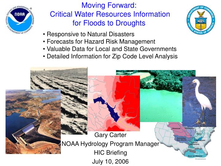
Moving Forward: Critical Water Resources Informationfor Floods to Droughts • Responsive to Natural Disasters • Forecasts for Hazard Risk Management • Valuable Data for Local and State Governments • Detailed Information for Zip Code Level Analysis Gary Carter NOAA Hydrology Program Manager HIC Briefing July 10, 2006
Better Information for Water Management Decisions Water Management Hydrology and Water Resources Modeling, Data Assimilation Drought Mitigation Flood Management Flash Flood/Debris Flow Public Safety Water Supply Transportation Emergency Management Agriculture Ecosystem Stewardship Weather and Climate Predictions: Temperature Precipitation Wind, … Water Prediction Hydrologic Ensemble Prediction Decision Support Tools Socioeconomic Sciences NOAA’s High-Resolution, Gridded Water Resources Product Suite
Hydrology Program Objectives • Program Priorities • Extend Hydrologic Forecasting Service to Include: • Community Hydrologic Prediction System (CHPS) • Robust Hydrologic Data Assimilation Techniques • Operational Distributed Models • Meet Customer Needs, e.g., National Integrated Drought Information System (NIDIS) • Conduct economic impact analyses and case studies to identify the potential benefits of water resource forecasts Water Resource Services • Watershed and soil condition forecasts for hazard resilient communities • Run-off or River flow • Soil moisture • Soil temperature • Precipitation • Snowpack • Surface storage • Ground water • Water temperature • Water quality • Short- to long-term water risk forecasts support hazard resistant businesses (including agriculture) and local ecosystem stewardship
Community Hydrologic Prediction System (CHPS) – next steps NWSRFS Data Service –deliver, via AWIPS Operational Build 7.2, first increment of distributed hydrologic modeling capability integrated into NWSRFS using CHPS Data Services Hydrology XML Consortium – build schema-compliant XML read/write adapters, develop SHEF-XML translators, develop common dictionary, move Consortium beyond OHD Future NWSRFS Enhancements – Reservoir model: provide RFCs with a CHPS service to run the USACE Hydrologic Engineering Center’s Reservoir System Simulation program (HEC-ResSim) as an integral part of NWS operations Additional Hydraulic Models: identify potential applications and feasibility for operational use of the USACE River Analysis System (HEC-RAS) Rapid Prototype Opportunity: leverage WL/Delft Flood Early Warning System (FEWS) infrastructure to expedite migration to CHPS- compliant hydrologic science to operations
HydroMet Testbed Operations NOAA Earth System Research Lab Physical Sciences Division - Processing observations for 2005-2006 - Planning next instrumentation phase
Long-term Vision: Integrated Water Science Coupled ocean/atmospheric/ land-surface model (global) WEATHER & CLIMATE FOCUS Coupled atmospheric/land-surface model (regional) Observing Systems Common Hydrologic Land-Surface Modeling System (Uncoupled) Research Labs WATER FOCUS Land Surface Hydrology & Water Resources Modeling Interface with Estuary Models, Water Quality Models
Long-term Vision:Water Science Center • Enable Full Utilization of Existing and New Observing Systems • Infrastructure and tools to enhance data infusion and assimilation capabilities (e.g., Land Information System – LIS; Global Land Data Assimilation System - GLDAS) • Research-to-Operations • Test new water prediction models and forecasting techniques for time scales of hours to months NOAA EPA DOD New observing systems In-Situ Radar Experimental RFC: Data Assimilation and Water Resources Modeling Operational Data Assimilation and Water Resources Modeling USGS NASA Airborne Satellite New physiographic data Community Modeling Physiographic DOE USDA Academia
Arizona NIDIS DemoSummer 2007 - Colorado Basin RFC Observations NERON SW Expansion Analysis Experimental Forecast System Collaborative Research Distributed Model Forecasts “Forecast Grids” Soil Moisture, Streamflow, etc. NIDIS web portal Users (public, industry…)
What could the Hydrology Program deliver as an initial contribution to NIDIS???Low Flow Hydrologic Data Low-Flow Related Impacts in the North Platte River Basin National Weather Service / National Drought Mitigation Center Station ID: NTPN1 - North Platte River at North Platte, NE Flow = river flow expressed in cubic feet per second Stage = river level expressed in feet Source: Project Report on Low Flow/Stage Related Impacts in the North Platte River Basin Prepared by the National Drought Mitigation Center (NDMC) for NWS Central Region, July 25. 2005
Funding Priorities • Enhancing core hydrologic operations (RFCs and WFOs) • Evolving to an open system architecture and developing an integrated water science program • Leveraging multi-disciplinary collaborations to expedite the transfer of research to operations for new services related to: • Water Resources • Coastal / Estuary / Inland Environmental Stewardship and Hazard Risk Management
Hydrology Program: FY 2006 Enhancement Activities AHPS $4.9M Water Resources $1.5M Hurricane Supplemental $2.5M Evolving Future Environment Current Operational Environment Requirements Process
Hydraulic Model Evaluation • Collaborative Research • HydroMet and HydroTestbed • Hydro Science Roadmap • Integrated Water Science
MPE Evolution (RFC and WFO) • FFMP Enhancements • Gridded QPE • Site Specific Model (variational data assimilation) • Debris Flow Applications
Distributed Model Calibration and Enhancement • Logistical, Deterministic, and Ensemble Verification Projects • More Robust Ensemble Prediction Techniques • DMIP II • Streamflow Regulation Accounting (Calibration and Extension)
CHPS Evaluation and Evolution • HYDRO XC Consortium • Distributed Model Applications • Streamflow Regulation Tools • Interactive Calibration Software (rearchitecture)
AHPS and RFC Web Page Evolution • HydroGen Enhancements • Static Flood Inundation Map Libraries