Download
1 / 52
520 likes | 599 Views
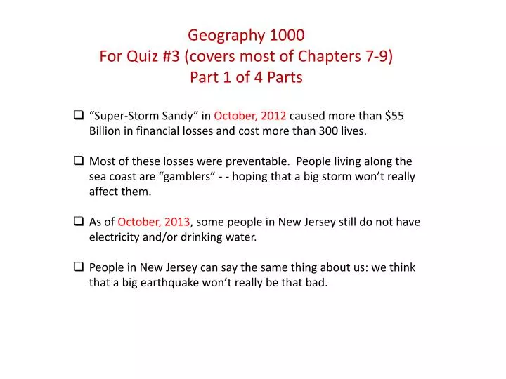
“Super-Storm Sandy” in October, 2012 caused more than $55 Billion in financial losses and cost more than 300 lives. Most of these losses were preventable. People living along the sea coast are “gamblers” - - hoping that a big storm won’t really affect them.

E N D
“Super-Storm Sandy” in October, 2012 caused more than $55 Billion in financial losses and cost more than 300 lives. • Most of these losses were preventable. People living along the sea coast are “gamblers” - - hoping that a big storm won’t really affect them. • As of October, 2013, some people in New Jersey still do not have electricity and/or drinking water. • People in New Jersey can say the same thing about us: we think that a big earthquake won’t really be that bad. Geography 1000 For Quiz #3 (covers most of Chapters 7-9) Part 1 of 4 Parts
Photo taken by a friend of Nick Urban, who was a Geography 1700 student Fall 2013 Consider that counter-clockwise (cyclonic) rising air is condensing vapor back into liquid water as it rises, decompresses and cools. In the center, rain is falling as the “bucket” over-fills. Downdrafts may occur there also. At the edges, a ‘wall cloud’ and a funnel cloud may form due to rapidly rising air. Great turbulence and severe wind can result from air rising and falling.
U.S. Storms • Tornadoes in 2011 killed more than 550 Americans. • At least one tornado in 2013 was among the largest ever recorded – more than two miles wide on the ground and exhibiting wind speeds above 300 miles per hour. • The 1925 “Tri-State Tornado” may have been much larger than any tornado ever ‘recorded.’ This one cyclone lasted for hours – killing more than 700 people. <What would happen now if that same ‘twister’ occurred again?> • Cyclones can occur anywhere cold/dry and warm/wet air meet, usually in mid-latitudes where large continents create extremes and where coriolis force is active.
Katrina (2005) and Super-Storm Sandy (2012) add more than $200 Billion to this chart, not counting other U.S storms since 2004. 2008 projection was for $200 Billion combined, not PLUS.
Severe Weather and World-Class Storms • The United States is regarded as having the greatest variety of bad weather. Why? <Large continents have interiors far from mild ocean influence, cold-dry air collides with warm-wet air and coriolis force causes spin acceleration -- faster wind.> • Typhoons in the Pacific Ocean and ‘cyclones’ in the Indian Ocean have killed as many as 500,000 people in one storm alone. Even so, the USA can be worse due to having more cold-dry air than Bangladesh, which collides with wet-warm. • Why does it matter that Americans tend to be some of the world’s best gamblers? <Americans can run fast or hide quicker than people in most poor countries.> • More than 90% of the world’s tornadoes occur in the USA.
Anatomy of ‘bad’ weatherThe “Big Six” Attributes of the Atmosphere • Differential heating of the earth causes air pressure • air moves from higher pressure to lower pressure as wind. • Moving air and heat evaporate water – energy becomes latent <hidden> in water vapor, called humidity. • Wind carries water vapor and heat to other places. • When that air cools, latent heat and liquid water return as warm clouds. • Precipitation occurs when liquid or frozen water falls from clouds.
Important Any time air becomes laden with moisture it will tend to be more buoyant than drier air elsewhere. When that air also becomes warm it can become even more buoyant. It could start rising on its own (convective rising). In dry Utah, when wind moves air upward over a mountain, the cooling effect can cause condensation, releasing heat and producing clouds. If air is wet enough, a simple rainy episode on the mountainside could turn into a genuine ‘convective’ uplift, leading to more substantial precipitation, stronger wind and so on. So, humidity that moves through Utah might not have turned into a genuine stormy day were it not for mountains that started the air moving upward. Afterward, the humid took over and caused its own rising and more storminess. A few times each year, there is enough water in Utah air to cause a strong convective uplift that could produce a tornado. How a rainy day can turn violent. “Sometimes Mikey likes it”
This photo of Tooele County illustrates how Utah can have severe weather anytime there is enough moisture in the air.Humidity is water vapor that contains latent (hidden) heat.
Severe storms are caused by heat stored as water vapor in the atmosphere. • Modern science is now able to provide 10-11 minutes of warning ahead of cyclones. <what does ‘warning’ mean?> • Severe storms are part of the normal water cycle. Without hurricanes, Florida would have persistent drought. Dangerous cyclones in India, Myanmar and Bangladesh are part of the vital monsoon season that helps prevent famine and starvation. • Understand adjustments that can minimize damage and personal injury from coastal cyclones • Know the prudent actions to take for hurricane or extra-tropical cyclone watches and warnings
Cyclones • An area or center of low pressure with rotating winds • Counter-clockwise in Northern Hemisphere • Clockwise in Southern Hemisphere • Tropical or extra-tropical • Based on origin and core temperature • Tropical storms may become more intense as they move out of the tropics and into the sub-tropics and mid-latitudes
Some major regional storm categories • Nor’easter - Extra-tropical cyclone that moves along northward along East Coast U.S. • Hurricanes - Tropical cyclones in Atlantic and eastern Pacific Oceans • Typhoon - Tropical and Extra-tropical cyclones in Pacific Ocean west of International Dateline and north of the equator • Cyclones– same kind of storm, but in the Indian Ocean. • Monsoon – a seasonal shift in wind, but often brings too much rain (or not enough)
Category 1 Category 5
Tropical Depressions and Tropical Storms • Tropical depressions • Tropical disturbance wind speeds increase and begin to spin. • A low pressure center is formed. • Tropical storm • Winds increase to 63 km (39 mi) ph. • Storm is given a name.
Hurricanes, cont. • Rain bands • Clouds that spiral inward around center • Increase in intensity towards the center of the hurricane • Eyewall • Innermost band of clouds • Contain the greatest winds and rainfall • Eye • Area of calm at center of the hurricane • Often sunny and even downdrafts • After storm ‘eye’ passes, 2nd half of hurricane will arrive
Hurricane Structure • Warm, moist air spirals upward around eyewall. • Air rises and cools, then condenses out clouds and hidden heat • Release of heat and moisture promotes more rising air, sometimes with increasing speed • Upward rotation draws air from eye, causing dry air to sink back into center. • Upward rotation also causes air to flow out the top of the storm concentrated in exhaust jets. • Allows additional warm, wet air to feed in at the base of the storm • Storm will continue until warm, wet air supply ends at the base
Cross-Section of a meso-scale cyclone High-pressure, clockwise outflow: opposite of cyclonic Some references call it “macro” – no storms are larger A brief Utah ‘air mass’ thunderstorm by comparison.
What sustains “extra-tropical” storms? • A cyclone will run out of energy when the difference in moisture and temperature inside the storm is not much greater than the drier/cooler air outside. • Passing over dry land or over cool water will tend to drain a cyclone of energy. • However, an extra-tropical storm that collides with a relatively cold blizzard or “Nor’easter” can rebuild temporarily by having something cooler and drier to use for ‘pushing-off’ and rising again for a while.
Low pressure develops along fronts. Cold front on southwest, warm front on east. Cold air circulates counter-clockwise. Warm air rises on the southeast side. Dry air aloft feeds the cyclone from behind the cold front. Occluded front develops, trapping warm air aloft. Pressure gradient weakens and storm dissipates. Extra-tropical Cyclone Development Air will flow when there is a ‘gradient’ or “slope” between high and low pressure. Air pressure results from differences in temperature. High pressure flows to low pressure. WIND.
Hurricanes in East and Gulf Coasts • Usually, take one of three paths • Season starts June 1 and ends Nov 30 Figure 9.21
Geographic Regions at Risk for Cyclones, cont. Westerlies What makes the USA so unusual in severe storms? Because, we should have desert in Alabama - - but we don’t. Instead, we have “fight club” -- ”tornado alley”.
Track of Extra-Tropical StormsTrade winds from east to west collect ocean transfer ocean heat to air vapor where it can collide with drier air further north. This red arrow is probably wrong. Hurricanes do not reach Los Angeles. Hurricanes west of Mexico tend to blow away from land because of the same trade winds that blow hurricanes toward land in the Gulf and Atlantic.
Geographic Regions at Risk for Cyclones The coast is “hurricane” country, but cyclones include tornadoes that occur across much of the USA. Hurricane regions are also tornado regions. Our definition of ‘cyclones’ should include “tornado alley”. All together, the United States collects more than 90% of the world’s tornadoes.
North American Regions at Cyclone Risk • Atlantic coast of eastern USA and Gulf Coast and islands • Baja California and West Coast Mexico • Hawaii • Winter windstorms in Pacific Coast • Winter snow Sierra Nevada, Rocky Mountains, and east • Spring and summer thunderstorms and tornadoes in U.S. and Canada
“Super-Storm Sandy” in October, 2012 caused more than $55 Billion in financial losses and cost more than 300 lives. • Most of these losses were preventable. People living along the sea coast are “gamblers” - - hoping that a big storm won’t really affect them. • As of October, 2013, some people in New Jersey still do not have electricity and/or drinking water. • People in New Jersey can say the same thing about us: people in Utah think that a big earthquake won’t really be that bad. Geography 1700 Chapter 9 Part 2 of 4
Low pressure develops along fronts. Cold front on southwest, warm front on east. Cold air circulates counter-clockwise. Warm air rises on the southeast side. Dry air aloft feeds the cyclone from behind the cold front. Occluded front develops, trapping warm air aloft. Pressure gradient weakens and storm dissipates. Extra-tropical Cyclone Development Air will flow when there is a ‘gradient’ or “slope” between high and low pressure. Air pressure results from differences in temperature. High pressure flows to low pressure. WIND.
Hurricanes in East and Gulf Coasts • Usually takes one of three paths • Season starts June 1 and ends Nov 30 Figure 9.21
Geographic Regions at Risk for Cyclones But what about “tornado alley”? Let’s broaden our definition of “cyclone”
Geographic Regions at Risk for Cyclones, cont. Westerlies What makes the USA so unusual in severe storms? Because, we should have desert in Alabama - - but we don’t. Instead, we have “fight club” -- ”tornado alley”.
Track of Extra-Tropical StormsTrade winds from east to west collect ocean transfer ocean heat to air vapor where it can collide with drier air further north. This red arrow is probably wrong. Hurricanes do not reach Los Angeles. Hurricanes west of Mexico tend to blow away from land because of the same trade winds that blow hurricanes toward land in the Gulf and Atlantic.
Geographic Regions at Risk for Cyclones The coast is “hurricane” country, but cyclones include tornadoes that occur across much of the USA. Hurricane regions are also tornado regions. Our definition of ‘cyclones’ should include “tornado alley”. All together, the United States collects more than 90% of the world’s tornadoes.
Geographic Regions at Risk from Cyclones, Summary • Tropical cyclones • East and Gulf Coasts • Hawaii and Atlantic Canada • Baja California and West Coast Mexico • Extra-tropical cyclones • Winter windstorms in Pacific Coast • Winter snow Sierra Nevada, Rocky Mountains, and east • Spring and summer thunderstorms and tornadoes in U.S. and Canada
A classic “extra-tropical” cyclone. In our hemisphere they are called hurricanes.Notice the tall clouds, well-developed “eye” and the counter-clockwise winds.Low air pressure inside these storms (rising air) allows ocean levels to rise also, allowing ‘taller’ sea level during the storm.High winds and heavy rain then add much more to ‘storm surge.’Flooding. 600+ miles wide
Looking down on a cyclonic storm, notice that the right side probably exhibits higher wind speeds because the forward speed of the storm adds to the wind speed inside the storm. If wind speed inside the storm reaches 100 mph and if the entire storm is moving forward at 20 mph, then the combined speed of wind on the forward-moving side should be 120 mph. Likewise, the “back side” of the storm subtracts forward speed to yield just 80 mph winds. Higher wind means higher storm surge flooding. Storm forward track = 20 mph Lower wind speed Higher wind speed
Is it true that tropical storms can become stronger when they take their energy (heat) into encounters with cooler/drier air?
Can you see why cyclonic storms can “hit” twice? For the same reason a‘dust devil’ hit Mr. Allred’scar twice.Still, it is important that dry dust devils rise only until they lose their heat source, such as a black asphalt parking lot.But wet tornadoes contain their own source of heat – latent heat in invisible water vapor.They rise until they run out of water & heat.
Westerlies – cooler/drier Trade winds flow east to west. After collision with westerlies, storm fronts tend to flow SW to NE. Calculate net wind speed right front vs left rear. Easterly Trade Winds – warmer/wetter
Facing the on-coming storm, calculate the left vs right side wind speed differential to show why the storm is often worse on one side or the other.Wind speed 100 mphStorm track 20 mph.Can you see why cyclonic stormscan “hit” twice?What about a‘dust devil’ hitting Mr. Allred’s car?
Cyclone Effects: High Winds • Described by Saffir-Simpson Scale • Decrease exponentially with landfall • Strongest recorded winds in U.S. from extra-tropical cyclone • Responsible for strong winds in blizzards and tornadoes Figure 9.28
Cyclone Effects: Storm Surge 1. Low atmospheric pressure allows sea water to rise as much as three feet, like drawing soda up a straw. 2. High winds can push storm water far upstream and inland, adding perhaps 6-10 feet of flooding above normal sea level. 3. High winds can cause severe damage even without water involved. 4. High winds cause higher and faster wave crests that push inland. 5. Heavy rain can cause downstream flooding even as sea water is pushing upstream. People live in between and sometimes drown. 6. Flooding is even worse if the storm coincides with high tide. Spring tide would be worse yet = Super Storm Sandy had it all – 20 feet of surge in some places. Combined total flooding in a hurricane can even exceed 30 feet.
Links to Other Natural Disasters • Coastal erosion • Flooding • Mass wasting • Other types of severe weather • Tornadoes, severe thunderstorms, snowstorms, and blizzards
Natural Service Functions of Cyclones • Source of precipitation -- Many places depend on severe storms to help meet annual water budget. • Redistribute warm air from tropics • Maintain ecosystems • Winds carry plants, animals, and microorganisms. • Waves stir up deeper, nutrient-rich waters. • Winds topple weak and diseased trees in forests. • Waves break apart some corals.
Human Interaction with Cyclones • Urbanization of vulnerable coastlines • Destruction of sand dunes • Construction of seawalls and bulkheads • Poor building materials and practices • Global warming
Forecasting and Warnings • Forecast includes: • If it will make landfall • Where and when • Wind strength • Rainfall amount • Storm surge • Monitored by U.S. Hurricane Center, Canadian Hurricane Center. • Hurricane watch means likely hurricane in 36 hrs. • Hurricane warning given when hurricane is likely within 24 hrs or less.
Forecasting Tools • Weather satellites • Detect early warning signs • Cannot show wind speed • Aircraft • U.S. Air Force, NOAA airplanes fly into the storm to collect data • Doppler radar • Give information on rainfall, wind speed, and direction of the storm
Forecasting Tools, cont. • Weather buoys • Automated weather stations that give information at their locations • Computer models • Predict and track hurricane progress • Have vastly improved hurricane information • Still lacking in predicting storm intensity
Storm Surge Predictions • Predict the time and elevation of surge. • Forecasters use wind speed, fetch, and average water depth. • Need detailed information on topography. • Different elevations on land affect the storm surge. • Computer models use central pressure, size, forward speed, track, wind speed, and seafloor topography. Let’s keep in mind that prediction is still an issue – even though we can see a hurricane coming, we don’t know how each part of the storm will match-up with a coastline and urban areas. The result is sometimes widely varying differences in storm surge and people who get caught by surprise. Allred’s Note
Hurricane Prediction and the Future • Deaths have decreased dramatically because of better forecasting, improved education, and greater public awareness. • However, coastal populations are increasing, causing an increasing risk.
Perception of and Adjustment to Cyclones • Perception of hazard depends on personal experience. • More experienced people may take hazard more precautions. • More experienced people may also take less precautions. • Community adjustments to cyclone hazard: • Warning systems(Hurricane Katrina may have been the most advertised disaster in human history. The whole world watched it develop). • Evacuation plans and shelters • Insurance • Building design