Download
1 / 125
1.25k likes | 1.26k Views
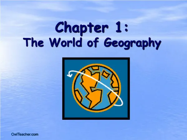
The World of Geography. Chapter 1: What is Geography? * It is the study of our earth; our home. OR *Anything that can be mapped!. *Geography mixes up the physical and human aspects of our world into one field of study. *Geography shows the relationship between people and the environment.

E N D
Chapter 1: What is Geography? *It is the study of our earth; our home. OR *Anything that can be mapped!
*Geography mixes up the physical and human aspects of our world into one field of study. *Geography shows the relationship between people and the environment.
What is a geographer? • Someone who analyzes the Earth from many points of view.
The Five Themes of Geography • There are five ways to look at the earth • When geographers work, they are guided by two basic questions: • Where are things located? • Why are they there? To find these answers, geographers use five themes to organize information
Things that geographers study: • oceans • plant life • landforms • people • how the Earth and its people affect each other
The Five Themes: • Location – Geographers begin to study a place by finding where it is, or its location. • Place – Geographers study the physical and human features of a location. • Human-Environment Interaction – Geographers study how people affect or shape physical characteristics of their natural surroundings and how does their surroundings (environment) affect them?
Movement – Helps explain how people, goods, and ideas get from one place to another. • Regions – Geographers compare the climate, land, population, or history of one place to another.
Location • There are two ways to think about location: • absolute location – describes the place’s exact position on the Earth. • relative location – explains where a place is by describing places near it.
Place • This includes a location’s physical and human features. • To describe physical features, you might say that the climate is hot or cold or that the land is hilly. • To describe human features, you might discuss how many people live there, what types of work they do, or what they do for fun.
Human-Environment Interaction • How do people adjust to and change their environment? How does the environment adjust to and change the people? • Geographers also use interaction to study the consequences of people’s actions.
Movement • Explains how people, goods, and ideas move from one place to another. • Helps geographers understand cultural changes.
Regions • A region has a unifying characteristic, like climate, land, population, or history. • On maps, geographers use color and shape or special symbols to show regions.
Pangaea: The Supercontinent • Geographers theorize that millions of years ago the Earth had only one huge landmass, which they call Pangaea.
They believe that 200 million years ago, some force made Pangaea split into several pieces and begin to move apart, forming separate continents.
The theory of plate tectonics explains why the continents separated. • Continents are part of plates that shift over time.
The Movement of the Continents When geographers first began to study world maps, they realized that the continents look like pieces of a jigsaw puzzle.
Volcanoes, Earthquakes, and Shifting Plates • The world’s plates move in different directions, causing a variety of effects: • Ridges: In some places, plates move apart, and magma leaks through the cracks in the crust. In the oceans, over time, the cooling rock builds up to form lines of underwater mountains called ridges.
Transform • Movement when two plates slide laterally past each other. • When there is sufficient buildup of pressure, rocks in the plates break and get jerked apart.
Earthquakes: • Along plate boundaries, there are many weak places in the Earth’s crust. • When plates push against each other, the crust cracks and splinters from pressure. • These cracks are called faults. • When the crust moves along faults, it releases great amounts of energy in the form of earthquakes.
Convergent • When two plates move towards each other, they would collide.
Volcanoes: In other places, the plates push against one another, forcing one plate under the other. Tremendous pressure and heat builds up causing molten rock to explode on the surface.
Divergent • Occurs when two plates move away from each other
Rift Valley • forces are strong enough to cause the plate to split apart
The Geographer’s Tools • Globes and Maps: • As people explored the Earth, they collected information about it. • Mapmakers wanted to present this information correctly. • The best way was to put it on a globe, a round ball that represented the Earth.
Because globes are not practical or easy to use to carry, flat maps were invented. • However, the earth is round and a map is flat. • Mapmakers had to find ways to make maps accurate.
Globes and Maps • The most accurate way to present information on the islands, continents, and bodies of water of the world is to put it all on a globe, a round ball like the Earth itself. • The only difference between a globe and the Earth itself is the scale, or size, represented on the globe.
Globes have a disadvantage: They cannot be complete enough to be useful and at the same time be small enough to be convenient. • Therefore, people invented flat maps.
Maps try to show the Earth, which is round, on a flat surface. • This causes distortion, or a change in accuracy of the shapes and distances of places. • It is impossible to show the Earth on a flat surface without some distortion.
Getting It All On the Map The World: Mercator Projection • In 1569, a geographer named Gerardus Mercator created a flat map to help sailors navigate long journeys across the globe. • The Mercator projection, or method of putting a map of the Earth onto a flat piece of paper, is used by nearly all deep-sea navigators. • The Mercator projection is a conformal map, meaning that it shows correct shapes, but not true distances or sizes. • There are many types of other projections of the globe.
Interrupted Projection Peters Projection Equal-Area Projection The World: Three Projections There are many ways to show a globe on a flat map. The interrupted projection map, on the left, shows real sizes and shapes of continents. The equal area map , below left, shows size accurately. The Peters projection, below, shows land and oceans areas and correct directions accurately
ARCTIC OCEAN The World: A Robinson Projection
The Parts of a Map Compass Rose • A compass rose is a model of a compass. It tells the cardinal directions, which are north, south, east, and west. Scale • The scale on a map tells you the relative distance on the map to the real world. For example, a map’s scale may tell you that one inch on the map equals one mile in the real world.
Key • The key, or legend, on a map explains what the symbols on a map represent, such as triangles representing trees. Grids • Some maps use a grid of parallels and meridians. On a map of a small area, letters and numbers are often used to help you find your location.
Unit 2 Earth's Physical Geography
Our Planet, the Earth • How does the Earth move in space? • Why do seasons change?
The Earth and the Sun Days and Nights • The Earth travels around the sun in an oval-shaped orbit.
It takes 365 1/4 days, or one year, for the Earth to complete one revolution around the sun. • As the Earth revolves, it is also spinning on its axis. • Each rotation (or complete spin on the axis) takes about 24 hours. • It is daytime on the side facing the sun and night on the side away from the sun.
The Earth and the Sun Understanding Seasons Why are the days longer in some parts of the year? • The Earth’s axis is at an angle. • In about half of the Earth’s orbit, the tilt causes a region to face toward the sun for more hours than it faces away from the sun. • Days are longer. • In other regions that face away from the sun for more hours, days are shorter.
Why does the temperature change during the seasons? • The warmth you feel at any given time of year depends on how directly the sunlight falls on you. • Some regions receive a great deal of direct sunlight, while others receive very little. • This is also a result of the Earth’s tilt and orbit.
Spring and fall equinoxes: Days and nights are almost equal everywhere Equator March 21September 23 0º Tropic of Cancer 23 1/2º N June 21 First day of winter, or winter solstice, in Northern Hemisphere Tropic of Capricorn 23 1/2º S December 21 66 1/2º N Never Arctic Circle Antarctic Circle 66 1/2º S Never Looking at Latitudes Gets Direct Sunshine on Line of Latitude Where is it? Seasons
Looking at Latitudes: Zones • Low Latitudes: The Tropics • Area between the Tropic of Cancer and the Tropic of Capricorn • In this region, it is almost always hot.
Middle Latitudes: The Temperate Zones • Area between the Tropic of Cancer and the Arctic Circle • AND the area between the Tropic of Capricorn and the Antarctic Circle • In this region, there are seasons, each with a distinct pattern of daylight, temperature, and weather.
High Latitudes: The Polar Zones • Area between the Arctic Circle and the North Pole • AND the area between the Antarctic Circle and the South Pole • In this region it is very cool to bitterly cold.