Download
1 / 36
380 likes | 661 Views
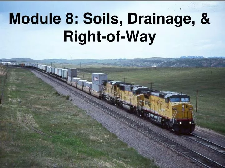
Module 8: Soils, Drainage, & Right-of-Way. Objectives. Soils – The foundation upon which the railroad structures are built. Drainage – Controlling runoff and keeping the track dry. Right-of-Way – The property owned by the railroad. Subgrade Soils. Subgrade soils perform three functions:

E N D
Objectives • Soils – The foundation upon which the railroad structures are built. • Drainage – Controlling runoff and keeping the track dry. • Right-of-Way – The property owned by the railroad.
Subgrade Soils • Subgrade soils perform three functions: • To bear and distribute the load of the train • To provide a solid platform for the track and ballast • To facilitate drainage
Load Distribution Loading Track Structure Stress Distribution
Roadbed Stability Stability of a railroad bed subgrade depends on: silt gravel Soil Types Compaction When Built Maintenance of Side Slopes Maintenance of Drainage
Soils in Subgrade Soil strength depends on many variables: • Grain Size and Distribution • Angularity (or smoothness) of Particles • Presence of Organics (peat) • Water Content • Hardness
Unified Soil Classification System • Three Major Soil Types • Coarse-Grained Soils (50% particles > 0.074 mm dia.) • Sand • Gravel • Fine-Grained Soils (50% particles < 0.074 mm dia.) • Clay • Silt • Organic • Peat • Blackdirt / Topsoil
Soils Notes • Track fails when differential rail deflections become excessive • Stiffer ground is better under track to reduce deflection • For Better Track Bed: • Replace Bad Soils • Expansive Clays (ie – Bentonite) • Silts • Peat • Black Dirt / Top Soil • Increase Compaction when Roadbed is Built • Design Good Drainage
What Kind of Soil Do I Have? • Soil Boring Samples are taken to determine types of soil, and at what depths they are present • “In Situ” Soil Properties Tests: • Cone Penetration Tests • Pressuremeter Tests • Vane Shear Test
Soil Boring Log • Shows graphically soil types at depths
Soil Failures Crack parallel to embankment soil slide plane bulge soil Slide Clay Heave
Subgrade Ballast Pockets Impervious Impervious
Soil Improvements Adding a berm to the toe of slope Lime injection stabilization Asphalt Underlayment Soil Cement Stabilization
Drainage Drainage is the process of collecting and managing stormwater through the use of ditches, pipes, box culverts, bridges, etc. to protect the railroad track structure. All good railroaders know the three most important elements for good track are: • Drainage,2) Drainage,and 3) Drainage!!
Drainage - Good drainage keeps subbase from getting saturated and soft - Sub-Ballast Side Slope is typically between 24:1 to 40:1 Rainfall drains due to slope
Drainage Hydrology (rainfall and runoff) is used to determine stormwater runoff through such methods as the USGS Regression Equations, Rational Formula, National Resource Conservation Service methods (TR 55 and TR 20), Army Corps of Engineers HECRAS, & FHWA HYDRAIN computer models. Hydraulics is used to properly size the conveyance mechanism of the stormwater runoff. Mannings’s equation, culvert design charts, and computer modelling help assist the engineer in determining ditch size, culvert openings, and bridge span lengths.
Recommended Procedures Existing Drainage Study Establish Watershed Limits Identify Floodplain Boundaries Identify Existing Bridges, Culverts, and Problem areas Select Outlet Points Select the Proper Hydrologic and Hydraulic Criteria Go Out in the Field Proposed Drainage Study Superimpose Proposed Improvements on the Existing Drainage Study Identify Floodplain and Wetland Impacts and Mediate Never Relocate an Existing Outlet Maintain Existing Watershed Limits Review Adjacent Property Owner Impacts, They are Protected Under the Law Initiate Permitting
Culvert Pipe Design NOTICE: Stresses on a culvert pipe below a track are over twice as much as on a culvert crossing under a highway! Loading on a Culvert Pipe across a Track Loading on a Culvert Pipe across a Highway
Permitting Stormwater Typically the Local Authority (City, County, or Stormwater District) Floodplain and Floodway State, County, Local and Federal Emergency Management Agency (FEMA) Waters of the US US Army Corps of Engineers Environmental Protection Agency Department of Natural Resources
Drainage Poor Maintenance Potential Results
Erosion & Sediment Control • Today, many local, county, state, and federal agencies are taking an active role in erosion control and require an E&SC plan. • The railroads are required to have an E&SC plan filed with each state which has to be updated annually. • Construction projects require an E&SC plan to obtain the permits for construction.
Erosion & Sediment Control E&SC plans typically consist of these sections: • General – publication references, work description, construction schedule, and a plan for the resident state. • Products – items such as barriers, fences, matting, fabrics, aggregate, inlet protection, dust suppressors. • Execution – plan to carry out construction and E&SC protection. • Railroad Certified Responsible Land Disturbers • Copy of Resident State’s E&SC Requirements.
Right-of-Way Valuation Maps (ICC 1914 Cadastre) Station/Land/Track/Terminal Variants Multiple maps may exist for the same location (detail) Profile Maps Tend to show high water, r/w changes & scour histories Show relationships to original ground lines Land Schedules (ICC Form DV-107 ) Important source of information about tile field rights and drainage easements / senior water & drainage rights Pipeline & Terminal Utilities Mapping GIS/LIS - The future of digital records and railroad information management
Right-of-Way -Continued Track Charts Normally 1”=3000’ Schematic with graphical data information sets Show maintenance history / pipe & bridge locations/ planning tool Layout is peculiar to each railroad (all similar, but different) More commonly used on railroads by employees than Val maps Stationing Engineer Profile Stationing is common between Val maps and Profiles Stationing is slope chaining per ICC Valuation General Order #5 of 1914 Beware of EQUATIONS (Vertical Datum Shifts/ Horizontal/Construction) Mileposts True location of the milepost is determined by stationing Mileposts in the field tend to “wander” after maintenance activity Long and short miles (not always 5280’ for various reasons)
Valuation Maps Official Record of the Railroads Discussed here is US regulation (ICC/STB Standard); Canada & Mexico have their own rules, quirks, standards and formats. Property Use Record for the Railroads Right-of-way limits, how acquired Relationship(s) to local land lines Railroad tracks, bridges, & structures Highway & highway bridge crossings Ingress/egress for utilities – water, sewer, gas Beware of the abuse of the term “easement”, and remember rules granting the crossing of railroad lines may change from state to state. ICC Form DV-107
Field Surveying Hard hat Eye protection Reflective vest Steel toed boots Photo by Charlie Tucker
Words To The Wise CAVEAT #1 –Buried signal cables are not likely to show up on railway mapping – the RR Signal Dept. needs to locate & ID cables. CAVEAT #2 –Utilities crossing railroad ROW will not show up on local assessor maps. These Contracts/Permits/Licenses tend not to show up in the local courthouse / public records repository. CAVEAT #3 – Railroads support but do not belong to Utilities Locates services for reasons listed above in #2, and to avoid safety conflicts with 49CFR214 “On – Track- Safety” compliance issues.
Valuation Maps (Close-up on next slide) Predecessor railroad name Valuation Section and Map Sheet Numbers (Are referenced in many documents, but are being replaced by FRA/DOT line segments)
Valuation & Profile Maps Provides valuable history of the railroad IF the railroad was in existence in the period 1914-1920 or since, there is a copy of the mapping that can still be recovered(NARA) Needs to be kept updated (49 CFR 1201) NOTE: Since Staggers deregulation of the 1980’s only the Class 1 railroads are required to keep current maps and records. Good public stewardship and engineering practice suggest that mapping be kept current by all landowners to mitigate risk and protect the railroad’s land interests/ assets , the adjoining landowner(s) and the general public. PLEASE PRESERVE NGS/USGS/USC&GS MONUMENTS and PROPERTY CORNERS FOUND ALONG THE RIGHTS OF WAY SAMPLE PROFILE MAP FROM ICC GENERAL ORDER #1 (1914)
Stationing & Mileposts • Engineering stations provide the length of each track segment and locates the following: • Points of switches, bridges, culverts, road crossings, mileposts, etc. • Mileposts indicate the distance along the railroad in miles. • A railroad mile may/may not equal 5,280 feet, each mile is individually measured. BNSF Birmingham Sub, M.P. 588, Tupelo, MS
Fences Needed for: • Security Fencing – provides security for railroad property and separation from the public in urban areas • Livestock Fencing – keeps livestock off railroad property • Snow or Sand Fencing – creates a place for drifting of snow/sand away from the track • Slide Fencing – signalized fencing indicating a rock/mud slide, or fallen trees from steep embankments
Special Signalized Fences Signalized slide fence detects material falling off of the slope Signalized slope fence detects movement of an unstable roadbed and alerts the dispatcher Slide Fencing & Slope Stability Fencing
Vegetation Control More than just esthetics Prevents choking of track and ditches which creates drainage and maintenance problems Improves sight distances and reduces tripping hazards Prevents interference with railway personnel performing normal duties and the safe operation of trains May Require Permit
Vegetation Control Mechanical Control Chemical Control