Download
1 / 20
210 likes | 319 Views
Cadastre software based on Open Source in Kyrgyzstan. Alexander Solovov Solution developer. Land Registration Agency. Local name – Gosregister Responsible for land cadastre, rights registration and property valuation Has about 49 regional offices countrywide.

E N D
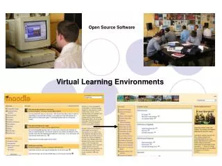
Cadastre software based on Open Source in Kyrgyzstan Alexander Solovov Solution developer
Land Registration Agency • Local name – Gosregister • Responsible for land cadastre, rights registration and property valuation • Has about 49 regional offices countrywide. • One central office, Land use Institute, Agency of cartography and geodesy. • Supported by World Bank and Sida through Swedesurvey agency (Swedesurvey worked before 2009)
Automated registration system (ARS) • Core system for automation of business processes in land registration office. • Developed in 2003 • Based on MS SQL Server 2000 and MS Access (client) • Currently used almost in all offices • Has central database replicated from regional offices, providing external services to the banks, real estate agencies and others
Before introduction of cadastre software • ARS operations on creating new property objects or modifying existing (e.g. amalgamation, subdivision) were implemented in text mode. • ARS didn’t have any spatial data or reference on spatial sources. • In most of the offices paper maps are used to handle geo data. • In some offices various standalone tools are used for mapping (ArcGIS, MapInfo, AutoCAD, etc.) • Usage of standalone tools brings confusion of different versions of data, inconsistency and has a high risk of data loss or damage
Cadastre softwareFirst attempt • In 2007 was initiated a creation of cadastre software in scope of World Bank project. • The following tools and formats were used: • ESRI ArcGIS Engine • Visual C# • Shape files
Disadvantages • Map objects are managed by coordinates only • No graphical tools • No central database and network environment support • High cost per one sit (about $800) • Proprietary code • Difficult to extend
Cadastre software Second attempt • In 2008 Swedesurvey had initiated development of new cadastre software with extended capabilities • Project was targeted on small regional offices whose didn’t have any perspective to get commercial software • Two versions were created in the scope of Swedesurvey project • Third version has been created in 2010 in the scope of World Bank project
Basic requirements • Create a solution, based on Open Source components (free of charge) • Introduce network database support as a central storage of digital maps • Develop graphical tools to manage map objects • Integrate with ARS database and support existing business rules • Move all cartographer functions from ARS to Cadastre software • Extend and improve different functions from previous release • Add new functions
Components • PostgreSQL • PostGIS • SharpMap • GeoAPI.Net • Proj.Net • GDAL • Visual C#
System architecture • Client-server three-tier architecture with well-defined interfaces • Business layer (middle) exposed through web-services • Modular nature of tiers • Works over TCP or HTTP (HTTPS) protocols
Integration with ARS • Integrated with ARS (main database) by Property code (identification number) • Property objects are created or modified in cadastre software and automatically replicated into ARS • Information on owners, rights and restrictions is taken from ARS to display in cadastre software and use in extended search and analysis functions
Core functions • Map layers management and customization • Add, remove layers (raster, shape file, PostgreSQL) • Customization of colors, fills, lines, labels and business objects binding • Map viewing • Simple georeferencing • By World File • By polygon on the map • Applications processing • Moving applications between departments • Applications distribution inside department • Actions are bound to application
Core functions • Spatial analysis • Set of common spatial functions integrated with information from registration database (ARS). Type of owner, type of land, type of usage, cost, etc. • Basic topology verification • Export to shape file or raster formats • Printing forms • Cadastre plan • Land parcel binding • Free printing with customized parameters
Core functions • Advanced search • By map objects • By property parameters • By address • By owners • Property objects operations • Creation • Amalgamation • Subdivision • Liquidation • Buffer • Creation of buffer zones internal or external
Advanced graphical tools • Rule • Point • Arc • Polyline • Polygon • Closed polygon • Internal polygon • On the fly switching between polygon, polyline and arc • Perpendicular
Advanced graphical tools • Parallel • Movement • Rotation • Vertex editing • Amalgamation • Subdivision • Copying • Length and angle • Total station • Linear intersection
Results • Development of the last version was finished in November 2010 • Introduced in the biggest registration office. Two offices are on the plan by the end of 2011 • It was decided to abandon the use of proprietary software and introduce open source solution in all offices gradually • New requirements are prepared for the next release
Thank you for attention! Questions?