Download
1 / 15
150 likes | 327 Views
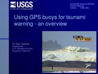
Earthquake Research Affiliates Partners’ Meeting Caltech 6 May 2005. Using GPS buoys for tsunami warning - an overview. Dr. Ken Hudnut Geophysicist U. S. Geological Survey Pasadena, California. Photo by John Galetzka Caltech Tectonic Observatory. Acknowledgements.

E N D
Earthquake Research Affiliates Partners’ Meeting Caltech 6 May 2005 Using GPS buoys for tsunami warning - an overview Dr. Ken Hudnut Geophysicist U. S. Geological Survey Pasadena, California
Photo by John Galetzka Caltech Tectonic Observatory Acknowledgements Caltech: Prof. Kerry Sieh, John Galetzka, and Dr. Chen Ji USGS: Dr. Lucy Jones, Dr. Eric Geist, NEIC Staff Dr. Kristine Larson, Univ. Colorado; Ben Remondi And many others at NOAA and worldwide through the internet
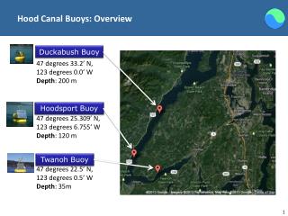
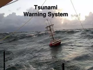
NOAA buoy System DART
Caltech Tectonic Observatory GPS Array SuGAr On-land GPS stations are essential
GPS buoy systems • NOAA DART buoys are expensive and high maintenance • GPS buoys developed by GFZ and Univ. Tokyo groups • GPS can be used for large numbers of low-cost buoys to complement existing system • NavCom-AXYS contract for US Navy (NAVOCEANO); 2 cm inshore, 10 cm offshore • NOAA-USGS testing program for warning application • Tie in with existing earthquake and weather monitoring and alerts
GPS precise real-time positioning Robust ambiguity resolution Phase-differential Range of only 30 km before - recently stretched to 300+ km by several people; now it’s practical Courtesy of Choi and Larson; base station is ~400 km away
HA-NDGPS tests NOAA/NGS with Remondi and DOT/FHWA support - IGEB funding Hagerstown to Chesapeake Bay at 245 km range real-time demo
Gyros (IMU or INS) with GPS • Stable gyro technology (RLG) is costly ($80K) but MEMS-gyro and IFOG are low-cost and approaching accuracy Barbour & Schmidt, 1998
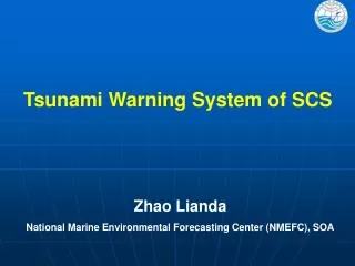
California Scenarios Central or South America M9 - as tsunami passes Isla Guadelupe it is accurately measured by diff. GPS buoys tied to CGPS site GUAX Alaska, Kamchatka or Japan M9 measured at buoys near Hawai’I and Farallons - Bay Area predictions improved Cascadia M9 - waves obs. in detail so that shallow- water and edge effects are observed (and also predicted) much better
Padang - what to do? Photo by John Galetzka Caltech Tectonic Observatory
Inexpensive package of GPS/INS can be added (after R&D and testing) to existing NOAA buoys offshore of So. Calif. to complement other Instrumentation for earthquake and tsunami early warning systems Photo by John Galetzka Caltech Tectonic Observatory SoCal - What to do?