Download
1 / 28
280 likes | 286 Views
Explore the tools encompassing all phases of scientific analysis, including data usability, interoperability, subsetting, and data mining using ESML. This solution solves the problem of data format heterogeneity, making applications and data more interoperable.

E N D
ESML, Subsetting, Mining Tools MODIS Science Team Meeting July 24, 2002 Sara Graves Rahul Ramachandran Information Technology and Systems Center (ITSC) University of Alabama in Huntsville (UAH) www.itsc.uah.edu
Tools Encompassing All Phases of Scientific Analysis • Science Data Usability • Data/Application Interoperability • Earth Science Markup Language (ESML) • Science Data Preprocessing • Subsetting • Various Subsetting Tools such as HEW • Science Data Analysis • Data Mining • Algorithm Development and Mining (ADaM) System • Mission/Project/Field Campaign Coordination • Electronic Collaboration
Science Data Usability http://esml.itsc.uah.edu
Earth Science Data Characteristics HDF HDF-EOS • Different formats, types and structures (18 and counting for Atmospheric Science alone!) • Different states of processing ( raw, calibrated, derived, modeled or interpreted ) • Enormous volumes • Heterogeneity leads to Data usability problem netCDF ASCII Binary GRIB
Data Usability Problem DATA FORMAT 1 DATA FORMAT 2 DATA FORMAT 3 FORMAT CONVERTER READER 1 READER 2 APPLICATION • Requires specialized code for every format • Difficult to assimilate new data types • Makes applications tightly coupled to data • One possible solution - enforce a Standard Data Format • Not practical, especially for legacy datasets
ESML Solution DATA FORMAT 1 DATA FORMAT 2 DATA FORMAT 3 ESML FILE ESML FILE ESML FILE ESML LIBRARY APPLICATION • ESML (external metadata) files containing the structural description of the data format • Applications utilize these descriptions to figure out how to read the data files resulting in data interoperability for applications
What is ESML? • It is a specialized markup language for Earth Science metadata based on XML • It is a machine-readable and -interpretable representation of the structure and content of any data file, regardless of data format • ESML description files contain external metadata that can be generated by either data producer or data consumer (at collection, data set, and/or granule level) • ESML provides the benefits of a standard, self-describing data format (like HDF, HDF-EOS, netCDF, geoTIFF, …) without the cost of data conversion • ESML is an Interchange Technology that allows data/application interoperability
MODIS/CERES Collocation Application MISR/ Others MODIS ESML file CERES ESML file ESML file Network ESML Library Collocation Algorithm • Scientists can: • Select remote files across the network • Select fields by modifying semantic tags in the ESML file • Purpose: • To study the relationship between shortwave flux and cloud/aerosol properties • Important for climate change studies Analysis
Science Data Preprocessing http://subset.org
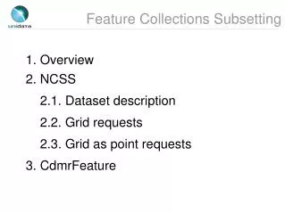
Currently Available/Planned Subsetting Applications • HEW Subsetting • Complete System (available) • Subsetting Engine Only (available) • Subsetting Center (available) • SPOT - Subsettability Checker (available) • HEW Integration with ECS (in work) • Remote Subsetting Service (planned) • Subsetting as a Web Service (planned) • Customized Subsetting • MODIS tools (available) • Coarse-grain SSM/I Subsetter (available) • General Purpose Customizable Subsetting • Based on ADaM Data Mining Engine (available) • Subsetting Tool using ESML (in work)
Tools developed for MODIS Scientists • MODIS – Land, Quality Assessment • modland – subsetter for MODIS gridded data • stitcher – pieces together 2 or 4 contiguous MODIS tiles • MODIS – Atmosphere • modair - specialized subsetter for MODIS swaths
End user HEW integration with ECS EDG System ECS 2 1 • UAH/ITSC-written subsetting and interface software • Ongoing testing with ECS 6a.05 and EDG 3.4 at NSIDC, LP DAAC, GDAAC • Enhancements for DAACs may be made EDG ECS Order submission (HTML) 7 4 3 Output data Data order (Reingested) and reply Subset ODL and reply 5 6 Input Subsetter Output data data Subsetting System
ESML enabled generic Subsetter Other Formats Binary/ ASCII ESML file ESML file ESML file HDF-EOS Network ESML Library Subsetting Algorithm For HDF-EOS data not formatted for subsetting with the HDF-EOS library:ESML file can be used to correct the semantic tag required to subset HDF-EOS data without the need to recreate the data file Subsetted Data
Science Data Analysis http://datamining.itsc.uah.edu
Data Mining • Data Mining is the task of discovering interesting patterns/anomalies and extracting novel information from large amounts of data • Data Mining is an interdisciplinary field drawing from areas such as statistics, machine learning, pattern recognition and others
Iterative Nature of the Data Mining Process EVALUATION And PRESENTATION KNOWLEDGE DISCOVERY MINING SELECTION And TRANSFORMATION CLEANING And INTEGRATION PREPROCESSING DATA
Input Output HDF HDF-EOS GIF PIP-2 SSM/I Pathfinder SSM/I TDR SSM/I NESDIS Lvl 1B SSM/I MSFC Brightness Temp US Rain Landsat ASCII Grass Vectors (ASCII Text) Intergraph Raster Others... GIF Images HDF-EOS HDF Raster Images HDF SDS Polygons (ASCII, DXF) SSM/I MSFC Brightness Temp TIFF Images Others... ADaM Engine Architecture Preprocessed Data Patterns/ Models Results Data Translated Data Processing Preprocessing Analysis Selection and Sampling Subsetting Subsampling Select by Value Coincidence Search Grid Manipulation Grid Creation Bin Aggregate Bin Select Grid Aggregate Grid Select Find Holes Image Processing Cropping Inversion Thresholding Others... Clustering K Means Isodata Maximum Pattern Recognition Bayes Classifier Min. Dist. Classifier Image Analysis Boundary Detection Cooccurrence Matrix Dilation and Erosion Histogram Operations Polygon Circumscript Spatial Filtering Texture Operations Genetic Algorithms Neural Networks Others...
Reasons for Building a Data Mining Environment • Provide scientists with the capabilities to iterate • Allow the flexibility of creative scientific analysis • Provide data mining benefits of • Automation of the analysis process • Reduction of data volume • Provide a framework to allow a well defined structure for the entire analysis process • Provide a suite of mining algorithms for creative analysis • Provide capabilities to add “science algorithms” to the framework
ADaM : Mining Environment for Scientific Data • The system provides knowledge discovery, feature detection and content-based searching for data values, as well as for metadata. • contains over 120 different operations • Operations vary from specialized science data-set specific algorithms to various digital image processing techniques, processing modules for automatic pattern recognition, machine perception, neural networks, genetic algorithms and others
User Defined Algorithms Trainable Classifiers General Purpose Algorithms Input Data Visualization/ Analysis Packages Training Data Extensibility of ADaM ADaM Mining Engine Input Modules Analysis Modules Output Modules
Reasons for using ADaM for Scientific Data Analysis • Provide scientists with the capabilities to iterate • Allow the flexibility of creative scientific analysis • Is a powerful tool for research and analysis given the volume of science data • Extremely useful when manual examination of data is impossible • Allows scientists to add problem specific algorithms to the ADaM toolkit • Minimizes scientists’ data handling to allow them to maximize research time • Reduces “reinventing the wheel”
Mission/Project/Field Campaign Coordination Electronic Collaboration
Strategic and Tactical Coordination Technologies to coordinate complex projects • Data acquisition and integration from multiple platforms, instruments and agencies for quick exploitation • Intra-project communications before, during, and after CAMEX campaigns
NASA managers may review status of aircraft, instruments, flight plans at various times throughout the mission Web-based interface with customized information access for different user groups; rapid development, scalability and portability Coordination Clearinghouse Scalable, reliable data management Experiment PI: Coordinates with all participants, posts plan of the day RDBMS Forecaster: Contacts local weather, forecast centers, weather support web sites to prepare and post daily morning weather briefing Radars NASA Aircraft USAF Aircraft NOAA Aircraft Preflight mission briefing and flight planning Aircraft Crew: Perform aircraft maintenance and report status. CAMEX-4 Coordination:pre-flight
Download latest satellite imagery to web Communications Satellite Coordination Clearinghouse Experiment PI: Modify flight plan as needed in response to changing weather events RDBMS Forecaster: Continue monitoring satellite imagery, radar data, and landing forecasts Radars NASA Aircraft USAF Aircraft NOAA Aircraft Instrument scientists: Collect, process, and store data on board aircraft Transmit selected data to National Hurricane Center for inclusion in computer forecast models CAMEX-4 Coordination:in flight
Mission and Instrument scientists: Post sortie and instrument reports and quicklook data Coordination Clearinghouse RDBMS Radars Forecaster: Prepare post-flight weather briefing NASA Aircraft USAF Aircraft NOAA Aircraft Aircraft Crew: Prepare aircraft and instruments for next flight and update status. CAMEX-4 Coordination:post-flight