Download
1 / 27
270 likes | 378 Views
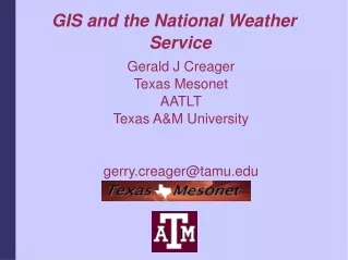
Gerald J Creager Texas Mesonet AATLT Texas A&M University http://mesonet.tamu.edu gerry.creager@tamu.edu. GIS and the National Weather Service. GIS and the National Weather Service. What is GIS?

E N D
Gerald J Creager Texas Mesonet AATLT Texas A&M University http://mesonet.tamu.edu gerry.creager@tamu.edu GIS and the National Weather Service
GIS and the National Weather Service • What is GIS? • A Geographic Information System (GIS) is a database system with software that can analyze and display data using digitized maps and tables for planning and decision-making. A GIS can assemble, store, manipulate and display geographically referenced data, tying this data to points, lines and areas on a map or in a table. • It's a MAP associated with a database (with pictures) created with computer technology
GIS and the National Weather Service • Why relate weather data via GIS? • How long have meteorologists drawn weather maps? • The days of the grease pencil are long gone • Fax machines are no longer the manner in which we disseminate charts • Computers can make our lives easier (Really!) • The amount of data we're dealing with is growing at an accelerated rate • Data base technology does a good job of managing massive datasets • graphics capabilities have become more refined • The Web has revolutionized how we distribute weather information
GIS and the National Weather Service • Web delivery of weather data is now the norm, along with conventional means (TV) • Every WFO has a homepage • Every WFO has a webmaster! • WFOs and RFCs have a variety of projects capitalizing on Internet technology • Why? • Provide the best product • To the Nation • To the Public • To enhance public safety by providing timely, accurate information
GIS and the National Weather Service • Most products are rendered using ESRI-compatible data formats (shp) • Not all the shapefiles are readily available • XML and RSS can help • OGC standard web services can help
GIS and the National Weather ServiceMoving the Data • RSS and XML • Provide data feeds of forecasts, watch/warn, etc • Web services • Open Geospatial Consortium • Consortium of Industry, Government and Academia • Goals include creating an environment for cross-platform data sharing • Working groups active in a variety of areas • Specifications are gaining international recognition • Web Map Service • Web Feature Service • Web Coverage Service
GIS and the National Weather ServiceMoving the Data: XML • Experiments with XML • XML – a markup language, similar to HTML, designed to aim machine/computer processing of data • Tests in two formats based in XML: • Common Alerting Protocol (CAP) • Really Simple Syndication (RSS) • Tests include TPC/NHC products, NWS Watch/Warnings • http://weather.gov/alerts/ • Currently only over Internet, but possible dissemination via NOAAPORT • Overall positive feedback • http://www.nws.noaa.gov/alerts/
GIS and the National Weather ServiceAcademic Products • Early adopters • Iowa Environmental Mesonet • http://mesonet.agron.iastate.edu/ • Texas Mesonet • http://mesonet.tamu.edu • Simultaneous adopters (ca. 2001) • Possibly the first to use GIS services to display (near) realtime weather data
GIS and the National Weather ServiceSPC http://www.spc.noaa.gov/compmap/
GIS and the National Weather ServiceGraphical Warnings Cooperative effort between WFO Ft Worth and NCTCOG • NWS provides Level III radar data • NCTCOG provides census and population density data • NCTCOG parses warnings and displays county warnings • Successful partnership between NWS and local government/agency
GIS and the National Weather ServiceModel Graphics • Accurate map registration provides better representation to the user • Animated grapical representations enhance user experience
GIS and the National Weather ServiceRadar, Counties and Topography Incorporating additional data via layers, such as county boundaries, rivers, highways and topography enhances user awareness of weather phenomena in their vicinity.
GIS and the National Weather ServiceAgency/Academia Partnering
GIS and the National Weather ServiceHydrology – Flood Climatology
GIS and the National Weather ServiceSupporting Storm Spotters and EM's • Texas A&M offers a WMS feed of CONUS Level II imagery for WinAPRS, UI-View and Xastir users • 1. If you need more info, contact n5jxs@tamu.edu • 2. If the above names are foreign to you, talk to your ham radio spotters about APRS and its potential uses in spotting • 3. I know the names are strange. So are Hams. But at least we know we are!
GIS and the National Weather ServiceNon-Agency GIS Representations • Texas Mesonet represents data using GIS formats • Data available via OGC Web Services
GIS and the National Weather ServiceWhere to go? • http://products.weather.gov/viewliste.php • List of experimental products and websites • http://www.spc.noaa.gov • Severe weather GIS products/imagery • http://mesonet.tamu.edu • (coming soon: How-To link) • http://mesonet.tamu.edu/currentwx.html • WMS, WFS data available • http://mesonet.tamu.edu/products/radar/LevelII.html • Radar products site (mostly Texas, Florida) • More coming • http://mesonet.tamu.edu/L2radar.html • Level II radar mosaic
GIS and the National Weather ServicePolygon Warnings • Polygon Warning evaluation commenced 1 MAR • Graphical warning pages by NWS PRH • http://www.prh.noaa.gov/regsci/gis/ • Graphical warning pages by Texas A&M • http://mesonet.tamu.edu/PolygonTest/ • Both pages represent the same data • Each page uses a different method to acquire the data and render the web map
GIS and NWSGIS and WEATHER! • Contact: • Gerry Creager • gerry.creager@tamu.edu • n5jxs@tamu.edu • 979.458.4020 • http://mesonet.tamu.edu Questions?