Download
1 / 8
90 likes | 325 Views
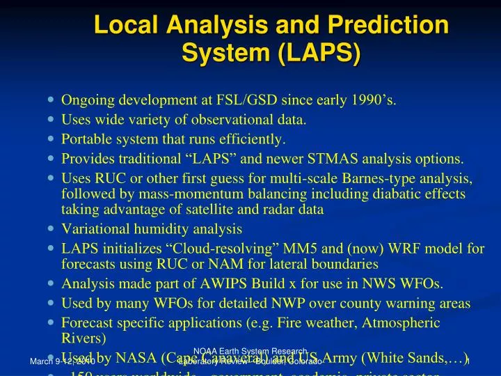
Local Analysis and Prediction System (LAPS). Ongoing development at FSL/GSD since early 1990’s. Uses wide variety of observational data. Portable system that runs efficiently. Provides traditional “LAPS” and newer STMAS analysis options.

E N D
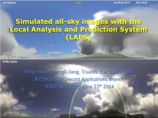
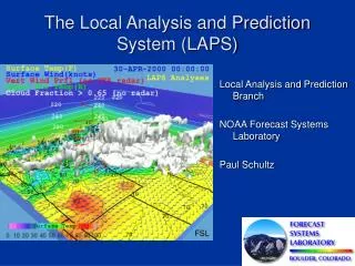
NOAA Earth System Research Laboratory Review - Boulder, Colorado Local Analysis and Prediction System (LAPS) Ongoing development at FSL/GSD since early 1990’s. Uses wide variety of observational data. Portable system that runs efficiently. Provides traditional “LAPS” and newer STMAS analysis options. Uses RUC or other first guess for multi-scale Barnes-type analysis, followed by mass-momentum balancing including diabatic effects taking advantage of satellite and radar data Variational humidity analysis LAPS initializes “Cloud-resolving” MM5 and (now) WRF model for forecasts using RUC or NAM for lateral boundaries Analysis made part of AWIPS Build x for use in NWS WFOs. Used by many WFOs for detailed NWP over county warning areas Forecast specific applications (e.g. Fire weather, Atmospheric Rivers) Used by NASA (Cape Canaveral) and US Army (White Sands,…) ~150 users worldwide - government, academia, private sector
LAPS DA Configuration Data Data Ingest Intermediate data files Error Covariance Trans LAPS GSI STMAS3D Trans Post proc1 Post proc2 Post proc3 Model prep WRF-ARW MM5 WRF-NMM Probabilistic Post Processing Ensemble Forecast
LAPS Basic Structure Univariate Analysis Analysis Merging/ Balancing NWP Model Initialization/ Prediction Data Very diverse Force geometric, Reconcile gridded Generate forecasts data sets smoothing constraints fields; force and user-specific to interpolate data to consistency based products high resolution grids on atmospheric scale
LAPS Diabatic Initialization Surface RAOB Sat ACARS GPS Radar(Vr) Profilers Radar(Z) Sat Aircraft METAR Data Ingest/Quality Control Data Fusion Cloud Analysis NWP FG T, Constraints: Mass Continuity u/v Time Tendencies Background Error Observation Error T, , p, u, v, , RH 3DVAR Dynamic Constraint c Forecaster Adjust for Model: Hydrometeor Concen. Saturation Condition T, , p, u, v, RH qc qi, qr qs, qg LAPSPREP Isobaric Output Native Output NWP System LAPSPOST LBC National NWP LSM IC
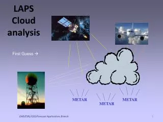
Cloud Analysis Scheme • Uses satellite Vis and IR • Aircraft observations • Surface observations • Radar • Interpolates cloud obs to grid with SCM • Cloud feeds back into water vapor analysis
Some dependence on cloud type, Updraft goes to top of cloud CS Strongest updrafts in regions of high reflectivity CB Downdrafts below freezing level Randomness in broad convective regions 0C Updated CWB/ FSL scheme (cloud derive subr)
Illustration Initialization 5 min forecast Hot Start Cloud insertion Cloud liquid (shaded), vertical velocity (contours) and cross-section streamlines for analyses (right) and 5-min forecasts (left). The top pair shows LAPS hot-start DI with upward vertical motions where clouds are diagnosed and properly sustained cloud and vertical motions in the forecast; the bottom pair demonstrates the artificial downdraft that usually results from simply injecting cloud liquid into a model initialization without supporting updrafts or saturation. Note that cloud liquid at the top of the updraft shown in the hot-started forecast (above right) has converted to cloud ice.