Download
1 / 38
380 likes | 385 Views
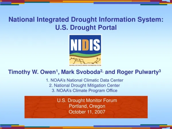
Idaho's Complex Water Issues in the Eastern Snake River Plain Aquifer: Underground Rivers, Increasing and Decreasing Groundwater and Spring Levels, Human Impacts.... Long Term Drought --- Current & Future Concerns. US Drought Monitor Forum Portland, Oregon October 10-11, 2007

E N D
Idaho's Complex Water Issues in the Eastern Snake River Plain Aquifer: Underground Rivers, Increasing and Decreasing Groundwater and Spring Levels, Human Impacts....Long Term Drought --- Current & Future Concerns • US Drought Monitor Forum Portland, Oregon • October 10-11, 2007 • Ron Abramovich, Hydrologist, Water Supply Specialist • USDA Natural Resources Conservation Service (NRCS) • Snow Survey Office Boise Idaho • http://www.id.nrcs.usda.gov/snow/
Drought Monitor Products • US Drought Monitor – Current Conditions • US Seasonal Drought Forecast --- Near Future – Next Three Months
Drought Monitor Products • US Drought Monitor – Looks at Current Conditions • US Seasonal Drought Forecast --- Looks at Near Future – Next Three Months • Summary ---- Thoughts….. • Is There a Need for Map that Shows: Future Water Concerns / On Going Concerns? • Such as : • Colorado - 9th year of drought, the unusually low level of Lake Mead has caused the Colorado River to down cut into the sediment deposited in the upper reaches of the lake • Great Lakes - continue to struggle with near-record low levels • Oglala Aquifer • Rio Grande River • Eastern Snake River Plain Aquifer • Lake Okeechobee – Florida – setting new minimum records since spring 2007 currently a foot below previous record for today • Others
Summary --- Current Status Eastern Snake River Plain Aquifer • Modelers Suggest – overall aquifer is fairly close to equilibrium and we should not expect substantial declines in aquifers levels. • However -- aquifer and springs are very responsive to Surface Water Supply. If we get some mid-1980's and mid-1990's water years, we would expect considerable recovery. • In fact are seeing some recovery in the 1000 Springs from a couple of near average years in 2005 and 2006. • It is probably safe to say - we will continue to see fairly significant annual variations but the real wild card is what will happen with incidental recharge. • If irrigation entities, line canals, pressurize systems and eliminate more gravity flow systems, additional declines could occur. • Drought is a large hit and if repeat the last 7 years, then we could be in trouble.
Eastern Snake River Plain Aquifer Idaho By: Doug Geller Emporia State University GO 571 Hydrogeology, Spring 2006 Largest aquifer in West Map source: Idaho Department of Water ResourcesApproximate aquifer area: 10,000 square miles
King Hill 150 miles Milner
Electricity Cheap & Abundant, Deep Ground Water Wells Installed Pumping 24/7
1957 Palisades Reservoir built for 1) irrigation 2) flood control and 3) hydropower
Dry Periods 1987-1994 & 2000-2007 1970s Conversion From Flood to Sprinkler Irrigation Systems
General Flow of Aquifer Travel Time 100+ Years
Lower Valley – Where the Big Lost River Sinks into Ground near the Idaho National Laboratory (INL)
Upper Big Lost River --- Chilly Barton Flat Springs – usually need 700 cfs flow for 14 days to increase flow from sub-surface to surface flow during the snowmelt runoff season. Then, need flow of 350 cfs to sustain surface flow in streams. Big Lost River never went surface in 2004 and in 1930s. 20% loss of stream water in sinks above Mackay Reservoir 700 cfs
2006 Good Year Runoff Year D-Nothing on Surface
Summer of 2006 GW levels came up 30-40 feet in mid valley above Arco where wells in Upper Valley are only 60 feet deep. Wells depths increase to over 1000 feet deep south of Arco, shelf drops down to Snake River Plain Aquifer. 2006
Little Lost Basin -- one basin to east Groundwater remained level, did not increase after 2006 runoff (94% of average) 2007 runoff (53% of average)
Sep 25, 2007 Spring Creekprovides 12% of inflow to American Falls Reservoir. Fills almost every year from spring flows except in severe droughts Milner
Past two years, flow is near record low, Slight increase in 2007 from 2006 runoff. Next year, see impacts from low runoff in 2007… ????
Water District #1 1.2 to 1.3 million irrigated acres Number of actual users is difficult to determine A&B Irrigation District Presented by Dan Schaeffer, Vice-Chairman, Board of Directors.
A&B Acreage Unit A Surface Water - 17,301 acres • American Falls Resv storage right 46,800 • Palisades Resv storage right 90,800 Unit B Deepwell – 65,041 acres • 1,100 cfs – 1948 priority
Eastern Snake Plain Aquifer Ground Water Conditions • A&B ground water levels have been declining since 1970 all across the ESPA. • Declines of 20 to 40 feet are common throughout the aquifer. • A&B shows an average decline of about 26 feet with a maximum decline of 55 feet.
Problems encountered in “chasing” water since 1980 • 137 pumps lowered. • 109 pumps had new bowls purchased and installed to maintain pumping criteria from a greater depth. • 47 wells drilled deeper • 7 new wells drilled to offset loss of other wells or to aid in delivery capacities of others.
7 original wells were temporarily abandoned. • 1377 acres converted to surface water because wells drilled up to 1000 feet yielded no water. • An additional 2000 acres are in serious trouble now.
Costs of “chasing” water levels • A&B has spent in excess of $3 million since 1995. • There are additional Power costs, due to pumping from greater depths.
A&B District’s Average Drawdown Water Surface What’s Next!!!!!!!!!!
Current Recharge Projects Cottonwood injection well west of Oakley Dam, southern Idaho April 10, 2006, ~100 cfs, 5000 inches Intake was ~200 cfs in early May
Current Status • Modelers Suggest – overall aquifer is fairly close to equilibrium and we should not expect substantial declines in aquifers levels. • However -- aquifer and springs are very responsive to Surface Water Supply. If we get some mid-1980's and mid-1990's water years, we would expect considerable recovery. • In fact are seeing some recovery in the 1000 Springs from a couple of near average years in 2005 and 2006. • It is probably safe to say - we will continue to see fairly significant annual variations but the real wild card is what will happen with incidental recharge. • If irrigation entities, line canals, pressurize systems and eliminate more gravity flow systems, additional declines could occur. • Drought is a large hit and if repeat the last 7 years, then we could be in trouble.
Drought Monitor Products • US Drought Monitor – Current Conditions • US Seasonal Drought Forecast --- Near Future – Next Three Months
Drought Monitor Products • US Drought Monitor – Looks at Current Conditions • US Seasonal Drought Forecast --- Looks at Near Future – Next Three Months • Summary ---- Thoughts….. • Is There a Need for Map that Shows: Future Water Concerns / On Going Concerns? • Such as : • Colorado - 9th year of drought, the unusually low level of Lake Mead has caused the Colorado River to down cut into the sediment deposited in the upper reaches of the lake • Great Lakes - continue to struggle with near-record low levels • Oglala Aquifer • Rio Grande River • Eastern Snake River Plain Aquifer • Lake Okeechobee – Florida – setting new minimum records since spring 2007 currently a foot below previous record for today • Others