Download
1 / 30
310 likes | 504 Views
Satellite Imagery Data Products & Services. Farida Raghina Manager, Sales & Customer Relations November 29, 2011. Pacific Geomatics Ltd. A Canadian Remote Sensing Company founded in 1988. Data Vendor – Optical and Radar satellites.

E N D
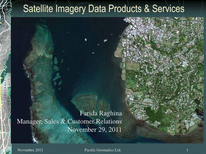
Satellite Imagery Data Products & Services Farida Raghina Manager, Sales & Customer Relations November 29, 2011 Pacific Geomatics Ltd.
Pacific Geomatics Ltd. • A Canadian Remote Sensing Company founded in 1988. • Data Vendor – Optical and Radar satellites. • Products: GeoEye1, IKONOS, Worldview 1 & 2, QuickBird, Landsat, Aster, IRS, ALOS Palsar, Prism, Radarsat, RapidEye, SPOT, TerraSAR-X • Services: Orthorectification, mosaicking and tonal balancing, cloud patching and haze correction, colour enhancements, project management, training, generation of DTMs/DEMs/Contours, creation of multi-resolution data sets. • Digital Elevation Models (Aster, Ikonos, Worldview, GeoEye) Pacific Geomatics Ltd.
OPERATIONAL HIGH RESOLUTION OPTICAL SENSORS Pacific Geomatics Ltd.
Current GEOEYE Sensors Pacific Geomatics Ltd.
Current Digital Globe Sensors QuickBird WorldView 2 WorldView 1 Pacific Geomatics Ltd.
High Resolution Satellite Summary Pacific Geomatics Ltd.
Advantages of WV-2 Spectral Bands DigitalGlobe Proprietary
COMING SOON • HIGH RESOLUTION OPTICAL SENSORS Pacific Geomatics Ltd.
GEOEYE - 2 Pacific Geomatics Ltd.
Launch: 2012 Resolution: 33cm Pan and 1m Multispectral at nadir (commercially available resolution tbd) Bands: Pan, BGR+NIR bands Swath Width: 14km Collection Capacity: 658,000 sq km/day Pacific Geomatics Ltd.
WORLD VIEW – 3 Pacific Geomatics Ltd.
Launch: 2014 Resolution: 30-46cm (expected) Bands: 8 (BGR, NIR, Coastal, Yellow, RedEdge, NIR2) Swath Width: 14.2km Collection Capacity: 676,000 km2 Pacific Geomatics Ltd.
PLEIADES Pacific Geomatics Ltd.
DATA PRODUCTSGEOEYE PRODUCTS GeoProduct: For those who want satellite imagery for visual and interpretive applications that are geometrically accurate and cost effective. This is a radiometrically corrected map oriented image and is shipped with the sensor camera model in rational polynomial coefficient (RPC) format. Geo product needs to be processed with RPCs to be geometrically accurate on a flat plane. Typical applications include environmental monitoring, image interpretation, disaster response etc. GeoProfessional: products are orthorectified (terrain corrected products). Perfect for anyone demanding greater image positional accuracy. These products are suitable for feature extraction, change detection, base mapping and other similar applications. GeoStereo: For those requiring images that deliver 3-dimensional viewing and feature recognition. This product provides two images with stereo geometry to support a wide range of stereo imagery applications such as DEM creation, building height extraction, and creating various spatial layers. Pacific Geomatics Ltd.
DATA PRODUCTSDIGITAL GLOBE PRODUCTS Basic: Imagery products are designed for users having advanced image processing capabilities. It is the least processed image product and comes with the camera model information for sophisticated users to perform processing services such as orthorectification, 3D feature extraction etc. Standard: Imagery products are the most flexible and are suited for visual analysis image classification, as a backdrop for GIS and mapping applications that require a modest level of accuracy and as the basis for doing your own orthorectification. StereoImagery: These products are designed for users with advanced image processing capabilities and photogrammetric tools. This product is ideal for Digital Elevation Model (DEM) generation, 3D visualization and feature extraction applications. Pacific Geomatics Ltd.
High Resolution Satellite Data Ordering PRODUCT SPECS: Standard or Ortho Ready? DRA On or Off? 8 Bit or 11 Bit? 3 band or 4 band Pan sharpened or Bundle Product? Pacific Geomatics Ltd.
RADAR SATELLITES • Radarsat 1 & Radarsat 2 • TerraSAR – X • Envisat • PALSAR Pacific Geomatics Ltd.
Image Processing Services • Our standard image processing includes: • Orthorectification • Client provided control (GCPs) • RPC (Sensor) Model • Mosaicking and tonal balancing • Cloud patching / haze correction • Colour enhancements • Image compression (ECW/SID) Pacific Geomatics Ltd.
Elevation Data Generation • DTM generation from stereo imagery: • DEM (regular grid at 1-5m) • Contours (1m) • Breaklines (including hydrography and access features) • Random mass-points at high and low points • Vertical accuracy of +/- 1 to 1.5m with surveyed control Pacific Geomatics Ltd.
Project Specific Services • Project management • Training in software and data usage • Creation of multi-resolution datasets • Digital Mapping and GIS • 3D Visualization Pacific Geomatics Ltd.
DigitalGlobe Solutions Site Specific Imagery Advanced Products Information Solutions Global Basemap Advanced Ortho Series Stereo Collection Advanced Elevation Series Archive Imagery Precision Aerial Tasking FirstLook FirstWatch Analysis Services IMAGE INSIGHT
GeoEye’s Web Dissemination Platform - EyeQ End-User Environment • Collection Systems • GeoEye-1 & 2 • WorldView-1 & 2 • Others • On-Demand Processing and Dissemination Services • Service Oriented • Source Agnostic • OGC Compliant • Secure • Scalable • Interoperable GeoEye Portal • Products • Airport Mapping DataBase • SeaStar • Others Partner & Customer Portals End User Applications 3rd Party Content Customer Devices
CLIENT BASE: GLOBAL • APPLICATIONS: • Mining & Exploration: High resolution images can be acquired in mountainous, remote regions and can be used to plan property exploration and map geological information and analyze surface features. • Forestry: High resolution imagery can provide accurate mapping of logging roads, and detailed inventory of harvested areas and burns. • Agriculture: Remote sensing data is valuable in crop prediction models and the visible and infrared imagery allows for health and productivity analysis. • Oil & Gas: Oil spill mapping, oil seep exploration, facility management. • Environmental Mapping: High resolution imagery is used to map and monitor environmental change, thereby help manage natural resources. • Vis Sim: Multi-Res ortho imagery for flight simulators. Pacific Geomatics Ltd.
WHY PACIFIC GEOMATICS?? • Customer Service: Provide the right data, at the right time and at the right price! • Business Relationships: Excellent relationships with various satellite owners such as Digital Globe, GeoEye, Astrium, ESA, MDA, RapidEye/Iunctus, etc. Voted the Top North American Distributor for GeoEye in 2011!! • Personal Relationships: Having worked with SOPAC for very many years, have grown to know, respect and understand the needs of the people of the South Pacific Islands. Pacific Geomatics Ltd.
Questions??? Look forward to a long lasting work relationship with SOPAC/SPC and the South Pacific Island Nations !! Pacific Geomatics Ltd.
VINAKA VAKA LEVU Pacific Geomatics Ltd.