Download
1 / 1

E N D
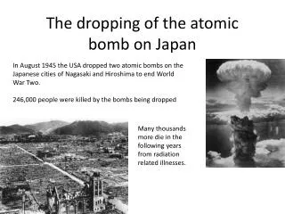
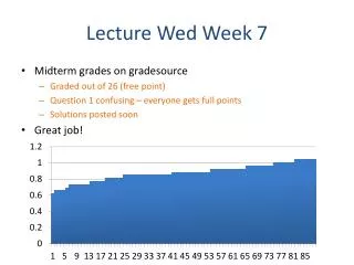
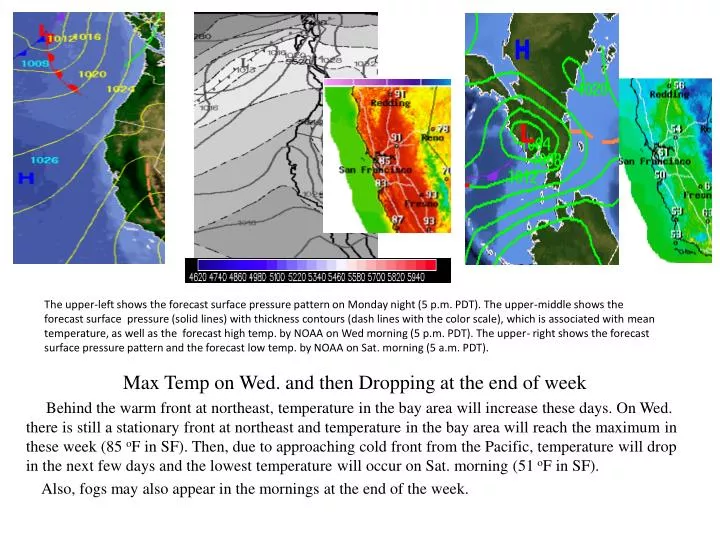
The upper-left shows the forecast surface pressure pattern on Monday night (5 p.m. PDT). The upper-middle shows the forecast surface pressure (solid lines) with thickness contours (dash lines with the color scale), which is associated with mean temperature, as well as the forecast high temp. by NOAA on Wed morning (5 p.m. PDT). The upper- right shows the forecast surface pressure pattern and the forecast low temp. by NOAA on Sat. morning (5 a.m. PDT). Max Temp on Wed. and then Dropping at the end of week Behind the warm front at northeast, temperature in the bay area will increase these days. On Wed. there is still a stationary front at northeast and temperature in the bay area will reach the maximum in these week (85 oF in SF). Then, due to approaching cold front from the Pacific, temperature will drop in the next few days and the lowest temperature will occur on Sat. morning (51 oF in SF). Also, fogs may also appear in the mornings at the end of the week.