Download
1 / 26
260 likes | 383 Views
NSDI Implementation Milo Robinson FGDC. U. S. Policy – OMB Circular A-16 From Global – GSDI To Local – Canadian/ U.S. Projects. Federal Geographic Data Committee (FGDC).

E N D
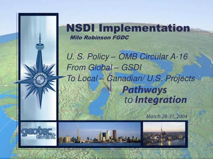
NSDI ImplementationMilo Robinson FGDC U. S. Policy – OMB Circular A-16 From Global – GSDI To Local – Canadian/ U.S. Projects
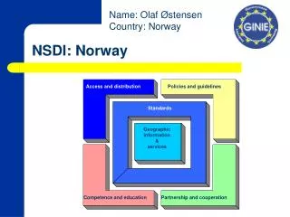
Federal Geographic Data Committee (FGDC) • A US Federal Interagency committee responsible for facilitating geospatial related activities and implementation of the NSDI across the Federal government • 19 Federal agencies are members • Cooperate and coordinate with organizations from state, local and tribal governments, the academic community, and the private sector.
U.S. Geospatial Policy Roots Source Year Description EO T.R. 1906 Created U. S. Geographic Board. EO 3206 Wilson 1919 Created a new Board of Surveys and Maps that took over the responsibilities of U.S. Geographic Board. EO 9094 FDR 1942 Abolished Board of Surveys and Maps and authorizes Director of OMB to perform the functions of the Board. OMB (BOB) A-16 1953 Describes responsibilities of Federal agencies with regard to the coordination of surveying and mapping activities.
Primary U.S. Policy based on: OMB Circular A-16 Exhibits A,B,C, & D 1953 to 1964 Attachments to A-16 that outline prog.and oper. for Topographic, Atlas, Geodetic, Int. Boundaries. Some Exhibits were revised. A-16 Revised 1967 Better describes responsibilities of Federal Agencies (leadership and coordination). OMB M 83-12 1983 Establishes coordination of Federal digital cartographic data programs. A-16 Revised 1990 Establishes Federal Geographic Data Committee and links more programs. EO 12906 1994 Establishes the National Spatial Data Infrastructure (NSDI). A-16 Revised 2002 Strengthens coordination responsibilities of Federal agencies and incorporates NSDI
NationalSpatialDataInfrastructure(NSDI) The Vision of the NSDI: to assure that spatial data from multiple sources (Federal, State, and local governments, academia, and the private sector) are widely available and easily integrated to enhance knowledge and understanding of our physical and cultural world.
How is the A-16 structured? • National Spatial Data Infrastructure • Federal Geographic Data Committee • Scope-Federal Agencies & Activities • Federal Responsibilities • Appendices
What are the Significant Changes in A-16? • Incorporation of NSDI • Assignment of Roles and Responsibilities including Agency responsibility for a spatial data theme in appendix E • OMB is Vice Chair of FGDC • More Compelling Language • Q/A Format • Link to Budget • See www.whitehouse.gov/omb/circulars/
Is A-16 New policy? • Avoid duplication of work and improve the standardization of maps (1906) • Invite the ”map using public” to meetings for ”conference and advice” (1919) • A central information office that was to furnish all map and survey data information within the government as well as from other sources (1919)
Is it Improved Policy? • Interoperability of Federal information systems • Enhance E-government • Support Global Spatial Data Infrastructure
Global Spatial Data Infrastructure • GSDI 1 Bonn Germany Sept 1996 • GSDI 2 Chapel Hill NC October 1997 • GSDI 3 Canberra Australia November 1998 • GSDI 4 Capetown South Africa March 2000 • GSDI 5 Cartagena Colombia May 2001 • GSDI 6 Budapest Hungary September 2002 • Over 250 attendees • Over 50 Nations represented • GSDI 7 Bangalore India February 2004 • GSDI 8 Cairo (with FIG) April 2005
GSDI Evolution • Steering Committee formed at GSDI 3 in 1998 together a number of Working Groups • Technical Working Group produced first edition of SDI Cookbook for GSDI 4 in 2000 • FGDC in secretarial role after GSDI 4 • Proposal to create a GSDI Association agreed at GSDI 5 in 2001 • GSDI Association operational in 2004 for GSDI 7
Create a Global Spatial Data Infrastructure (GSDI) ……… To encourage the collection, processing, archiving, integrating, and sharing of geospatial data and information using common standards and interoperable systems and techniques ….. and accessible via the web
Why did FGDC get involved? GSDI is consistent with mission of FGDC • FGDC involved from the beginning Rationale: • Truly transnational issues • Exchange of issues -- successes/problems • Lessons to be learned • Serious interest in global interoperability • It just makes good business sense
GSDI – An idea at the cusp Foster SDI developmentlocally to globally • Access data at a variety of scales and from multiple sources • Common standards an interoperable systems and techniques • Heavy reliance on partners world-wide • Support sustainable development • Poverty and famine reduction • Advancing health, safety, & social well being of all nations
Joint US-CanadaSpatial Data Infrastructure Projects • Access, Metadata/Clearinghouse • Standards • Partnerships • Framework
Objectives of the joint demonstration projects • Refine US/ Canadian spatial data infrastructure (SDI) • Have an interoperable SDI for North America & beyond… • Stimulate cross border cooperation between Canada and the US for common objectives • Obtain down to earth user perspective at the application level or local level • Receive practical recommendations on technical and policy issues to advance SDI • Encourage private sector participation • Visibility, communications and outreach on SDI initiatives
Funding • Funded through GeoConnections and FGDC • Based on cost sharing - project participants must leverage funds by matching through cash or in-kind contributions
Project Requirements • Project participation - minimum of 4 organizations (2 from Can. & US - including private sector ) • Projects cover a common geographic area of mutual concern that crosses the international boundary • Demonstration of collaborative approaches in solving regional/community issues using framework data • The project has to find tangible solutions to a specific issue
The Yellowstone to Yukon (Y2Y) Roughly defined by the Rocky Mountains from central Wyoming to the Yukon Territory
Data Challenges • Non-Uniform Standards and Formats • Mismatch at the Border • Restricted Data Sets • Uncertain Spatial Data Quality • No understanding of how data was derived • What data would you trust? • Some Data sets are Missing Merging data across jurisdictional boundaries • Management agency • State/Provincial • National • Lack of consistent data models • Source scales vary • Inconsistent positional accuracy • Attribute systems vary • Challenge to ‘cross walk’ the attributes • Edge matching is difficult • Vertical integration is difficult
Challenging Hydrology Example • Hydrology across a portion of the U.S./Canada border • Different densities • Different scales
Challenging Connectivity Example at the Border • features • at border
What have we learned? • Never assume that they know everything that they should • some training may be required • remember the learning curve • In this new High Tech. Environment, face to face meetings are still one of the best ways to understand each others! • Be patient and be flexible when they ask for something, be ready to guide them, provide contacts, avenues--leadership
Pathfinder: • Milo Robinson, Federal Geographic Data Committee • mrobinson@fgdc.gov • (703) 648-5162 • www.fgdc.gov • www.gsdi.org • www.geoconnections.ca