Download
1 / 25
250 likes | 346 Views
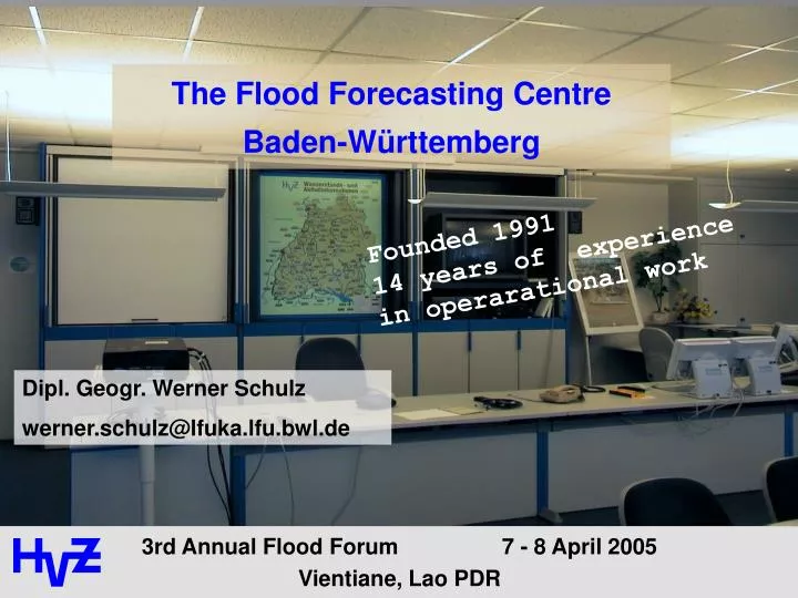
The Flood Forecasting Centre Baden-Württemberg. Founded 1991 14 years of experience in operarational work. Dipl. Geogr. Werner Schulz werner.schulz@lfuka.lfu.bwl.de. General Information. Area 35 752 km² Inhabitants 10,5 Mio. 1111 local authorities 291 Inhabitants / km².

E N D
The Flood Forecasting Centre Baden-Württemberg Founded 199114 years of experience in operarational work Dipl. Geogr. Werner Schulz werner.schulz@lfuka.lfu.bwl.de
General Information • Area 35 752 km² • Inhabitants 10,5 Mio. • 1111 local authorities • 291 Inhabitants / km²
General Information Worms: 68.827 km2 Upper Rhine catchment area gauge Maxau 50.196 km2 99.97 m a.S.L Feldberg1498 m a.S.L. < 100 km >
Schorndorf, Flood of the River Rems (500 km2) 20th March 2002
watersheds < 500 km² > 25 mm in 1h - > 35 mm in 6h Floods in Baden-Württemberg: typical Events Duration: 1-2 days surge: few hours
> 50,000 km² extensive rainfall> ~ 70 mm in 48 h Floods in Baden-Württemberg: typical Events Duration: 1-2 weeks increase: 2 -5 days
Excess of the water level threshold Flood Warning Fire-brigadeHead Quarter Call Water authority Shipping authority Harbour police Majors office ... District Administration office
HVZ Data pool: topical Water Levels • water-levels: • about 170 gauges, in parts in France and Suisse • different technical systems • updated every half hour • input for forecasts water-levels:
HVZ Data Pool: Precipitation Measurements • Precipitation : • about 230 rain gauges • updated every hour • input for forecasts
HVZ Data Pool: Precipitation Forecasts • Precipitation Forecasts • 48 –hour forecast: 3 times a day • 7 – days forecast: 3 times a day • Input for forecasts
Flood- Forecast Models of theHVZ Forecasts are calculated and published fully automatically for about 45 gauges (hourly) Hydrological models • Kalman-Filter-Models • Catchment Models (RR) • Synoptic Model Rhine • Water-Balance Models
Forecast Lead-times during a Flood Event 17 18 10 lead-time 36 18 12 9 9 4 - 5 hours 18 9 36 6 12 6 9 6-10 hours 36 6 9 9 24 11-15 hours 9 9 6 9 9 16-20 hours 24 9 9 > 20 hours 24 6 24 9 12 12 12 4 4 6 6 6 6 6 9 Estimations with lead-times of 7 days for flood warning
Collecting of Data under operational Conditions The data are collected from different measurement stations.The HVZ recall the data… … from own measurement stations … from measurement stations of other administrations (Bavaria, water management of the Federal Republic, France) … from files via ftp (Suisse, Austria)
Collecting of Data under operational Conditions Data recall of HVZ: Facts Data of about 380 measurement stations (with more than 7000 different components) daily collected During a flood, collecting of water level data for 180 stations every half hour Collecting the data of more than 10 different devices or types of communication Data collecting with more than 30 modems, 2 ISDN- und 2 ftp-Ports (parallel)
Experiencies in operation The systems works reliable and with sufficient speed (180 measurement stations in 10 minutes) The manufacturers of the measurement stations provides the interface for data communication. Direct call (modem -> station) is more efficient than ftp
Flood - Forecasts in Baden-Württemberg Consideration of Retention Basins along the River Rhine Use and calculation of the retention measurements according to the international agreement with fixed rules. • Use, different from the agreed rules, only, if • the forecast points out a use with better results • and all partners agree with the deviation
5000 m³/s 4700 m³/s 10. 11. 12. 13. 14. 15. 16. 17. 18. 19. 20. 21. 22. 23. 24. 25. 26. 27. Maxau without retention mesurements Maxu, measured values (with measurements) Forecasts for the River Rhine Flood May1999 cm 900 850 800 750 Used volume: 30 Mio m³ Peak diminished: 24 cm 700 650
Provided Flood Information Flood Forecasting Centre Baden-Württemberg / Karlsruhe published information: - water levels and discharge hourly - water level forecasts hourly - precipitation measurements hourly - weather alerts as required - situation reports as required
Published Information • Internet www.hvz.baden-wuerttemberg.de • Telefon - announcement 0721 / 9804-61 • Videotext (television) Tafel 800 ff • Broadcast SWR1, SWR3, Welle, Regenbogen, ... • Mobile WAP wap.hvz.baden-wuerttemberg.de
E E Nieder- schlags- vorher- sagen (DWD) Schnee- schmelz- vorher- sagen (DWD) Nieder- schlagshöhen (UMEG, DWD, Land) Meteosat- bilder (Eumetsat, DWD) Radar- bilder (DWD) Vorhersagen Rheinfelden (LHG Bern) Steuerstand (KWK) Wasserstandsdaten (Bundesrepublik Deutschland, Bayern, Baden-Württemberg, Frankreich, Schweiz) Telefon- ansage Telefon Messnetz- programm LVN Rundfunk Videotext Internet WAP Telefax 400 Infobox Datenpool Plausibilisierung, Weiterverarbeitung, Visualisierung, Hochwasservorhersagen, Bewertung
IntranetInternet WAP telephone announcement Fax 400 polling servicetelevisionbroadcast Water management governmentalauthorities Administration of the neighbour states Citizens Dissemination of Information Flood Forecasting Centre Baden-Württemberg / Karlsruhe published information: - water levels and discharge hourly - water level forecasts hourly - precipitation measurements hourly - weather alerts as required - situation reports as required