Download
1 / 15
420 likes | 1.28k Views
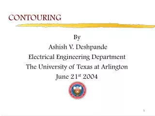
Contour What?!. How to read and understand topographic maps. What is a topographic map?. What is a topographic map?. A topographic maps shows the shape of a landscape Topography = “shape of land” Elevation = height above sea level. What is a contour line?.

E N D
Contour What?! How to read and understand topographic maps
What is a topographic map? • A topographic maps shows the shape of a landscape • Topography = “shape of land” • Elevation = height above sea level
What is a contour line? Contour lines are continuous lines used on a topo map in order to show points of the same elevation http://static.ddmcdn.com/gif/how-to-read-topographic-map-2.jpg
What is a contour? Major/Index Contour linelabeled with elevation above sea level Contour Intervalthe elevation change between any two contour lines What is the elevation on point A on your map? What is the contour interval on this map? A http://static.ddmcdn.com/gif/how-to-read-topographic-map-2.jpg
What is the contour interval? Determine the contour interval for the following 4 topographical maps Map A
Identifying slope steepness steep slope • What do you notice about the contour lines that represent the steep slope of the mountain? When the slope or angle of a mountain side increases, the contour lines are located closer together • What about the gentle slopes? When there is less slope or the slope is more gentle the contour lines are further apart gentle slope http://upload.wikimedia.org/wikipedia/commons/d/d1/Courbe_niveau.svg
Activity: Identifying slope steepness • Draw the side view of the mountain represented by this contour map • Discuss with a partner; Which side has the most steep slope, and which side has the leaststeep slope
Identifying slope steepness http://www.cibolasar.org/minilessons/nav_lesson/USMC_mapfigs.jpg
Activity:Contour This! Match the numbered contour maps with its correct landscape profile http://www.cibolasar.org/minilessons/nav_lesson/contour_match.jpg
Direction of water flow What do you observe about the contour lines regarding the flow of the water? Water flows perpendicular to the contour lines Rivers also flow downhill through the concave part of the contour
Contour this! Which direction does the river flow? • Where is the river? • Which direction does the river flow? http://www.cibolasar.org/minilessons/nav_lesson/USMC_mapfigs.jpg