Download
1 / 51
510 likes | 516 Views
Learn about the different types of clouds, how cloud condensation nuclei form, and the characteristics of fog. Discover cloud formations and classifications.

E N D
Clouds ATS351 Lecture 5
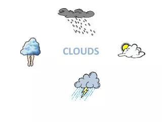
Outline • Review CCN • Fog • Clouds Types • Use of Satellite in Cloud Identification
Cloud Condensation Nuclei • Aerosols may become CN; and CN may become CCN • But not all CN are CCN • Larger concentrations over land • Cloud droplets can form on both insoluble and soluble particles • A particle that will serve as CCN is called hygroscopic or hydrophilic • condensation may occur at RH <100% • A particle that will not serve as a CCN is called hydrophobic. • condensation may occur at RH >100% • CCN Sources may include: • dust, volcanoes, factory smoke, forest fires, sea salt
Cloud Condensation Nuclei • Described by the size of the particle
Haze • Dry haze • Just the small particles themselves, maybe a little bit of condensation • Wet haze • Begins at RH ~ 75% • Much more light scattering than dry (3x)
Fog • Going above 70% RH to 100% • Condensation on less active nuclei • Essentially, a thick wet haze on the ground or a low cloud • Called fog when visibility is less than 1 km • 4 Main Types • Radiation • Advection • Upslope • Evaporation/Mixing
Fog • Type of CN affects fog • Over the ocean • Fewer, larger drops • Over urban areas • More, smaller drops • Lower visibility • London Fog • Chemical reactions can • cause fog to become acidic • If temperatures drop belowfreezing, freezing fog • may result
Radiation/Ground Fog • Surface radiatively cools • Light breeze helps more air contact cold surface • Common in the fall and winter (associated with ridges) • Common in low-lying areas • River valleys • Form upward from the ground • Deepest around sunrise • May intensify after sunrise (dew evaporation) • “Burns Off” with more insolation • Dissipates from bottom up • Dissipates easily around edges (thin, mixing)
Advection Fog • Warm air moves over a cold surface. • Breeze required • Pacific Coast Cold Current • Gulf Stream and British Isles • May combine with radiation fog
Upslope Fog • Moist air rises up the side of a mountain • Just like a cloud forming, but touching the surface • Would be seen on western slopes (not around Fort Collins as much except in the case of easterly winds and associated upslope) • Can last for days under • the right conditions
Evaporation (Mixing) Fog • Just like breathing out when it’s cold • Cold air over warm water (steam fog) • Seen over a pool or spa • Increased moisture raises the dew point • Maintained through vapor pressure difference and mixing • Steam devils on a lake • Precipitation Fog
Foggy Weather Annual number of days with fog in the US
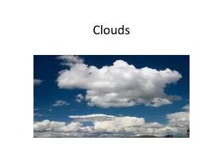
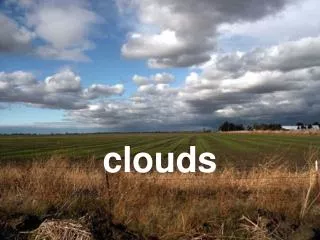
Clouds • Clouds result when saturation occurs • Properties: • Variety of sizes • Contain water drops and/or ice crystals • Various heights • Stratospheric clouds rare, but important for creation of the ozone hole
Cirriform Clouds • Usually exist above 16,000 feet • Generally thin, sometimes partially translucent • Comprised of ice crystals • Absorb longwave radiation, but highly reflective of visible radiation (high albedo) • Rarely precipitate • Virga • Examples:
Cirrostratus (Cs): Usually present when halos around the sun are observed Halo
Stratiform clouds • Characterized by a horizontally uniform base (Layered) • May or may not precipitate • May exist at any level
Nimbostratus (Ns): Patchier and rainier than regular stratus
Cumuloform clouds • Large vertical extent • May or may not precipitate • Result from vertical motion • Cumulus (Cu) Examples:
Mammatus clouds • Precipitation evaporates out of anvil • Evaporation cools the air and it sinks • If drops are large, mammatus will be long lived
Fractus Clouds • Also known as scud clouds • Low, detached clouds caught in the outflow of a thunderstorm • Can also be seen below stratus clouds.
Pyrocumulus • Caused by fire, volcano or industry • Caused by intense heating of moist air • Only forms in Calm wind situations
Contrails • Condensed exhaust from jet aircraft • Important when considering climate effects of clouds
Cloud Formations • Lenticular • Kelvin-Helmholtz waves • Cloud streets • Wall Clouds • Shelf Clouds
Lenticular Clouds • Stationary, lens-shaped clouds over mountains at high altitude • Stable, moist air flows over mountain, creating a large scale standing wave • Indicates region of turbulence
Kelvin-Helmholtz Waves • Form when two parallel layers of air are moving at different speeds and in different directions • Upper layer is usually faster • Very short lived
Cloud Streets • Form due to horizontal rolls in the atmosphere • Also due to uneven surface heating • Clouds form over updrafts in rolls • Occurs more frequently over the ocean
Shelf and Roll Clouds • Low, horizontal, wedge-like cloud • Shelf: Attached to Parent Storm • Roll: Removed from Parent Storm • Formation is due to gust front from thunderstorms
Wall Cloud • Associated with severe thunderstorms • Indicates area of strongest updraft • The strongest tornados form here
Really High Clouds • Nacreous Clouds (mother of pearl) • Form in stratosphere • Seen best at polar latitudes in winter • Composition not well known • Noctilucent Clouds • Sometimes seen in the mesosphere • Stars shine through them • Made of tiny ice crystals
Noctilucent Clouds From Surface From Space
Satellite Imagery • Visible imagery: essentially a black and white camera on a satellite. Measures brightness in the visible spectrum. • Infrared imagery: measures infrared radiance from the surface it is pointed at. From blackbody theory, the temperature of the surface can be found; since temperature changes with height, the cloud-top height can then be estimated.
Visible Satellite • Pros- good at showing low clouds and fog- available in high spatial resolution • Cons- only works in daylight- clouds can be confused with reflective features like snow- optically thin clouds like cirrus don’t show as well
IR Satellite • Pros- available at all hours- provides an estimate of cloud-top height • Cons- lower spatial resolution- low clouds don’t show because their temperatures are close to the surface temperature • Color enhancement table often applied to bring out important temperatures Raw Enhanced
Clouds and Satellite Imagery • The bright, puffy areas in the visible image on the right are cumulus and cumulonimbus clouds (the cumulonimbus are fuzzier around the edges). Notice how the cloud tops over the Front Range are cold in the IR imagery
Cirrus in visible vs. IR • Because cirrus are cold and optically thin (meaning the sun can be seen through the cloud), they are more easily seen in the IR than the visible