Download
1 / 16
170 likes | 295 Views
Our vision: via carpatica. Transsylvanische Alpen. Explications to the map of Carpathians from page 3 (each click corresponds with a paragraph below) We will start at the Danube and hike through the first part of the Southern Carpathians.

E N D
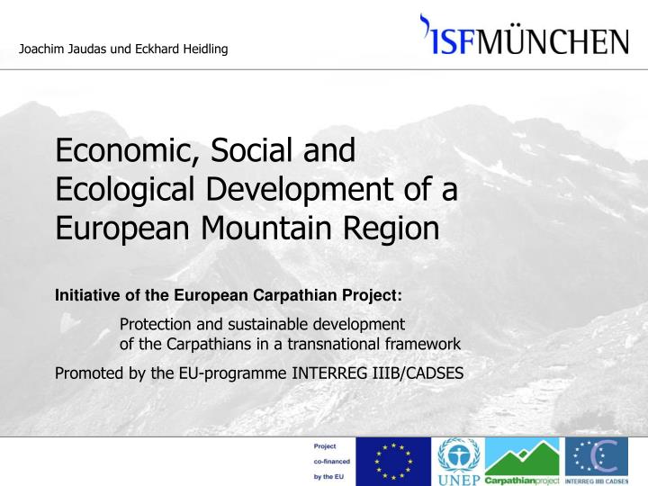
Our vision: via carpatica
Transsylvanische Alpen
Explications to the map of Carpathians from page 3 (each click corresponds with a paragraph below) We will start at the Danube and hike through the first part of the Southern Carpathians. On the ridge path, we will traverse the Transylvanian Alps and ascend Rumania’s highest mountain Moldoveanu and then climb through the steep and jagged limestone rocks of the Pietra Craiuli. Quiet and lonesome passages follow in the Eastern Carpathians. We continue our hike to the former border of Galicia, the country with its great multi-ethnic past in the middle Europe. The path continues along the historical boundary between – well today it is the boundary to Transcarpathia, a Ukrainian region. But when we take a closer look, we can find Austrian, Hungarian, Czechoslovakian and Soviet boundary stones – evidence of a turbulent past east and west of this boundary on the ridge of the Лісистi Карпати 'Lisysti Karpaty', also called Beskids. We come to Slovakia and to Poland. And there we pass the High Tatras – the world’s smallest high mountain region. The Gerlach stit, with its 2.655 m the highest peak of the Carpathians, is situated in this region. We finish our hike passing through the Western Carpathians, which also touch the Czech Republic, and in Bratislava, after 1.300 km or so – who has ever measured the distance? – we reach the Danube again.
via carpatica as a vision A vision does not correspond with reality It is a guiding line for practical steps to be taken
Via carpatica is our vision. A vision however is not the reality, it does not correspond with the reality. However a vision can be useful: it is a goal to work towards to and a guiding line for our practical actions. What is the plan and what are the goals of the Carpathian Project of ISF München? Which results should be achieved? In which framework?
Frame Initiative of the European Carpathian ProjectProtection and sustainable development of the Carpathians in a transnational framework Promoted by the programme INTERREG IIIB/CADSES of the European Union Duration September 2005 till August 2008
Goals of the European Carpathian Project: The objective of the Carpathian Project is to enhance the sustainable development of the Carpathian region based on its rich natural and cultural heritage. The project will analyse the available information base, develop strategies and policy instruments and will implement pilot activities together with regional and national stakeholders. The project builds on the transnational framework established by the Carpathian Convention to apply EU policies throughout the Carpathian region.
Goals of the Carpathian Project of ISF München Development of sustainable mountain tourism Creation of occupational and qualificationalperspectives for the local population Identification and organisation of necessary training courses
Approach of the project Pilot region: Transsylvanian Alps (Fagarasi Mountains) Co-operation with local players in a bottom up approach: Authorities of the provinces Brasov, Sibiu and Arges “Siebenbürgischer Karpatenverein” (SKV) Mountain rescue services (Salvamont) Hut administrators Association of Mountain Guides Romania (AGMR) Ecology group “Club for protection of nature and tourism” (CPNT) “Friends of Nature Romania” (Prietenii Naturii Romania) Connections to other regions and organisations transfer of know-how
Work plan Inquiry of the present touristic infrastructure through interviews with relevant local players Development of an infrastructural concept forthe pilot region Identification of job opportunities Identification of the necessary qualifications Support of local players in the organisation of necessary training courses
Expected results Extension and improvement of the existing path and hut network and of the infrastructure in areas close to the mountains Development of quality criteria for huts and paths Improving the acces to information for users of huts and paths, including guides and maps as well as a website. Creation of new job opportunities on the mountains and in the valleys Training measures for those employed in mountain tourism Transfer of know-how among European mountain regions Creation of three types of networks- among the local players - within the Carpathians - between Alps and Carpathians
If we will be able to realise these goals and achieve these results, mountain tourists one day will be able to hike on marked paths over the ridges and crests of the Carpathians – from the Danube back to the Danube, find a hut in the evening, where they can spend the night and get something to eat. They will find route descriptions and they will get information on the Internet. They will find an infrastructure in the valleys that will provide an easier access to the mountains. And all this will be made possible by the efforts made and the services rendered by the resident population, which in turn will also help to secure jobs. This will be an important contribution to the stabilisation of this European region.
Activities till autumn 2006 July 2006:Inquiry of acitivities related to sustainable mountain tourism in the Fagarasi Mountains August 2006:Development of a concept of sustainable tourism for the Fagarasi Mountains September 2006: I. Workshop in Sibiu with 35 participants from all the relevant domains of mountain tourism:- Tourism Association of the province Sibiu (AJTS)- “Siebenbürgischer Karpatenverein” (SKV)- Mountain rescue services (Salvamont)- Association of Mountain Guides Romania (AGMR)- “Friends of Nature Romania” (Prietenii Naturii Romania)- Hut administrators- Ecology group CPNT etc.
Perspectives II. Workshop in the spring of 2007:Evaluation of first results and planning of future tasks Summer of 2007:Implementation