Download
1 / 33
330 likes | 404 Views
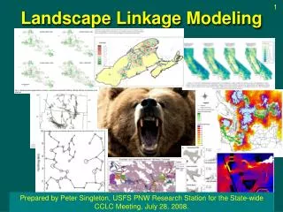
Green Mountains to Adirondacks Habitat linkage (Wide-Ranging Mammals). Paul Marangelo The Nature Conservancy – VT Chapter . Dr. Robert Long Western Transportation Institute. 35 k. 42 k. Region with best connectivity potential. Connectivity assessment (modeling). Threat identification.

E N D
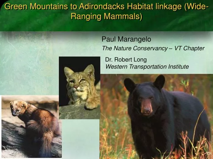
Green Mountains to Adirondacks Habitat linkage (Wide-Ranging Mammals) Paul Marangelo The Nature Conservancy – VT Chapter Dr. Robert Long Western Transportation Institute
35 k 42 k Region with best connectivity potential
Connectivity assessment (modeling) Threat identification Strategy development and implementation Linkage Conservation
Focal Species Approach Black Bear Bobcat Fisher • Goal maintaining “minimum level of permeability” to preserve genetic integrity of WRM populations in “core” habitats.
Linkage assessment approach: multiple models and genetic analysis • Least-cost-path analysis based on focal species • Overlay with wildlife road crossing assessment models developed by VTF&W • Microsatellite DNA analysis of fisher populations to assess role of Lake George as dispersal barrier • Future – FUNCONN analysis for focal species
Least Cost Path Analysis • Most probable pathways for movement • Analysis frame • East to west directionality • Empirical habitat suitability models from field data used to code land-cover with habitat suitability to produce cost surfaces.
Interpretation of results • Suggests a primary potential movement corridor for target species. • Useful tool for evaluating the relative conservation value of potential connectivity zones - can prioritize land conservation or restoration efforts with the intention of increasing connectivity for the target species. • High volume north-south roads (particularly US Route 7 in Vermont) appear to be primary immediate threats to east-west connectivity.
CAVEATS: • Least-cost path approaches will identify and rank paths across landscapes regardless of whether or not such paths are viable for species movement. Actual movement between Green Mts and ADKs exceptionally difficult to document
Green Mtn – ADK linkage partnership • State, NGOs, Regional Planning commission • Technical assistance to towns (community visioning for conservation values – local support for connectivity and wildlife habitat) • Incorporate connectivity language into town plans • Identify specific road crossing sites: implement strategies to enhance permeability across roads • Additional modeling (FUNCONN)
Working with Uncertainty • Poor information regarding permeability of large water bodies • Connectivity restoration or connectivity protection? • Risk of investing in a “bridge to nowhere” • Selling need to protect/enhance permeability for a low-use corridor/road crossing
2008: FUNCONN analysis Graph theoretic/least cost hybrid
Additional relevant points: • Partnership goal for this linkage: Permeability across multiple pathways. • Geographical extent of TNC analysis is limited.
Assessment of outcomes • Analysis has motivated a partnership to work on ADK – GM linkage. • Reasonably well-received by a county-wide transportation committee made up of representatives from town planning boards. • Need to identify specific attributes on road corridor that facilitates wildlife crossing to move forward with recommendations to local planning boards.
Key Project Aspects: • Question being addressed/Application • Type of Analysis • Addressing structural or functional connectivity? • Structural: physical continuity or connectedness of the landscape • Functional: connectedness of the landscape as perceived by one or more focal organisms or ecological process • Based on focal species? • Based on field data, models, or both? • Final Products • Geographic extent (local, statewide, regional) • How effective was the project and how well did it answer the original question
Green Mountains/Adirondacks Habitat linkage partnership • Linkage area may be larger than TNC analysis frame. • Looking forward, this is one of many possible focal efforts withinthe linkage area. • Individual initiatives will likely comprise of a subset of the larger group of partners interested in working on this linkage.
Combining existing assessments: • Considering limitations of any one habitat modeling methodology, corroboration of results from different models helps strengthen our hypotheses. • Overlay VTF&W Wildlife Crossing Values for road corridors • 2008: Apply additional habitat connectivity models • FUNNCON: Graph theoretic/least cost path hybrid (Theobald) • Pathway Analysis Through Habitat (PATH)
Interpretation of results • Primary potential movement corridor for target species has some corroboration with WCS study.
What is Next (research)? • Results from Lake George Fisher microsatellite DNA study • Contract for additional connectivity modeling work (FUNNCON)
What’s next (on the ground)? • Develop a partnership to identify/implement strategies to maintain/enhance permeability on key segment of Rt. 7. • Road crossing focus • Where? • Study suggests Rt 7 between Brandon and Pittsford • Where is greatest opportunity for success? Strategies: Where to start?
The rest of the meeting: discussion • #1 Decide on focal road segment • #2 Decide (discuss) conservation goals • #3 Decide on strategies and action steps to achieve goals. • #4 Do the work
Importance of regional connectivity/habitat linkages • Wide-ranging mammals: maintain genetic diversity by maintaining ability of individuals to disperse between regional “core” habitats • bobcat • black bear • fisher • moose
Functional connectivity for WRM between Green Mountains and Adirondacks: • Is connectivity at present sufficient to allow for movement of wide-ranging mammals between the Adirondacks and Green Mountains? • Threats • Abating threats (road permeability)
East-west cost-distances with the corridor function in ArcGIS used to identify the highest ranking areas for providing connectivity across the region. Predicted Ease of East-West Movement: Fisher Predicted Ease of East-West Movement: Fisher Predicted Ease of East-West Movement: Fisher Predicted Ease of East-West Movement: Fisher Predicted Ease of East-West Movement: Fisher Predicted Ease of East-West Movement: Fisher Predicted Occurrence Model: Fisher Predicted Occurrence Model: Fisher Predicted Occurrence Model: Fisher Predicted Occurrence Model: Fisher Predicted Occurrence Model: Fisher East-west cost-distances with the corridor function in ArcGIS used to identify the highest ranking areas for providing connectivity across the region. East-west cost-distances with the corridor function in ArcGIS used to identify the highest ranking areas for providing connectivity across the region. East-west cost-distances with the corridor function in ArcGIS used to identify the highest ranking areas for providing connectivity across the region. East-west cost-distances with the corridor function in ArcGIS used to identify the highest ranking areas for providing connectivity across the region. East-west cost-distances with the corridor function in ArcGIS used to identify the highest ranking areas for providing connectivity across the region. Results of east-west connectivity analysis for fishers with a high assigned cost of crossing water bodies. Results of east-west connectivity analysis for fishers with a high assigned cost of crossing water bodies. Results of east-west connectivity analysis for fishers with a high assigned cost of crossing water bodies. Results of east-west connectivity analysis for fishers with a high assigned cost of crossing water bodies. Results of east-west connectivity analysis for fishers with a high assigned cost of crossing water bodies. Estimating ease of east-west movement: Fisher Predicted Occurrence Model: Fisher