Download

1 / 13
130 likes | 234 Views
Joint Research Centre. The European Commission ’ s in-house science service. Non-rush mode On demand Standard base widely adaptable to user requests Weeks-months. Rush mode On demand “Standardized” Hours-days. Reference maps Pre-disaster situation maps. Reference maps

E N D
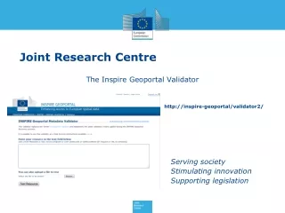
Joint Research Centre • The European Commission’s in-house science service
Non-rush mode • On demand • Standard base widely adaptable to user requests • Weeks-months • Rush mode • On demand • “Standardized” • Hours-days Reference maps Pre-disaster situation maps Reference maps Post-disaster situation maps Reference maps Disaster response maps The GIO EMS setup Validation 2
UAV to fill up the gap • When VHR satellite imagery is insufficient (resolution / delivery time) and classic airborne photogrammetry to expensive • UAV or strut mounts for small (manned) aircrafts are valid alternative (or are complementary) • In urban areas for : • Accurate damage assessments over high value assets. • Flood delineation • Rapid revisit opportunities (monitoring) • Disaster needs assessments in remote areas. • Grading (Destroyed, Partially destroyed, not affected) • consistent impact mapping over a disaster area • Support to response and recovery operations • Estimations of objective reconstruction needs.(PDNA)
SAR flood detection does not work in urban and forested areas. • This highlights the limitations of satellite-based approaches • UAV image based sensors can be a valid complement for impact analysis. • Better resolution • Limited scale extends • Can work under cloud canopy… • The idea is to use the UAV imagery for delineation of the flood extend in urban areas. (outline vector to be overlayed with airborne reference data sets…)
Using VHR for damage assessment is ok for a quick and dirty approach. • UAV solutions are making the use of airborne data more accessible. • Quick deployment, price and better resolution makes the airborne imagery competitive against VHR satellite imagery especially for damage assessments ( For sure the resolution is a key issue for a successful damage assessment. )
Resolution/accuracy requirements • 15 cm is our goal for damage assessments and flood delineation in urban areas……(same for forest fire delineation, landslides, IDP camp monitoring, PDNA, etc…..) • In Europe, we have access to a full coverage of Ortho rectified imagery (< 50cm) for reference. (GCP collection, or image matching with UAV data) • Typical size of our projects = starting from 5 km x 5 km….. • In certain cases just stitching is sufficient as a first available /releasable product version……rectified data can follow at a second stage. • Delivery via web mapping services to enable fast integration.
Some initial thought on technical issues • On board digital camera : • Image format : raw format to have the least proccessed output. 12-14 bit info per pixel (jpg – 8bit) • Blur free : high sensitive camera – quick exposure time to capture • Flexible : interchangeable cameras and lenses for a variety of mission criteria • Robust construction : to sustain shock and vibrations during operations. Compact enough to reduce payload • Lens options : RGB, NIR, Focal length….
Fixed wing versus copter UAV • Fixed wing more forgiving in the air • Natural gliding capability (no power) • Carry greater payloads • Longer distances, less power Disadvantage : the forward motion. But this is only a disadvantage when considering hovering.
Common operational guidelines • Image capturing ‘rules of thumb’ for accurate ortho-rectification and DEM generation • 60 % in track overlap and 40 % cross track overlap • Imagery sequence is important • One camera – one focal length • Images should be nadir • Images should have the same aspect ratio • GPS enabled camera..EGNOS (waas augmented, DGPS, …) • Accurate control points availability • IMU data ??? • Laser scanner on-board ???bottlenecks ??? • Open source for image processing ???
Thank you for your attention • Peter.spruyt@jrc.ec.europa.eu • gio-ems-rush@jrc.ec.europa.eu • http://emergency.copernicus.eu