Download
1 / 36
360 likes | 473 Views
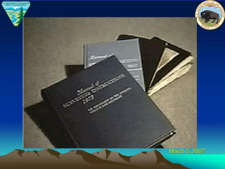
March 5, 2007. The Next Edition of the Manual of Surveying Instructions and the Modern Cadastre. Presented by: Mike Birtles, BLM Chief Cadastral Surveyor Montana State Office, Billings, MT and Bob Dahl, BLM Cadastral Surveyor Lands, Realty & Cadastral Survey Division Washington, D.C.

E N D
The Next Edition of theManual of Surveying Instructionsand the Modern Cadastre Presented by: Mike Birtles, BLM Chief Cadastral Surveyor Montana State Office, Billings, MT and Bob Dahl, BLM Cadastral Surveyor Lands, Realty & Cadastral Survey Division Washington, D.C. Montana Association of Registered Land Surveyors Conference Billings, MT March 2, 2007
Agenda Cadastre – Cadastral – Cadastral Survey What is the Manual of Surveying Instructions? Why is the Manual relevant to the Private, County and State Surveyors in Montana?
Agenda Scope of the project - Technical project nested in a web of administration What is the process? How are we going about it? Where are we to date?
OHA → ↑ IBLA IBIA IBCA
Cadastral Presence • At the DOI level – BLM is 1 of 15 Bureaus and Offices • Within BLM – Cadastral is one of nearly 60 programs
What is the Manual of Instructions for the Survey of the Public Lands of the United States? (Manual) Whom/What is affected?
Why is the Manual Relevant to the Private, County and State Surveyor in Montana?
MONTANA CODE Title 76 Land Resources and UseChapter 3 Local Regulation of SubdivisionsPart 4 Survey Requirements § 76-3-402 Survey and platting requirements for subdivided lands. (3) All subdivision of sections into aliquot parts and retracements of lines must conform to the Manual of Surveying Instructions
SUPREME COURT OF MONTANA Vaught v. McClymond, 116 Mont. 542 (1945) “The survey should be made … in accordance with instructions and regulations issued … by the general land office for the guidance of county surveyors and others in ascertaining boundary lines created by the government survey and in relocating corners or monuments theretofore established which may have become lost or obliterated.”
SUPREME COURT OF MONTANAVaught v. McClymond, 116 Mont. 542 (1945) “When lands are granted according to an official plat of a survey, the plat itself, with all its notes, lines, descriptions, and landmarks, becomes as much a part of the grant or deed by which they are conveyed, and controls so far as limits are concerned, as if such descriptive features were written out on the face of the deed or grant itself.”
SUPREME COURT OF MONTANAVaught v. McClymond, 116 Mont. 542 (1945) “The original corners and lines of a section as created and established by the government constitute the true and only boundaries of a designated quarter section.”
SUPREME COURT OF MONTANAVaught v. McClymond, 116 Mont. 542 (1945) “Congress has provided a system for the survey of public lands, and the boundaries and limits of the several sections and subdivisions thereof, including quarter sections, must be ascertained in conformity with the principles laid down in the federal statutes. (See Sections 751, 752, 43 U.S.C.A.)”
SUPREME COURT OF MONTANAVaught v. McClymond, 116 Mont. 542 (1945) “A survey of public lands does not ascertain boundaries; it creates them.” “The quarter lines are not run upon the ground, but they exist, by law, the same as the section lines.”
SUPREME COURT OF MONTANAVaught v. McClymond, 116 Mont. 542 (1945) “The location of corners and lines established by the government survey, when identified, is conclusive and the true corner of a government subdivision of a section is where the United States surveyors in fact established it, whether such location is right or wrong, as may be shown by a subsequent survey.”
SUPREME COURT OF MONTANAVaught v. McClymond, 116 Mont. 542 (1945) “Original monuments of survey established during a government survey, when properly identified, control courses and distances and field notes and an official plat of government surveys of record will control in ascertaining locations, even though the monuments established are gone.”
SUPREME COURT OF MONTANAVaught v. McClymond, 116 Mont. 542 (1945) “In ascertaining the lines of land or in re-establishing the lines of a survey, the footsteps of the original surveyor, so far as discoverable on the ground, should be followed and it is immaterial if the lines actually run by the original surveyor are incorrect.”
SUPREME COURT OF MONTANAVaught v. McClymond, 116 Mont. 542 (1945) “In surveying a tract of land according to a former plat or survey, the surveyor's only duty is to relocate, upon the best evidence obtainable, the courses and lines at the same place where originally located by the first surveyor on the ground.”
SUPREME COURT OF MONTANAVaught v. McClymond, 116 Mont. 542 (1945) “In making the resurvey, he has the right to use the field notes of the original survey. The object of a resurvey is to furnish proof of the location of the lost lines or monuments, not to dispute the correctness of or to control the original survey.”
SUPREME COURT OF MONTANAVaught v. McClymond, 116 Mont. 542 (1945) “The original survey in all cases must, whenever possible, be retraced, since it cannot be disregarded or needlessly altered after property rights have been acquired in reliance upon it.” “On a resurvey to establish lost boundaries, if the original corners can be found, the places where they were originally established are conclusive without regard to whether they were in fact correctly located.”
SUPREME COURT OF MONTANAVaught v. McClymond, 116 Mont. 542 (1945) "But the government surveys are, as a matter of law, the best evidence; and, if the boundaries of land are clearly established thereby, other evidence is superfluous and may be excluded;
SUPREME COURT OF MONTANAVaught v. McClymond, 116 Mont. 542 (1945) The best evidence is the corners actually fixed upon the ground by the government surveyor, in default of which the field notes and plats come next, unless satisfactory evidence is produced that the corner was actually located upon the ground at a point different from that stated in the field notes."
SUPREME COURT OF MONTANAReel v. Walter, 131 Mont. 382 (1957) The Manual contains the proper procedure for resurveys and subdivision of sections
SUPREME COURT OF MONTANAYellowstone Basin Properties, Inc. v. Burgess, 255 Mont. 341 (1993) Surveyors who comply with the Manual, and who uses the best evidence obtainable meets the standard of care required for Registered Land Surveyors in Montana
UNITED STATES CODETitle 43 Public Lands § 2 The Secretary of the Interior or such officer as he may designate (BLM) shall perform all executive duties appertaining to the surveying and sale of the public lands of the United States
Other Federal Laws – Containing Survey Rules – The Federal Survey Rules Title 43 U.S.C. §§ 751-753, 772, 773 Surveys by the U.S. on the faith of which property rights have been acquired, control over surveys subsequently made by the U.S. which affect such rights. Pittsmont Copper Co. v. Vanina, 71 Mont. 44 (1924)
UNITED STATES CODETitle 25 Indians § 176 Whenever it becomes necessary to survey any Indian lands, the same shall be surveyed under the direction and control of the BLM And as nearly as may be in conformity to the rules and regulations under which other public lands are surveyed
INTERIOR BOARD OF LAND APPEALSHoward Vagneur, 159 IBLA 272 (2003) 1) BLM is authorized to resurvey the corners and lines of government surveys 2) BLM Survey Manual defines a resurvey 3) Manual defines ‘existent’ ‘obliterated’ and ‘lost’ corners 4) Manual provides guidance to surveyors on how to base a resurvey on the ‘best available evidence’
INTERIOR BOARD OF LAND APPEALSHoward Vagneur, 159 IBLA 272 (2003) 5) BLM Official Surveys are presumed regular and 6) An accurate retracement and reestablishment of the lines of the original survey
United States Supreme Court It is settled law that the United States may survey what it owns and thereby establish and reestablish boundaries, but what the government does in this regard is for its own information and cannot affect the rights of owners on the other side of an existing boundary. United States v. State Investment Co., 264 U.S. 206, 212 (1924), citing Lane v. Darlington, 249 U.S. 331, 333 (1919).
MANUAL The Manual of Surveying Instructions describes how cadastral surveys of the public lands are made in conformance to statutory law and its judicial interpretation. (1973 Manual § 1-1.) It is within the province of the Director to determine what are public lands, what lands have been surveyed, what are to be surveyed, what have been disposed of, what remains to be disposed of, and what are reserved. (1973 Manual § 1-11.)
SUMMARY By fundamental law, upon the issuance of a patent for land by the Federal government; it is just as if the monuments, survey plat and field notes, and the laws, regulations and rules governing how to survey the land described in the patent, are stapled to the face of the patent. The survey rules are spelled out in the manuals, circulars, instructions and regulations issued by the GLO and later by the BLM.
Next Edition Website http://www.blm.gov/cadastral/Manual/nextedition.htm Announcements: Upcoming Presentations General Information - And Other Stuff - http://www.geocommunicator.gov/GeoComm/lsis_home/home/index.html http://www.glorecords.blm.gov http://www.usajobs.opm.gov/