Download
1 / 20
200 likes | 540 Views
Subsurface Sensing and Imaging for Civil Infrastructure Diagnostics. Students: Heejeong Shin, FNU Brawijaya, and Jennifer Marckesano (RPI) Kimberly Belli, Alex Bonnar, Rick Unruh, Linnea Linton (NU) Lev Pinelis (NU UROP) Advisors: Dimitri A. Grivas, Rensselaer Polytechnic Institute

E N D
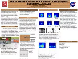
Subsurface Sensing and Imaging for Civil Infrastructure Diagnostics Students: Heejeong Shin, FNU Brawijaya, and Jennifer Marckesano (RPI) Kimberly Belli, Alex Bonnar, Rick Unruh, Linnea Linton (NU) Lev Pinelis (NU UROP) Advisors: Dimitri A. Grivas, Rensselaer Polytechnic Institute Sara Wadia-Fascetti, Northeastern University Carey Rappaport, Northeastern University Industrial Partners: TransTech Systems, Inc. Industrial Collaborators: Geophysical Survey Systems, Inc. Infrasense, Inc. Radar Solutions International Impact-Echo Instruments, LLC This work was supported in part by the Center for Subsurface Sensing and Imaging Systems (CenSSIS) under the Engineering Research Centers Program of the National Science Foundation (Award Number EEC-9986821).
Project Goals • Create a Multi-Modal Subsurface Sensing & Imaging (SSI) • Engineering Systemfor Civil Infrastructure Media • Soil Dielectric Modeling –model and simulate electromagnetic response of soil elements to identify and characterize geotechnical engineering properties • Sensor and Image Reliability – assess accuracy and repeatability of images of bridge deck and pavement structures through statistical quality control • Sensor Fusion – improve detection and measures of important CI & G features
CenSSIS Value Added • Interdisciplinary and industrial collaboration • Use of CenSSIS models • Linkages to other applications • Technology transfer • Educational outreach • Hosted UROP who investigated Impact Echo for CI & G applications • Developed Impact Echo Laboratory Module and Demonstration
, Z = e-iwDt e’ = Constant, Soil Dielectric Modeling Conventional Dielectric Model of Soil Media N=2 Rational Function Model of Dispersive Media ’ =relative permittivity or dielectric constant s = permittivity as f goes to 0 = relative permittivity as the frequency goes to infinity p = 1/relaxation frequency = 2f = applied radian frequency t = time step E = applied electric field, D = electric flux, J = electric current
Soil Dielectric Modeling Three Phases of Geo-Materials • Soil dielectric models assist to better understand interactions in soils and other CI&G materials • Predictive estimates of dielectric constants and electromagnetic properties of medium can: • Enhance design • Increase detection • Decrease uncertainties • Models are formulated of the interactions between EM signals and mechanical characteristics of CI&G materials to characterize mechanical behaviors through EM properties such as: • Density vs. Dielectric permittivity • Delamination vs. EM signal amplitude
Soil Dielectric Modeling Electromagnetic FEM Modeling Technique to Characterize the Interaction of Sensors and Porous Dielectric Media Laboratory Model EM Fields inside soil media showing EM sensors
Soil Dielectric Modeling • Average Dielectric Permittivity and Conductivity Are Related to: • Volumetric fractions of components (porosity, void ratio and degree of saturation) • Characteristics of each component and their interaction From Hilhorst, et al. (1994) Dielectric behavior of soil as function of frequency • Microstructure of the soil matrix (i.e., the shape, orientation, and arrangement of the particles and pores)
Sensor & Image Reliability Impact Echo Reliability Investigation • Data being analyzed for inclusion in M.S. Thesis (L. Linton) • Concrete slabs 3’-9” square x 9.5” thick Sampling of Experimental Results Experimental Setup Expected Results
Sensor & Image Reliability Core Number 22 (Photo by Prudent Engineering Group) Core Sample Investigation (South Grand Island Bridge, Buffalo, NY) • Core samples collected by Prudent Engineering Group for South Grand Island Bridge (Buffalo, NY) • GPR data collected by Infrasense, Inc. • Data analyzed from fundamental concepts of electromagnetics and compared to core samples
Sensor & Image Reliability GPR Accuracy Evaluation (North Grand Island Bridge, Buffalo, NY) Control Chart ROC Curve Contour Map for Rebar Amplitudes
Sensor & Image Reliability • Simulate multiple layers • Evaluate the accuracy of GPR in determining layer thickness • Each layer has different density and/or grain size • Simulate delamination within reinforced concrete • Investigate effects of object orientation and antenna polarization Exploratory Research Prior to Using the Soil Testbed Laboratory Setup:
Imperfect Migration process for pavement layer interface Lower accuracy of thin layer measurement (i.e., in asphalt) Dielectric values of different layers Determining the ground truth Addressing the near-field issue Sensor Fusion for Civil Infrastructure Diagnostics • Multi-modal sensors, implemented at the feature level, address: • Modeling • Registration • Proof of concept • Assumed dielectric constant and EM properties
Bridge Deck Model (Infrared) Bridge Deck Model (GPR) Debonding Asphalt Overlaid Deck Higher Temperature Delamination Non-overlaid Deck Sensor Fusion for Civil Infrastructure – GPR / IR Higher Temperature
Sensor Fusion for Civil Infrastructure– GPR / IR Infrared Image Suspected deteriorated area: Brighter area (higher temperature) Ground Penetrating Radar (GPR) Image Suspected delamination area: Weaker EM wave Reflection
Sensor Fusion for Civil Infrastructure – GPR / IE Preliminary comparison of Impact-Echo and GPR for Sensor Fusion I: Can detect directly OK: Can detect and make inferences P: Possible, not sure how X: Outside limits
Project Status • Fusion of GPR with Infrared and Other Modalities - Pilot study (complete) • Collect field data - Bridge decks: Grand Island Bridges – GIB, Buffalo, NY - Pavement structures: Grand Central Parkway – GCP, NYC • Evaluate ground truth data - Controlled field data: Two bridges, NY (planned) - Laboratory test (ongoing) - Reliability analysis (ongoing) • Evaluate sensor fusion algorithms (ongoing)
Industrial Collaboration Framework • Sensor/System Technology • Transtech Systems, Inc. http://www.transtechsys.com • Geophysical Survey Systems, Inc. (GSSI) http://www.geophysical.com • Impact-Echo Instruments, LLC http://www.impact-echo.com • Field Testing • Infrasense, Inc. http://www.infrasense.com • Radar Solutions International http://www.radar-solutions.com
References • Drnevich, V.P., et al, “REAL-TIME DETERMINATION OF SOIL TYPE, WATER CONTENT, AND DENSITY USING ELECTROMAGNETICS,” FHWA/IN/JHRP-2000/20, Purdue University (2001) • Maser, K, “CONDITION ASSESSMENT OF TRANSPORTATION INFRASTRUCTURE USING GROUND-PENETRATING RADAR. TECHNOLOGY REVIEW”, Journal of Infrastructure Systems, Vol. 2, No. 2, pp 94 – 101, ASCE (1996) • Maser, K., M. Horschel, and D. Grivas, “INTEGRATION OF GROUND PENETRATING RADAR AND INFRARED THERMOGRAPHY FOR BRIDGE DECK ASSESSEMENT”, Structural Materials Technology V – An NDT Conference, pp 119 – 128, The American Society for Nondestructive Testing, Inc. (2002) • Hilhorst, M. A. and Dirkson, C., "DIELECTRIC WATER CONTENT SENSORS: TIME DOMAIN VERSUS FREQUENCY DOMAIN," Symposium and Workshop on Time domain Reflectometry in Environmental, Infrastructure, and Mining Applications, Spec. Publ. SP 19-94, pp. 23-33 (1994) • Shin, H. and D. Grivas, “HOW ACCURATE IS GROUND PENETRATING RADAR(GPR) FOR BRIDGE DECK CONDITION ASSESSMENT?”, accepted for publication, Transportation Research Record, Academy of Engineering (2003) • Wadia-Fascetti, S., Grivas, D., Schultz, C.B., “SUBSURFACE SENSING FOR HIGHWAY INFRASTRUCTURE CONDITION DIAGNOSTICS: OVERVIEW OF CURRENT APPLICATIONS AND FUTURE DEVELOPMENT”, Paper No. 02-3987. Transportation Research Board 81st Annual Meeting, Washington D. C. (2002) • Rappaport, C., Wu, S., and Winton, S., “FDTD WAVE PROPAGATION MODELING IN DISPERSIVE SOIL USING A SINGLE POLE CONDUCTIVITY MODEL,” IEEE Transactions on Magnetics, vol. 35, pps. 1542--1545 , (1999). • Yang, B. and Rappaport, C., “RESPONSE OF REALISTIC SOIL FOR GPR APPLICATIONS WITH TWO DIMENSIONAL FDTD,” IEEE Transactions on Geoscience and Remote Sensing, pp. 1198--1205 , (2001).
Contact Information Rensselaer Polytechnic Institute Dimitri A. Grivas (grivad@rpi.edu) - Advisor Heejeong Shin (shinh3@rpi.edu) - Graduate Student FNU Brawijaya (brawi@rpi.edu) - Graduate Student Jennifer Marckesano (marckj@rpi.edu) - Graduate Student Phone: 518-276-8609 Web Site: http://www.rpi.edu/~grivad/censsis/index.htm Northeastern University Sara Wadia-Fascetti (swf@coe.neu.edu) - Advisor Carey Rappaport (rappaport@neu.edu) - Advisor Kimberly Belli (kbelli@coe.neu.edu) - Graduate Student Alex Bonnar (bonnar.a@neu.edu) - Graduate Student Linnea Linton (linnea@coe.neu.edu) - Graduate Student Rick Unruh (runruh@coe.neu.edu) - Undergraduate Student Lev Pinelis (lev20@hotmail.com) - UROP Phone: 617-373-4248 Web Site: http://sca.coe.neu.edu/censsis