Download
1 / 30
300 likes | 615 Views
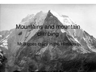
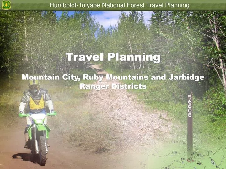
Travel Planning Mountain City, Ruby Mountains and Jarbidge Ranger Districts. Motorized recreation is a legitimate use of National Forest System lands – in the right places – at the right times. Off highway vehicles can be a fun way to experience national forests.

E N D
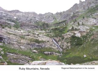
Travel PlanningMountain City, Ruby Mountains and Jarbidge Ranger Districts
Motorized recreation is a legitimate use of National Forest System lands – in the right places – at the right times.
Off highway vehicles can be a fun way to experience national forests.
There has been an Increases of Over 109% in the number of off-highway vehicles since the 1980s.
Irresponsible use of OHVs can cause long- lasting environmental impacts..
Since the Forest Plan was signed in 1986 there has been a increase in the number of user-created routes.
. Non-System Routes These are routes that have not been planned, evaluated, or managed by the Forest Service.
The type of motorized use can affect other forms of recreation.
The Mountain City/Jarbidge and Ruby Mountains travel plans are outdated and not in compliance with the 2005 Final rule for Travel Management.
Current Forest Travel System • Does not include many needed public routes • Allows for cross country motorized travel • Include routes that currently have no public rights-of-way • Many redundant routes. • There are routes that are causing resource damage.
The Need for the Travel Mgt.Rule • The goals of the Executive Orders 11644 and 11989 can no longer be met while allowing unrestricted cross-country motor vehicle use. • Executive Orders direct Federal Agency’s to ensure that off road vehicle use will be controlled and directed to protect resources, promote safety and minimize conflicts. • This is a National Approach, includes every Forest in U.S.. • We must manage motor vehicle use to sustain it, especially as use continues to increase. • Must protect natural resources I. A.-12
Valid Existing Rights • Designations must recognize valid existing rights. • Regulation does not take away any statutory or treaty rights. • In many cases, valid existing rights are covered by the exemption for written authorizations. I.B.-13
Exemptions from Designation • Aircraft. • Watercraft. • Over-snow vehicles. • Limited administrative use. • Emergency search and rescue or fire purposes. • National defense purposes. • Law enforcement response. • Use specifically authorized under a written authorization, such as grazing allotment mgt.. I.B.-14
Requirements of the Rule • Designated roads, trails, and areas shall be identified on a motor vehicle use map (36 CFR 212.56). • The map will be published at end of the NEPA process. Requires Annual review so that corrections can be made to the map. • Until designation is complete, current rules and authorities remain in place. I.B.-15
Elements of Designation • Designation involves: • NFS roads. • NFS trails. • Areas on NFS lands. • Jurisdiction is a key consideration. • Designation includes vehicle class and time of year. I.B.-16
Vehicle Classes • Designation includes class of vehicle. • The following five standard classes may be used: • Roads open only to highway-legal vehicles. • Roads open to all motor vehicles. • Trails open to all motor vehicles. • Trails open only to vehicles less than or equal to 50 inches in width (ATV Trail). • Trails open only to motorcycles. I.B.-17
Areas Definition from the Rule. • Areas are discrete, specifically delineated spaces that are smaller, and in most cases much smaller than a Ranger District. With Designation of an Area motor vehicle use would not be restricted to designated routes. They are typically OHV play areas (for example, dune areas, cinder cones, or beach areas). A System of routes designated to provide loop opportunities across a portion of a Ranger District would not meet the definition of a “Area designation”. We have not identified any Areas within this process.
Designations by Time of Year • Designations may specify time of year. • Routes and areas will be designated in terms of the time of year they are open to motor vehicle use, not in terms of seasonal restrictions, for example: • A designation should provide that Trail #X is open from July 1 through April 30, rather than closed from May 1 through June 30. • Most commonly used for protection of Wildlife, such as deer fawning and elk calving periods. I.B.-19
Dispersed Camping, Game Retrieval • The proposal currently designates routes to dispersed campsites. • Currently the Forest proposal prohibits the use of motorized cross country travel to retrieve game. I.B.-20
Visitors will be allowed to pull off of roads to park or camp, as long as they are not creating a new route to the campsite and not causing resource impacts.
Motor Vehicle Use Map • Will not display roads and trails unless designated for public motor vehicle use. • Displays designated vehicle classes and, if appropriate, times of year. • Will not display hiking trails Only Motorized Routes • Displays open public roads and trails under other jurisdictions for reference and navigation. • County roads are displayed for informational and navigational purposes if they provide access to NFS lands. I.B.-22
Prohibition on Motor Vehicle Use • The map is key to enforcement. • The rule represents a shift in responsibility. The public is responsible for obtaining a motor vehicle use map. • Making this cultural shift will require information and education. • Forest will be marking routes that are open to the public over the next 5 years. I.B.-23
Compile Existing Travel Management Information • Since travel planning is focused on proposed changes to the current Forest transportation system. The starting point is the current NFS roads and NFS trails managed for motor vehicle use. • The current transportation system has 598 routes totaling 1,707 miles. II.D.-25
Travel Planning Will Depend on the Local Input • Each district ranger will continue to work with the public to develop alternatives that meet public and resources needs. • Forest do not have legal authority to designate routes across private land if there is no legal easement. • Rule requires designation of routes, cross country travel is not consistent with this rule. II.D.-26
Project Schedule2009 January –March: Publish Scoping Document and collect Public Comment. March-May: Make appropriate changes to Proposed Action and Prepare Draft Environmental Document. May –August: Publish Draft Environmental Document and Collect public comment on the Draft. September-November: Finalize Environmental Document based on public comment December: Publish Environmental Document and Decision.
Public Involvement • Develop proposed changes to the transportation system that avoid serious environmental issues and meet the needs of the recreating public. • The Districts need your input into this travel analysis process. • Let us know what routes you need for your recreational use and also which routes you believe are causing resource impacts. II.F.-28
We need your input so that we can make decisions that meets everyone’s needs and protects the environment.