Download
1 / 38
390 likes | 577 Views
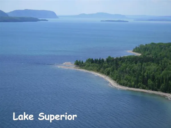
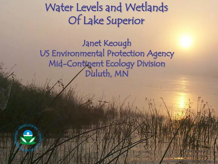
Water Levels and Wetlands Of Lake Superior. Janet Keough US Environmental Protection Agency Mid-Continent Ecology Division Duluth, MN. Outline for Today: Great Lakes Wetlands - Features and Functions Changing Water Level….what does this mean? Water Level Management of Lake Superior

E N D
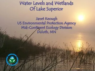
Water Levels and Wetlands Of Lake Superior Janet Keough US Environmental Protection Agency Mid-Continent Ecology Division Duluth, MN
Outline for Today: Great Lakes Wetlands - Features and Functions Changing Water Level….what does this mean? Water Level Management of Lake Superior International Joint Commission Plan of Study
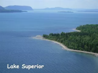
Coastal Wetlands of Lake Superior Open and Exposed to Lake Margins of a River Protected by a Barrier Beach
Values of Coastal Wetlands • Hydrological • Recreational • Ecological (Fish Habitat) • spawning areas • nurseries • feeding areas • 47 spp. closely associated with coastal wetlands
Fish Species Found in Allouez Bay Wetland: Alewife Northern Redbelly Dace Northern Pike Rainbow Smelt Largemouth Bass Blacknose Dace Pumpkinseed Brook Stickleback Smallmouth Bass Johnny Darter Silver Redhorse Ninespine Stickleback Rock Bass Iowa Darter Shorthead Redhorse Threespine Stickleback Bluegill Least Darter Eurasian Ruffe Stonecat Black Bullhead Sea Lamprey Coho Salmon Longnose Sucker Brown Bullhead Silver Lamprey Mottled Sculpin White Sucker Yellow Bullhead Logperch Slimy Sculpin Brook Trout Burbot Tadpole Madtom Golden Shiner Brown Trout Carp Bluntnose Minnow Blacknose Shiner Lake Trout Channel Catfish Brassy Minnow Common Shiner Rainbow Trout Hornyhead Chub Fathead Minnow Spottail Shiner Trout-perch Lake Chub Central Mudminnow Mimic Shiner Walleye Black Crappie Muskelunge Emerald Shiner White Perch Yellow Perch 57 species
Range of capture dates of larval fish species from Allouez Bay wetland Date June 7 June 15 July 1 July 15 Aug 9
Macrohabitat location of 12 most abundant larval fish species captured in Allouez Bay
Macrophyte cover preferences of 12 most abundant larval fish species captured in Allouez Bay
St. Louis River (MN) COASTAL WETLANDS: DIVERSITY OF HABITATS FOR FISH AND WILDLIFE Lost Creek (WI) Kakagon Slough (WI)
Water Level: All the action is in the coastal zone Great Lakes water level variation….the action is in the Coastal zone…..picture of either wave action or flooding Or sediment exposure
Small changes in Water Level Make a BIG difference in Coastal Habitats 1 FT ….even a difference as small as a few inches 6 IN.
Three Natural Types of Water Level Change in the Great Lakes: Less than 1 day = Seiche Seasonal Year-to-Year **Most Effects Are in the Coastal Zone**
Seiche – Induced Water Level Change 20 in MAJOR FRONT PASSAGE 1 HR 3 HR 7 HR 0
SEICHE: Phenomenon that occurs following a storm surge, when the wind abruptly subsides or barometric pressure changes rapidly on a lake, causing the water to oscillate until it stabilizes again
Seasonal Water Level Patterns of the Great Lakes Highest in Summer Peak Water Level Varies Across the Lakes Earliest in L Erie and L Ontario Latest in L. Superior
“Long – Term” Lake Level Lake Superior – 1918 - Present Lake Michigan – Lake Huron, 1918 - Present
Small changes in Water Level Make a BIG difference in Coastal Habitats 1 FT ….even a difference as small as a few inches 6 IN.
Domestic Water Use • Navigation • Fish Habitat • Hydropower Water Use Priorities
Distribution of Lake Superior Outflows Edison Sault Power Plant - 21,000 cfs Great Lakes Power Plant - 32,700 cfs Fishery Remedial Works - 500 cfs U.S. Government Power Plant - 10,400 cfs Compensating Works - 3,000 cfs Soo Locks - 400 cfs Typical St. Marys River Outflow - 68,000 cfs
Chronology of Lake Superior Regulation • Boundary Water Treaty of 1909 • 1914 IJC Orders of Approval • Supplementary Orders: 1978, 1979, 1985 • Regulation Plans • Sabin Rule • Rule P-5 • Rule of 1949 • 1955 Modified Rule of 1949 • SO-901 • Plan 1977 • Plan 1977-A
1909 Boundary Waters Treaty: • Resolved disputes concerning boundary waters at that time • Established principles and mechanisms to prevent and resolve future disputes • Created the IJC with the power to: • Approve diversions affecting levels and flows • Advise governments on boundary issues (quality & quantity)
1914 Orders of Approval • Granted permission for • Increased hydropower diversion • Construction of control dam • Specified conditions for construction and operation • Considered commercial navigation and riparian interests • Created International Lake Superior Board of Control to oversee outflow regulation
Chronology of Lake Superior Regulation • Boundary Water Treaty of 1909 • 1914 IJC Orders of Approval • Supplementary Orders: 1978, 1979, 1985 • Regulation Plans • Sabin Rule • Rule P-5 • Rule of 1949 • 1955 Modified Rule of 1949 • SO-901 • Plan 1977 • Plan 1977-A
Lake Superior Regulation Plan 1977-A • Balances levels between Lakes Superior and Michigan-Huron--Fundamental goal is to make storage in the 2 lakes (represented by levels) the same, when standardized to take out the differing sizes of the lakes and their drainage basins • Maintains Lake Superior water levels within a specified range when possible • Limits high flows in the St. Marys River • Regulates outflows within criteria, requirements, and limitations
Range of Levels Size of Drainage Basins Highest 6.3 Feet Average (1918-1999) 142,700 Square Miles 3.9 Feet 81,000 Square Miles Lowest Lakes Michigan-Huron Lake Superior Lakes Michigan-Huron Lake Superior This balancing takes into consideration the historic ranges of level fluctuation. The ranges of levels (from highest to lowest) on Lake Superior and Lakes Michigan-Huron reflect the differing sizes of their drainage basins.
Plan 1977-A Designed to generate monthly outflows necessary to balance the levels of Lake Superior and Lakes Michigan-Huron, taking into consideration their long-term average and historic rate of fluctuation Balancing Equation: Q = Ave. Q + A (S – (Ave. S + (MH – Ave. MH) (sd S / sd MH)) Lake Superior monthly outflow = Average Superior outflow + 200,000 cfs (a proportional constant) X (Superior month start – (ave. Superior month start + (Mich-Hur start – ave. Mich-Hur start) X Standard deviation of average Superior level / Standard deviation of average Mich-Hur level)) http://huron.lre.usace.army.mil
International Lake Supeior Board of Control Membership United States Canada BG Steven Hawkins Doug Cuthbert Secretaries John Kangas Peter Yee Regulation Representatives LTC Richard Polo David Fay
Upper Great Lakes Plan of Study • 1993 Levels Reference Study Recommendations • Recent precipitous drop in water levels • Demographic changes • Enhanced environmental understanding • Climate change and climate variability concerns • Technological advances • Build on experience from Lake Ontario – St. Lawrence River study Upper Great Lakes Plan of Study
Responsibility:To prepare a plan of study to review operations of IJC-approved water flow control structure at Sault Ste. Marie, Ontario/Michigan Purposes of the Review: • determine whether the requirements and criteria in IJC Orders meet the needs of the interests including the environment in the system, • identify potential improvements to Lake Superior outflow regulation and other measures to alleviate adverse effects of water level fluctuations
Study Approach • Understand present and future needs of interest groups, their relationships with water levels. • Evaluate capability and limitations of Lake Superior outflow regulation under current climate regime and under potential climate change. • Identify potential improvements to Lake Superior regulation, balance the needs of all interest groups • Emphasis on public involvement in the study. • Study to be conducted in 2 phases
Functional Scope Major Interest Groups • coastal zone • environment/ecosystem • hydropower • navigation • recreational boating and tourism • municipal, industrial and domestic water uses Other issues to be studied: climate change/variability, dredging, land use, ground water, diversions, consumptive uses, Lake Superior regulation, flow variations at hydropower facilities
Modifications of Lake Superior Outflow Management: Issues for Fish Effects of INCREASED or DECREASED water level variation on habitat loss or on access by fish? Effects on the temperature regime of shallow spawning reefs? Flow variation and Water level variation on The St. Marys River habitats