Download
1 / 43
470 likes | 815 Views
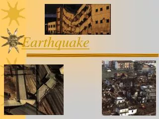
Edgecumbe earthquake. 2 March 1987. Just where is Edgecumbe?. Fault lines around Edgecumbe. Edgecumbe lies directly on a fault line that runs in a NE direction. The whole area lies in the region often referred to as the Taupo Volcanic Zone.

E N D
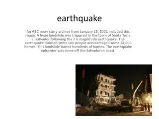
Edgecumbe earthquake 2 March 1987
Fault lines around Edgecumbe • Edgecumbe lies directly on a fault line that runs in a NE direction. • The whole area lies in the region often referred to as the Taupo Volcanic Zone.
The epicentre of the earthquake lay to the north of epicentre. Epicentre
Monday, 2 March 1987 • At 1:42 p.m. the first earthquake to cause major damage in New Zealand in almost 20 years sent shock waves across the Bay of Plenty, and particularly the Rangitaiki Plains area. • Some shocks looked like ocean waves, moving across the ground, breaking up the surface and leaving large cracks. • Everything shook.
The quake hits…. • Most people were caught unprepared. The only warning anyone got was a bout of severe shaking 7 minutes before the main earthquake. • It sent workers hurrying out of at least one factory in the area; if they had stayed, they might have been buried alive by goods falling to the floor when the bigger shock arrived. • Some schools were also evacuated.
A 6.3 on the Richter scale… • The Edgecumbe earthquake measured 6.3 on this scale - the largest NZ had seen for around 20 years.
What is the Richter scale • An earthquake is measured by its size, known as its magnitude. A Californian seismologist (earthquake researcher), Charles Richter, developed his scale as a way of comparing one earthquake with another. The Richter scale calculates the size of an earthquake by the amount of movement of the ground at the epicentre, using the height of the biggest shockwave and the time between the waves. These measurements are taken by a seismograph. However the actual force of an earthquake can also be affected by the depth of the earthquake.
Mercalli scale • Another way of measuring an earthquake is the Modified Mercalli scale, which measures the intensity of the earthquake, or the actual effect on people, buildings and the ground itself.
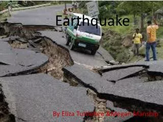
Fissures developed • Outside the town, a man was climbing a tree and saw a long open crack appear in the ground, stretching away from him across paddocks in both directions. This fault rupture was 7 kilometres long and, in places, 4 metres deep and 2 metres wide.
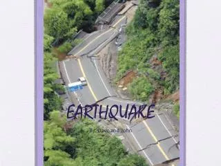
Landslides • Throughout the region much of the area suffered from landslides which blocked roads and made them impassable.
Cars and roads damaged • Someone else was picking peaches at the time. When the quake threw the ladder down she decided to check if everything was safe at home. She got into her car and began driving, not knowing that in the road ahead the fault had become a chasm 2 metres wide and that the road on the far side had dropped a metre and a half. Fortunately, her car flew across the gap and landed on its wheels.
In most parts of the plains the ground was stretched and ground levels dropped, but in Edgecumbe there were signs that the ground had been squeezed up or compressed. This was very clearly apparent on the roads. • For example, underground drainage pipes were rammed together, and some sections of railway track were shortened as rails bent.
Dam damaged • A short distance upriver from Te Toko, the Matahina dam was really put to the test and, as a survey showed later, the whole dam moved a short distance downstream (about 200 millimetres at the crest)
The drainage pattern changed • Water flows were disrupted in a number of places. The Rangitaiki River stopped flowing for about 10 seconds, then came pouring back. One woman watched as water poured out of her swimming pool and settled, 5 metres away.
Outside the towns and settlements, across the Rangitaiki Plains, several fault breaks had appeared in paddocks. As well as the one 7 kilometres long, other shorter breaks were scattered across the plains. • They all followed the same direction – roughly NE-SW. • In places, fountains of muddy water spurted from the ground, leaving small piles of pumice sands, some looking like miniature volcanoes.
Everything was shaken • Furniture was scattered, and fragile objects were thrown to the floor and broken. • The shaking tore pipes from water tanks, which then emptied, flooding rooms. Many people found the situation so depressing they left their homes and took refuge at the local marae.
The dairy factory is damaged • When the quake struck Edgecumbe, many farmers were attending a meeting at the local dairy factory. Some were thrown to the ground as plaster began falling from the ceiling and coffee urns crashed to the floor. Cars rolled around in the yard and huge storage tanks bent or toppled.
Services out of order • In Edgecumbe, many essential services were put out of action, making life very difficult until they could be restored. • Water, sewage, and gas pipelines were broken, and electricity supplies were cut. • Most houses suffered little structural damage, but roof tiles slid to the ground and many chimneys toppled and fell.
River stopbanks were damaged, not only by shaking, but also by the waves it set up in the water. • Several transformers weighing up to 20 tonnes were torn from their mountings at the power sub-station, in the rail yards a diesel locomotive of about 80 tonnes toppled onto its side.
Paper Mill damaged • The Tasman pulp and paper mill and the Caxton paper mill are the town’s main industries. Operators stopped one of the paper machines at the Tasman mill as soon as the strong foreshock was felt; it suffered less than the other two machines, which were wrecked when the main shock followed. • The mill was out of action for several weeks, because damage to the other installations was also severe. The Caxton mill was not so badly affected.
After shocks, almost as strong • By evening, four more severe shocks and many smaller one had hit the area. Although weaker than the main shock of magnitude 6.3, the stronger ones were capable of causing considerable damage. • They were part of a broad pattern, often but not always seen in New Zealand and in other earthquake-prone parts of the world, of foreshocks that shake the area before the main shocks, and more numerous aftershocks that continue for weeks or months later.
No one died but high costs • No-one was killed by the Edgecumbe Earthquake, and only about 25 people required hospital treatment. • It was not a very powerful earthquake, compared with some New Zealand has experienced, but in terms of money it was the most costly.