Download
1 / 5
60 likes | 208 Views
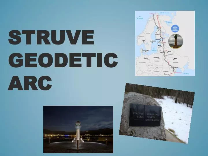
Struve Geodetic Arc. A chain of survey triangulations T he first accurate measuring of a long segment of a meridian This helped to establish the exact size and shape of the planet Development of topographic mapping 258 main triangles with 265 main station points. What?. Latvia.

E N D
Achain of survey triangulations • The first accurate measuring of a long segment of a meridian • This helped to establish the exact size and shape of the planet • Development of topographic mapping • 258 main triangles with 265 main station points What?
Latvia "Sestu-Kalns" (Ziestu) in Ērgļunovads ( 56°50′24″N 25°38′12″E) "Jacobstadt" in Jēkabpils ( 56°30′05″N 25°51′24″E)
In 1820 after the initiative of JēkabpilsTown Secretary Klauss • In 2005 - UNESCO World Heritage List • Reinforcedand covered with memorial stone by EduardsValters, teacher of natural sciences at Jēkabpils Gymnasium. STRŪVE PARK