Download
1 / 91
930 likes | 1.12k Views
Global Positioning System. A three-dimensional measurement system operates using radio signals transmitted from satellites orbiting the Earth Created and maintained by the U.S. Dept. of Defense and the U.S. Air Force Russia and a European consortium are implementing similar systems

E N D
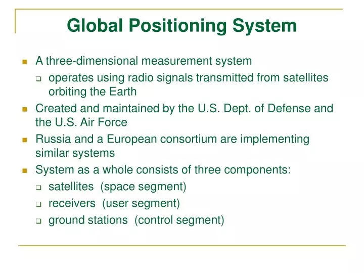
Global Positioning System • A three-dimensional measurement system • operates using radio signals transmitted from satellites orbiting the Earth • Created and maintained by the U.S. Dept. of Defense and the U.S. Air Force • Russia and a European consortium are implementing similar systems • System as a whole consists of three components: • satellites (space segment) • receivers (user segment) • ground stations (control segment)
Global Positioning Systems (GPS) • Fully operational in 1994 • 21 satellites, 3 spares • Not as available during times of conflict • 6 Orbital Planes • 20,200 km orbit • ~ 12 hour orbital period • Each visible for ~ 5 hours
Satellites (Space Segment) 24 NAVSTAR satellites (21 operational and 3 spares) • orbit the Earth every 12 hours • ~11,000 miles altitude • positioned in 6 orbital planes • orbital period/planes designed to keep 4-6 above the horizon at any time • controlled by five ground stations around the globe
Receivers (User Segment) • Ground-based devices • can read and interpret the radio signal from several of the NAVSTAR satellites at once. • Use timing of radio signals to calculate position on the Earth's surface • Calculations result in varying degrees of accuracy -- depending on: • quality of the receiver • user operation of the receiver • local & atmospheric conditions • current status of system
How It Works – Part 1 Start by determining distance between a GPS satellite and your position Adding more distance measurements to satellites narrows down your possible positions
How it Works – Part 2 Three distances = two points • Four distances = one point • Note: • 4th measurement not needed • Used for timing purposes instead
How it Works – Part 3 Distance between satellites and receivers • determined by timing how long it takes the signal to travel from satellite to receiver How? • Radio signals travel at speed of light: 186,000 miles/second • Satellites and receivers generate exactly the same signal at exactly the same time • Signal travel time = delay of satellite signal relative to the receiver signal • Distance from satellite to receiver = signal travel time * 186,000 miles/second
How it Works – Part 4 How do we know that satellites and receivers generate the same signal at the same time? • satellites have atomic clocks, so we know they are accurate Receivers don't -- so can we ensure they are exactly accurate? No! • But if the receiver's timing is off, the location in 3-D space will be off slightly... So: Use 4th satellite to resolve any signal timing error instead • determine a correction factor using 4th satellite • (like solving multiple equations...will only be one solution that satisfies all equations)
How it Works – Part 5 In order to make use of the distance measurements from the satellites, we must know their exact locations. • satellites are placed into high orbits -- makes their orbits very predictable • receivers have almanacs that tell them where satellites should be • minor variations in orbit are monitored -- correction factors transmitted along with the signals
Selective Availability (SA) intentional error introduced by the military for national security reasons • Pres. Clinton cancelled May 2, 2000.
Error Sources Satellite errors • satellite position error • atomic clock error Ionospheric/tropospheric effects on signal • GPS signal can be slowed slightly in the atmosphere • (atmospheric modeling & dual-frequency receivers help alleviate this) Multi-path distortion • signal may "bounce" off structures near the receiver
Error Sources - More Receiver errors • rounding errors in calculations, etc. Position dilution of precision (PDOP): • position of satellites in the sky • has a "multiplier effect" on other errors
Error Budget (typical case) • satellite clock: • satellite orbit: • ionosphere/troposphere: • multipath distortion: • receiver errors: 1.5 meters 2.5 meters 5.5 meters 0.6 meters 0.3 meters • and… PDOP will have a multiplier effect on total error. • - End result: position calculations can have significant error! • - Original statement from Department of Defense (Standard Positioning Service): accurate within 100 meters of true position 95% percent of the time; this is being updated to reflect post-SA conditions • - Current estimates: within 10-20 meters of true position • - in practice, even better results are frequently seen
Error Reduction Strategies Elevation masking • ensure satellites are at least a specified angle about the horizon • reduces ionospheric/tropospheric error Point averaging • position error varies with time • collect points for a period of time & average them • idea is to cancel out some error Differential correction • technique to remove much of the error from Standard Positioning Service • can apply differential correction in "real time" or after the fact (post-processing) • basic idea: • Any errors in a GPS signal are likely to be the same among all receivers within 300 miles of each other.
Error Reduction Strategies - More Differential correction (cont’d.) How it works: • use a base stationat a known position • base station calculates its own position & compares to its known position • determines correction factors that can be applied to receiver-calculated positions Differential correction will reduce horizontal position error to 1 - 3 meters with standard receiver • much GPS fieldwork for GIS/mapping purposes will require differential correction! National Differential GPS Network (NDGPS) being created
GPS Applications… • generating mapped data for GIS databases • “traditional” GIS analysts & data developers • travel to field and capture locational & attribute information cheaply others: • E911/firefighter/police/ambulance dispatch • car navigation • roadside assistance • business vehicle/fleet management • mineral/resource exploration • wildlife tracking • boat navigation • recreational
Introduction • Outputs (maps and tables/graphs) are the pinnacle of GIS projects • Two main types of output • Maps • Visualizations • Maps are good at summarizing and communicating • Cartography is the art, science and techniques of making maps & communicating about data and patterns
Maps and Cartography • Map – ‘digital or analog output from a GIS showing information using well established cartographic conventions’
Characteristics of Map • Two main types • Topographic • Thematic • Some map problems • Can miss-communicate • Each map is just one of all possible maps • Complex maps can be difficult to understand
Map Design • Maps are a means of communication and organization of thought, created to transmit some type of spatial information to the map reader. • » Success or failure depends on whether or not the map communicates the intended information. • Cartography as a communication system: • "How do I say what to whom?" • cartographer = I • map reader/audience = whom • map design & production methods = how • subject & goals of map = what
3D ViewResolution Merge Ikonos Imagery (1m) Draped Over 10m DEM Avalanche Path “I-Beam” Avalanche Path “Shed 10” Avalanche Path “Shed 7”
Thematic vs. Reference Maps • Our emphasis is on thematic maps (as opposed to reference maps) • thematic maps: portray information about the quantity and distribution of a particular spatial phenomenon (or several phenomena) • reference maps: general purpose “base” maps, e.g.: topographic maps, tax/cadastral maps, or navigation charts • Why? Differing roles of... • individual cartographers & GIS analysts vs. • large mapping organizations
“Rules” of Cartography • e.g. “maps should always have a scale bar” • ”Rules” should be considered in terms of what the cartographer is trying to communicate via the map • e.g., A series of page-sized maps of the entire U.S. displaying different population variables by state? » a scale bar may not be important for these maps • Readers are likely to already be familiar with the size and shape of the U.S. • The purpose of these maps has nothing to do with measuring distances. • But, some guidelines...
Map Elements • Most common: • map/spatial data • title • legend • scale • north arrow • inset(s) • textual information (incl. spatial metadata) • border, neatlines • coordinate grid
Inset map Scale Author North Arrow Data Source Map Body Projection Legend Grid Title
Map Elements Titles • Largest and most noticeable text on the map • Be precise! no superfluous words • Can be label, or can be a sentence • No unvarying information in titles for maps in a series • No "Map of..." in the title -- we know it's a map Scale • Only graphic scales will survive enlargement or reduction during reproduction • Some thematic maps may not need a scale bar Legends • Almost always required on thematic maps • Symbolization in the legend must exactly match symbolization used on the map • No "Legend" in the title for the legend
More Map Elements Textual information • Common uses: • author/publisher • date of production • date of map information • projection type and coordinate system information • data sources • brief information on how the map was produced Insets • locator maps • detail maps Borders, Neatlines • Provide a graphic "container” • Almost essential when an unclosed portion of a geographic area is being shown
More Map Elements Coordinate grid • Map must also state the coordinate system used
Map layout - visual balance (left) based on graphic or visual weight relative to the visual center Design Guidelines