Download
1 / 42
420 likes | 777 Views
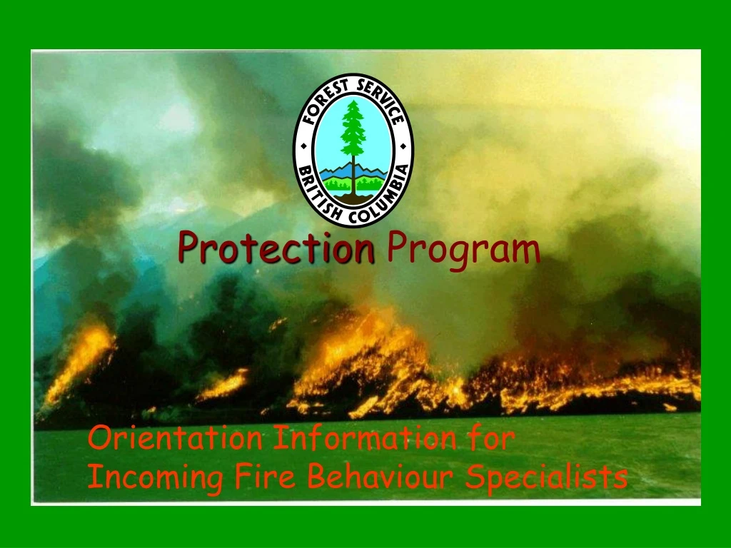
Protection Program. Orientation Information for Incoming Fire Behaviour Specialists. Welcome to BC. The total land area is 93 million hectares. Forests predominate, covering over 55% of the area. Extensive grasslands, wetlands and alpine areas make up the remainder.

E N D
Protection Program OrientationInformation for Incoming Fire Behaviour Specialists
Welcome to BC • The total land area is 93 million hectares. Forests predominate, covering over 55% of the area. Extensive grasslands, wetlands and alpine areas make up the remainder. • The area protected from wildland fire is 86.5 million hectares. • The climate varies from maritime to semiarid, influenced by moist westerly flows from the Pacific Ocean and dry continental flows from the NE. Precipitation varies from <200mm to as much as 6000mm/year. • The landscape is dominated by a series of mountain ranges generally running NW to SE. These have a strong influence on local climate and weather patterns.
Northern and Central Plateaus and Mountains: This area, mostly north of the 56th parallel, consists of rolling plateau country and series of lower less rugged mountain ranges than the those of the coast and SE. Pine, spruce and balsam dominate. Great Plains: This area of flat to gently rolling terrain is found in the northeastern part of the province, east of the Rocky Mountains. The main relief features are deeply incised river valleys. Forests are mostly pine, spruce and aspen in the south with black spruce dominant in the boggy boreal forest of the northern most parts. BC’s 5 Physiographic Regions:
Coast Mountains and Islands: 2 parallel mountain belts dominate the coast. The terrain is generally steep except on coastal plains. Forests consist primarily of Hemlock, Douglas Fir and Western Red Cedar. Recently harvested old growth areas can carry very heavy slash loads. Interior Plateau: This is a varied landscape, gently rolling in the north with deeply incised steep banked rivers in the south and rugged, deeply dissected terrain in the east. Large areas of grassland and lodgepole pine forest dominate the central to northern parts. The valley bottoms of the south tend to be open and semiarid. Ponderosa Pine grasslands give way to Interior Douglas Fir and Spruce as elevation is gained. BC’s5 Physiographic Regions:
Columbia Mountains and Southern Rockies: This is a varied area ranging from near rainforest to semi arid grassland. 4 rugged mountain belts comprise the Columbia Mountains. The northern and central parts of this area make up the interior wetbelt. Coastal tree species are present in this area along with most of the interior species. The southern valley bottoms, especially the Rocky Mountain trench area are pine grasslands similar to those of the southern Interior Plateau. BC’s 5 Physiographic Regions:
The average of annual fire starts for the 10 year period 1994-2004 is about 1900. A high of 4088 was experienced in 1994. Lightning and person caused fires usually each account for about half the average. The average annual area burned over the same 10 years has been about 49,000 hectares. The 2003 fire season increased this from the previous average of 25,000 ha. The fire season in BC is generally considered to be from April through October. However, in the dry southern parts of the province the season may stretch from March into November. Fire
The most severe fires usually occur from mid July through mid September. The northern boreal region often experiences the largest fires in late May and June, coinciding with the “spring dip” in foliar moisture content. Fire return intervals vary from 5-15 years in the open Ponderosa Pine grasslands to over 500 years in the coastal forests. Fire
BioGeoClimatic Zones • British Columbia has 14 major climatic, ecological subdivisions, known as biogeoclimatic zones. • Other than the Alpine Tundra, the zones are named for the primary climax tree species within them. (see map on next slide) • Further information and maps are available on the following websites: BiogeoclimaticEcosystem Classification website (to access the site, right click on the hyperlink and select <Hyperlink> then select <open>
Legend to Fire Size & Return Interval Tables(on 2 pages following)
Fire Return Interval by Biogeoclimatic Zone for B.C. Zone Cover type Fire type Fire intensity Min (yr) Avg (yr) Max (yr) BG Grass S L 4 - 5 5 - 15 15 - 25 PP Fd Py, Py, Py Fd S L 4 - 5 5 - 15 15 - 25 Fd Py, Py, Py Fd C M - H Rare Rare Rare SBS Pl, Bl Sx S + C M - H 75 - 100 100 - 150 150 - 250 BWBS Sb S + C M - H 50 - 75 75 - 125 125 - 175 At Pl Sw S + C M - H 75 - 100 100 - 150 150 - 250 Pl Sw Bl S + C M - H 100 - 150 150 - 200 200 - 300 SBPS Pl Sw S + C M - H 100 - 125 125 - 175 175 - 250 ICH Cw Hw S L 100 - 150 150 - 250 250 - 350 Cw Hw S + C M - H 100 - 150 150 - 250 250 - 350 IDF Py Fd, Fd, Fd Se S L 5 - 10 10 - 20 20 - 50 Py Fd, Fd, Fd Se S + C M - H 100 - 150 150 - 250 250 - 350 CDF Pl Fd, Fd, Cw Fd S L 50 - 100 100 - 300 300 - 400 Pl Fd, Fd, Cw Fd S + C M - H 50 - 100 100 - 300 300 - 400 MS Pl Se Fd, Se Bl S + C M - H 125 - 175 175 - 275 275 - 350 CWH Hw Cw, Hw Ba, Cw Ss S L - M 100 - 150 150 - 350 350 - 500 Hw Cw, Hw Ba, Cw Ss S + C H 100 - 150 150 - 350 350 - 500 ESSF Pl, Se Bl S L - M 150 - 200 200 - 300 350 - 500 Pl, Se Bl S + C M - H 150 - 200 200 - 300 350 - 500 SWB Bl Sw S + C M - H 150 - 200 200 - 350 350 - 500 AT Treeless or krummholz S L - M 250 300 - 400 500 - 600 MH Ba Yc Hm, Ba Hm S L - M 300 350 - 450 550 - 650 Ba Yc Hm, Ba Hm S + C M - H 300 350 - 450 550 - 650
Fire Size by Biogeoclimatic Zone for B.C. Zone Cover type Fire type Fire intensity Min (ha) Avg (ha) Max (ha) BG Grass S L .1 - 5 5 - 50 50 - 150 PP Fd Py, Py, Py Fd S L .1 - 5 5 - 50 50 - 150 Fd Py, Py, Py Fd C M - H .1 - 5 5 5 - 50 SBS Pl, Bl Sx S + C M - H .1 - 5 50 - 500 15 000 BWBS Sb S + C M - H .1 - 5 3000 - 10 000 200 000 At Pl Sw S + C M - H .1 - 5 3000 - 10 000 200 000 Pl Sw Bl S + C M - H .1 - 5 3000 - 10 000 200 000 SBPS Pl Sw S + C M - H .1 - 5 50 - 500 > 1000 ICH Cw Hw S L .1 - 5 150 - 500 > 25 000 Cw Hw S + C M - H .1 - 5 150 - 500 > 25 000 IDF Py Fd, Fd, Fd Se S L .1 - 5 5 - 50 50 Py Fd, Fd, Fd Se S + C M - H .1 - 5 50 - 500 > 5000 CDF Pl Fd, Fd, Cw Fd S L .1 - 5 5 - 50 150 - 500 Pl Fd, Fd, Cw Fd S + C M - H .1 - 5 5 - 50 150 - 500 MS Pl Se Fd, Se Bl S + C M - H .1 - 5 50 - 500 > 5000 CWH Hw Cw, Hw Ba, Cw Ss S L - M .1 - 5 50 - 500 > 500 Hw Cw, Hw Ba, Cw Ss S + C H .1 - 5 50 - 500 > 500 ESSF Pl, Se Bl S L - M .1 - 5 50 - 500 10 000 Pl, Se Bl S + C M - H .1 - 5 50 - 500 10 000 SWB Bl Sw S + C M - H .1 - 5 150 - 2000 > 5000 AT Treeless or krummholz S L - M .1 - 5 5 - 50 50 - 150 MH Ba Yc Hm, Ba Hm S L - M .1 - 5 50 - 150 150 - 500 Ba Yc Hm, Ba Hm S + C M - H .1 - 5 50 - 150 150 - 500
Fuel Types • Due to the wide variety of climates and terrain in the province, most FBP fuel types are represented in BC. • A number of fuels, especially the hemlock, fir , cedar mixes along the coast and in the interior wet belt, are not well represented by the FBP fuel types, so a best fit based on close examination of the fuel complex structure is required. • To represent the spruce-balsam stands in the central and northern interior the C-3 fuel type has been modified by reducing the crown base height and increasing the crown fuel load. Tables are available. Field validation continues.
Fuel Types • The C7 (Ponderosa Pine/Douglas Fir) fuel type has been revised as the C&b type to include an adjustable grass curing component. This should support a significant improvement in the accuracy of projections made before grass, which is the primary fire carrier in this type, has fully cured. • Large tracts in the interior plateau, especially between Tweedsmuir Park and Prince George in the central interior are heavily infested with Mountain Pine Beetle. Studies are proceding to determine the impact of different stages of the mortality process on fire behaviour.
Weather • Weather patterns locally are strongly affected by the mountain ranges. The wettest areas will be on the westward slopes and the driest to the east. The Okanagan area in the lee of the Coast Mountains is the hottest and driest part of the province. Temperatures in the 40’s and RH’s near 10% occur for short periods most summers. • During outflows, coastal areas can experience similar conditions along with high winds, when a high pressure system lies over the interior and a low sits off the coast. • Additional mountain influences are covered in the Topography section.
Weather • Though most weather systems move eastward from the Pacific Ocean, the southern part of the province is also subject to tropical moisture feeds that move north from the US. These increase the potential for high based lightning in the affected areas. • Additionally the area east of the Rocky Mountains is affected by drying flows from Alberta and the NWT. • Local weather patterns and anomalies should be discussed with the fire weather forecaster upon arrival at the fire centre.
Weather • Fire weather forecasters are dedicated to each fire centre during the fire season. They are physically located in the Coastal, Kamloops, Cariboo and Southeast Fire Centres. Service to the NW and Prince George Fire Centres is by phone and computer based briefing by Meteorological Services Canada (MSC), Kelowna based forecasters dedicated full time to each of these fire centres. • Fire weather data is collected hourly from an automated network of 219 fire weather stations. Daily values are also provided from 35 MSC weather stations to fill gaps in the hourly network.
Weather • The weather data and calculated codes and indices are posted on the website. • Temporary weather stations can be requested through the Logistics Section if no network sites are considered representative. 5 of the units are quick deploy types with Global Star satellite communications. • Belt weather kits are also available for feed back from the fireline. Most BC crews carry at least 1 kit with them. It is recommended to review proper data collection techniques with the crew member responsible when requesting readings from them.
Forecast Regions, Fire Weather Zones & Danger Index Regions • 5 synoptic level forecast regions • 30 weather zones which facilitate geographical grouping of weather stations • 3 danger regions to facilitate danger rating comparison across divergent climate regimes.
Avail on the fire weather web site Fire Weather Site
Weather Station Distribution Protection & MSC Sites Available on the fire weather website, this ArcIms map can be zoomed in and will display station information as well as recent hourly and daily data.
Meteorological Services Canada, Daily Station Locations These sites are updated once per day with the daily readings and FWI values. No hourly data is currently available.
Topography • Mountain dominated • Variable throughout BC • Significant impact on weather and fire behaviour
Topography Effects to consider: • Subsidence heating and drying in lee of mountains. • Channeling of winds along mountain ranges. • Funneling of winds through narrow valleys and gaps with resultant velocity increases. • Turbulence around gaps and terrain breaks. • Rapid heating of steep southerly slopes. • Upslope winds from daytime heating. • Significant downslope flows can develop at night. • Strong downslope flows below glaciers at any time.
Topography Effects to consider: • Overnight thermal belt development part way up the valley sides keeps temperatures and relative humidities near daytime levels. Wind sheer at the top of the inversion can lead to sudden increases in fire intensity and rates of spread as the inversion breaks and the upper winds are mixed down. Fire weather forecasters at the fire centres can provide estimates of breakthrough temperature and time at specified elevations. Local observation is crucial for validation.
Topography Effects to consider: • Temperature and RH change with elevation as a result of adiabatic cooling. Upper slopes will have a cooler, more humid burning environment than lower slopes. As a fire progresses, spot forecasts must be requested for the appropriate elevation. If the weather station in use is not within 500 meters elevation of the active part of the fire, a portable station should be deployed or a virtual station can be created at the appropriate elevation in WeatherPro3. To reflect the cumulative effect on fuel moisture, the codes from the parent station should be rerun using adjusted startup values provided by the forecaster.
Protection BranchOrganization The protection organization is structured as follows: • Headquarters office located in Victoria, includes the Provincial Fire Centre. • 6 regional Fire Centres: • Coastal, located in Errington • Kamloops, located at the Kamloops airport • Cariboo, located at the Williams Lake airport • Southeast, located at the Castlegar airport • Prince George, located in Prince George • Northwest, located at the Smithers airport
Protection BranchOrganization • Each fire centre is divided into Fire Management Zones run by a Zone Protection Officer. There are 35 zones in the province. • 3 person initial attack crews and 20 person unit crews (sustained action) are based seasonally around the zones. • The provincial Rapattack base is located in Salmon Arm. Crews and helicopters will be repositioned to secondary bases as required. • A 20 person Parattack team and jump ship are based at the Fort St John airport. • The Provincial Airtanker Centre is located at the Kamloops airport. This office coordinates the positioning of air resources around the province.
Protection BranchOrganization • Fire equipment depots are located in Chilliwack and Prince George. • ICS The Incident Command System has been implemented to manage fire events in BC. • The Fire Behaviour Specialist reports, as a technical specialist, to the Plans Section Chief.
Access to Protection Information • Protection public website: www.for.gov.bc.ca/protect/ • Protection internal website: wwwinternal.for.gov.bc.ca/protect/ • Fire weather and CFFDRS information is accessible from the internal website. • Necessary systems access will be granted on arrival.
Fire Behaviour Forecasts and Advisories • Fire Behaviour Forecasts are issue daily. The timing may vary based on organizational requirements. The standard national format can be used. • The following pages outline the requirements for Wind Advisories, Fire Behaviour Advisories and Extreme Fire Behaviour Warnings, which are issued by the specialist in addition to the forecast if the outlined conditions are met. • Fire Centres also issue these products on a wide area basis. Crews on your fire must be made aware that your forecasts, advisories and warnings supercede anything broadcast they hear from the fire centre on your incident.
Applies to Personnel employed by the Forest Service and involved in field work including projects, fire suppression operations and use of aircraft. Purpose To provide a safe work environment and to meet Workers’ Compensation Board Occupational Health & Safety Regulations. Continuously monitoring, updating and distributing weather and fire behaviour forecasts and feedback from on-site personnel can help predict potential fire behaviour. Strategies and tactics must be adjusted to ensure crew safety. The Forest Service will have Safe Work Standards that constitute safe methods, conditions and requirements for workers involved in fire line suppression operations. Critical Safety Statement Wind and Fire Behaviour must be anticipated and forecast wind and fire behaviour must be communicated to workers who may be at risk due to wind or fire behaviour. Exceptions If conditions call for deviation from these standards, an amending written practise will be developed to address the specific situation and ensure the safety of personnel. The appropriate Fire Centre Manager or the Director must approve this practise. Operational Safe Work Standard #5 FIRE BEHAVIOUR ADVISORIES & WARNINGS
DEFINITION(s) Wind Advisory A wind advisory is issued when wind conditions are forecast to present hazards (e.g., wind throw, hazardous flying conditions for aircraft) or conditions that exceed safety limits for transportation of workers. This advisory includes: severe turbulence; strong winds; downbursts; and hail. Wind advisories may be issued in the absence of aggressive fire behaviour. Fire Behaviour Advisory A Fire Behaviour Advisory is issued when intensities in excess of Intensity Class IV for a particular fuel type are forecast. These fire behaviour characteristics in excess of 4000kW/m will likely challenge direct suppression efforts. Extreme Fire Behaviour Warning An Extreme Fire Behaviour Warning indicates that fire behaviour is expected to exceed Intensity Class IV for a particular fuel type. And conditions may escalate rapidly in association with one of the following: passage of a cold front; significant change in wind direction (> 90 degrees); severe localized thunderstorms and downdrafts; and development of low-level jets. An Extreme Fire Behaviour Warning is issued independently of any other advisory. These conditions pose the greatest threat to worker entrapment. Operational Safe Work Standard #5
Key Components Every Advisory and Warning must include: -type of Advisory or Warning; -date and time of issuance; -applicable geographic area (simple geographic description of the -specific area affected); -expected arrival time and duration of disturbance; -description of conditions expected; -Who should receive it and how it is to be distributed (e.g., radio, telephone, or fax to all Zones, bases, active Fires, PATC, PFCO and neighbouring Fire Centres). Wind Advisory A Wind Advisory is issued to alert personnel that forecast conditions may present hazards to air operations, fireline or project operations. A Wind Advisory must include: -type and intensity of disturbance (e.g., outflow winds gusting to 50 km/h). Fire Behaviour Advisory Issuing Offices must adopt a format that highlights the period during which forecast conditions are expected to exceed Intensity Class IV. A Fire Behaviour Advisory must include: -relevant fuel type(s). Operational Safe Work Standard #5
Extreme Fire Behaviour Warning An Extreme Fire Behaviour Warning must include: -intensity of disturbance (e.g., generating 70 km/h winds); expected effect on fire behaviour (e.g., change in spread direction or fire intensity); -relevant fuel type(s); -if extreme fire behaviour is imminent, all personnel must be fully prepared to follow any specific instructions issued by the Incident Commander. Issuance Three levels of the organization can initiate an Advisory or Warning: Provincial Fire Centre (PFCO), Fire (IC) and Fire Centres (CFCO). Response Suppression strategies and tactics must be adjusted accordingly to ensure personnel safety is not jeopardized. Staff should report actual on-site weather conditions and fire behaviour characteristics to the Dispatch Centre to confirm or correct forecast information. Updates can then be passed on to others. The issuer should provide an explanatory note when forecast conditions do not occur. Advisories and Warnings must be retracted if forecast amendments mitigate the situation. Operational Safe Work Standard #5