Download
1 / 9
90 likes | 426 Views
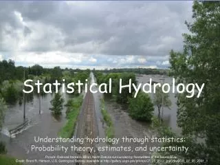
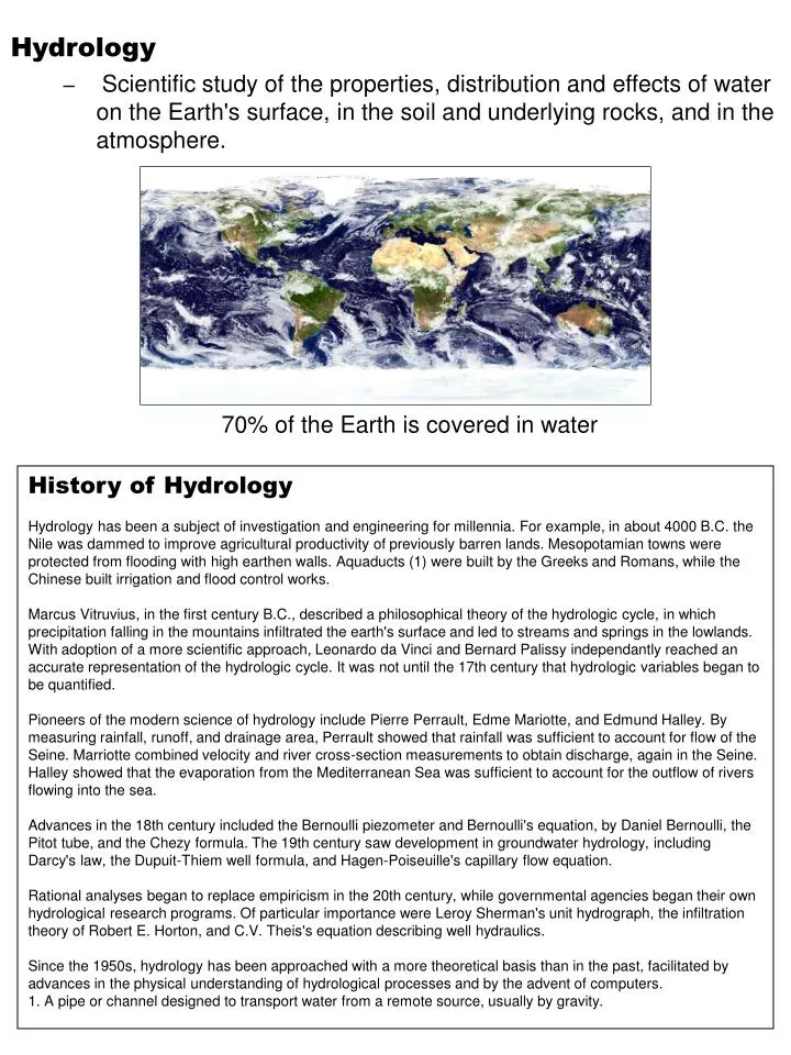
Hydrology Scientific study of the properties, distribution and effects of water on the Earth's surface, in the soil and underlying rocks, and in the atmosphere. 70% of the Earth is covered in water. History of Hydrology

E N D
Hydrology • Scientific study of the properties, distribution and effects of water on the Earth's surface, in the soil and underlying rocks, and in the atmosphere. 70% of the Earth is covered in water History of Hydrology Hydrology has been a subject of investigation and engineering for millennia. For example, in about 4000 B.C. the Nile was dammed to improve agricultural productivity of previously barren lands. Mesopotamian towns were protected from flooding with high earthen walls. Aquaducts (1) were built by the Greeks and Romans, while the Chinese built irrigation and flood control works. Marcus Vitruvius, in the first century B.C., described a philosophical theory of the hydrologic cycle, in which precipitation falling in the mountains infiltrated the earth's surface and led to streams and springs in the lowlands. With adoption of a more scientific approach, Leonardo da Vinci and Bernard Palissy independantly reached an accurate representation of the hydrologic cycle. It was not until the 17th century that hydrologic variables began to be quantified. Pioneers of the modern science of hydrology include Pierre Perrault, Edme Mariotte, and Edmund Halley. By measuring rainfall, runoff, and drainage area, Perrault showed that rainfall was sufficient to account for flow of the Seine. Marriotte combined velocity and river cross-section measurements to obtain discharge, again in the Seine. Halley showed that the evaporation from the Mediterranean Sea was sufficient to account for the outflow of rivers flowing into the sea. Advances in the 18th century included the Bernoulli piezometer and Bernoulli's equation, by Daniel Bernoulli, the Pitot tube, and the Chezy formula. The 19th century saw development in groundwater hydrology, including Darcy's law, the Dupuit-Thiem well formula, and Hagen-Poiseuille's capillary flow equation. Rational analyses began to replace empiricism in the 20th century, while governmental agencies began their own hydrological research programs. Of particular importance were Leroy Sherman's unit hydrograph, the infiltration theory of Robert E. Horton, and C.V. Theis's equation describing well hydraulics. Since the 1950s, hydrology has been approached with a more theoretical basis than in the past, facilitated by advances in the physical understanding of hydrological processes and by the advent of computers. 1. A pipe or channel designed to transport water from a remote source, usually by gravity.
Evaporation • is the transfer of water from bodies of surface water into the atmosphere. • Changes from liquid to gaseous phases. • Transpiration from plants, can be counted as evaporation. • Thus, this transfer is sometimes referred to as evapotranspiration. • 90% of atmospheric water comes from evaporation, while the remaining 10% is from transpiration Water/Hydrologic Cycle • The cycle of evaporation and condensation that controls the distribution of the earth's water as it evaporates from bodies of water, condenses, precipitates, and returns to those bodies of water. • Condensation • As water vapor rises, it cools and eventually condenses, usually on tiny particles of dust in the air. • When it condenses it becomes a liquid again or turns directly into a solid (ice, hail or snow). These water particles then collect and form clouds • Precipitation • is atmospheric moisture that has previously condensed to form clouds (changed from the gas phases to a liquid or solid phase), falling to the surface of the earth. • rainfall, snow, hail, fog drip other precipitation. • Infiltration • into the ground is the transition from surface water to groundwater. • The infiltration rate will depend upon soil or rock permeability as well as other factors. • Runoff • includes the variety of ways by which land surface water moves down slope to the oceans. • Not all precipitated water returns to the sea as runoff; much of it evaporates before reaching the ocean or reaching an aquifer. • Subsurface flow • incorporates movement of water within the earth • After infiltrating, subsurface water may return to the surface or eventually seep into the ocean. For more detailed information: http://ga.water.usgs.gov/edu/watercyclesummary.html
Rain gauge - rain and snowfall Stream gauge - stream flow Hydrologic Measurements • The movement of water through the Earth can be measured in a number of ways. Sling psychrometer – humidity Radar - cloud properties Piezometer - groundwater pressure and, by inferrence, groundwater depth Tensiometer - soil moisture Satellite Infiltrometer - infiltration Disdrometer - precipitation characteristics Time domain reflectometer - soil moisture
The regions in the figure correspond to: light blue zones are aquifers, darker blue hatched zone is an aquitard, light brown (tan) section is the vadose zone (unsaturated zone), and dark brown area is "impermeable" bedrock (an aquiclude). Aquifer • An underground bed or layer of earth, gravel, or porous stone that yields water. Helpful Definitions: Aquitard-is a geological formation of layers comprised either of clay, with tiny connected pores, or on non-porous rock that restrict water flow from one aquifer to another. Vadose zone (unsaturated zone)- is part of the ground that is between the water table and the surface that is not considered groundwater. Aquiclude-An impermeable body of rock that may absorb water slowly but does nottransmit it. • Unconfined aquifers • sometimes also called water table because their upper boundary is the water table • Typically (but not always) the shallowest aquifer at a given location • Usually receive recharge water directly from the surface, from precipitation or from a body of surface water • river, stream, or lake • Confined aquifers • have the water table above their upper boundary • typically found below unconfined aquifers.
Terminology • Zone of Saturation • The area where all the pore space in the ground is filled with water. • Zone of Aeration • The area of where the pore space is mostly empty, or full of air. • Water Table • The level below which the ground is saturated. • Groundwater Aquifer • A large volume of the subsurface that is thoroughly saturated with water, and through which water travels freely. It contains a large volume of water which can be accessed for use. • Aquiclude • A layer of impermeable material, for example clay, that prevents water from passing through. • Perched water table • Subsurface area saturated with water above an aquiclude, forming a local water table above the regional water table.. • Hydraulic Conductivity • A measure of permeability. ( How fast does the water travel through the substance?). • Hydraulic Gradient The difference in the elevation of the water table over a given length. • The rate of groundwater flow is dependent on the hydraulic conductivity and hydraulic gradient. The greater the conductivity or the greater the gradient the more rapid groundwater flows. • Transpiration • The process by which water sorbed by plants is returned to the atmosphere as a gas. • Evapotranspiration • The combined processes of Evaporation and Transpiration. • Porosity • The percentage of void space in a rock. • *Well sorted sand may have a porosity of 30% to 40%. *Poorly sorted sand will have a lower porosity because the finer grained sediment fills the spaces between the larger grains. *Most igneous rocks have very low to no porosity. *Limestones may have a low or high porosity. If it has undergone erosion or dissolution, it may even have large caverns. • Permeability • The ease with which water can pass through a substance. • A substance through which water cannot pass is said to be Impermeable. • The permiability of various sediment types, ranging from most permeable to least permeable, is: • Gravel Most permeable • Sand • Silt • Till Clay Least permeable • Hydraulic Head The term applied to water pressure due to the difference in the height of water in a closed system. Water tends to reach its own level. This phenomena may result in artesian wells and springs, and is used in providing water to municipalities via a water tower.
Ground Water • Water beneath the earth's surface, often between saturated soil and rock, that supplies wells and springs. • Water that seeps through the soil or rocks underground. • Problems • Ground water is being used so rapidly by humans that it sometimes does not have time to replenish itself • Pollutants dumped into the ground or in landfill may leak into the soil and reach aquifers • Unfortunately, contamination in ground water can spread into lakes and rivers. • Cleanup of contaminated ground water is an expensive and prolonged process, frequently taking decades.
Top Ten ways to preserve and protect groundwater • Dispose of chemicals properly. • Take used motor oil to a recycling center. • Limit the amount of fertilizer used on plants. • Take short showers. • Shut water off while brushing teeth. • Run full loads of dishes and laundry. • Check for leaky faucets and have them fixed. • Water plants only when necessary. • Keep a pitcher of drinking water in the refrigerator • Get Involved in Water Education • Groundwater is available in limited quantities. Since groundwater is an important resource for so many people, it is important to protect it • Many steps are being taken to keep pollutants from reaching groundwater supplies
Watershed- The region draining into a river, river system, or other body of water - They are very important because they provide habitats for animals, lessen flooding, and prevent erosion. -Pollution anywhere within the watershed can potentially affect life anywhere downstream from it. - We all live in watershed Information about your watershed www.epa.gov/surf
Hydrograph- record through time of discharge (flow) in a stream,- record through time of water level in an aquifer, measured in a well The flow of a river is quite irregular when considered over long time periods.It is characterized by rises from rainfall and snowmelt followed by gradually receding flow.The most elementary river and flood forecasts are concerned with predicting the time and height of stages caused by peak flows • A watershed's response to rainfall depends on a variety of factors: • watershed topography and geology; • land-use • river conditions • initial conditions • Applications of Hydrology • Mitigating and predicting flood, landslide and drought risk; • Designing irrigation schemes and managing agricultural productivity; • Providing drinking water; • Designing dams for water supply or hydroelectric power generation; • Designing bridges; • Predicting geomorphological changes, such as erosion or sedimentation. • Assessing the impacts of natural and anthropogenic environmental change on • water resources. • Assessing contaminant transport risk and establishing environmental policy • guidelines.