Download
1 / 17
170 likes | 330 Views
SeaDataNet. A Pan-European Infrastructure for Ocean and Marine Data Management : Achievements and challenges. SeaSearch and SeaDataNet. Data availability of vital importance for marine research European data set is fragmented Not always quality controlled Not always easily accessible

E N D
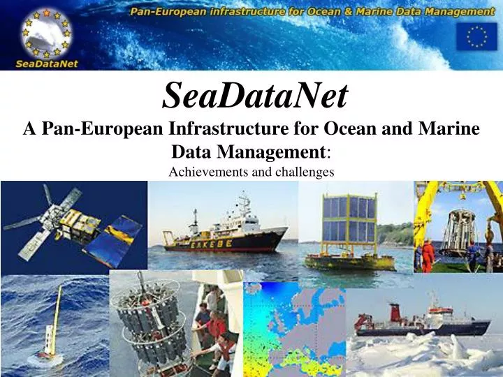
SeaDataNet A Pan-European Infrastructure for Ocean and Marine Data Management: Achievements and challenges
SeaSearch and SeaDataNet • Data availability of vital importance for marine research • European data set is fragmented • Not always quality controlled • Not always easily accessible • In 35 countries bordering European seas • Thousands scientific laboratories from government organizations and private industry collect data • Data are acquired using various sensors on board of research vessels, AUV, fixed and drifting platforms, airplanes and satellites • Measurements of physical, geophysical, geological, biological and chemical parameters, biological species, etc.
SeaDataNet I partners I3: Integrated Infrastructure Initiative • 49 partners including: • Major oceanographic institutes of 35 countries • National Oceanographic Data Centres (NODCs) • Divisions of major national marine research institutes • 3 satellite data centres • 3 scientific modelling centres • 2 SMEs experts in software development • 3 International organisations • (IOC, ICES, JRC)
SeaDataNet Metadata Services • Give overviews of marine organizations in Europe • Their engagement in marine research projects, managing large datasets, and data acquisition by research vessels and monitoring programmes for the European seas and global oceans • European Directory of Marine Organisations (EDMO) • European Directory of Marine Environmental Data sets (EDMED) • European Directory of Marine Environmental Research Projects (EDMERP) • Cruise Summary Reports (CSR) • European Directory of the initial Ocean-observing Systems (EDIOS)
Interrelationships between the directories, using vocabularies CSR EDMED XML … … … EDMERP Platf Param Country EDIOS CDI EDMO
Common Vocabularies • Controlled vocabularies containing keys, terms, abbreviations and essential (but often missing) definitions • Lists for platforms, countries, sea areas, etc… • International content governance by SeaVox list server • Web service • On-line user client • Export in .csv files
Metadata Services Tiers • These directories are compiled from national contributions, collated by SeaDataNet partners for their country. • Each of the directories has its own origin; • As part of SeaDataNet all directories have been harmonised in use of syntax, semantics and tools.
Status of request User registration Data download General request Metadata request Data request IFREMER Database Entry point for access hits services for metadata Data downloading services Visualisation services (WMS) for V2 SeaDataNet User’s portal schema V1 Project info metadata data Registr. Standards Cross search My transact. Shopping basket CDI Requestsstatus manager Software EDIOS EDMED AAA Vocabularies CSR EDMERP EDMO Organisation +data source id User Register CSR EDIOS CDI EDMO EDMED BODC Database + EDMERP at BSH at BODC at MARIS BSH Database Metadata & Data catalogues ENEA Database Download managers in data centres
Software and services • MIKADO XML editor for maintenance of entries for the Discovery services • XML Validation Web services for validating new metadata entries • NEMO, MedSDN2ODV and Med2MedSDN software for converting various data formats to SeaDataNet standard formats
Data products • SeaDataNet will provided added-value products to be created by regional centres • Mediterranean Sea • Black Sea • Baltic Sea • Arctic and North Sea • Atlantic and global ocean • First products => gridded climatologies • based on already available data-sets (mostly hydrographic data) • updated during the project life • To make products comparable, all regional data centers will use a common tool for spatial mapping • For this a new version of DIVA (Data Inverse Variational Analysis) was developed (University of Liege)
SeaDataNet offers • SeaDataNet partnership isproviding data, products and servicestoallusers, • SeaDataNetwantto involve new data centers or products’ providers • Enlarge the SeaDataNet partnership
SeaDataNet serves • In order to make best use of SDN data for science and for society, a robust operational infrastructure, based on European and internationally agreed standards, is required • This has been recognised by many, including the Commission, the ESF Marine Board, EuroGOOS, individual organisations and their research scientists.
SeaDataNet 1 - 2 • The SeaDataNet architecture has been designed as a multidisciplinary system from the beginning. It is able to support a wide variety of data types and to serve several sector communities. • SeaDataNet is also actively sharing its technologies and expertise, spreading and expanding its approach, and building bridges to other well established infrastructures in the marine domain. • This has resulted in adoption and an active role for a number of SeaDataNet partners in related data management projects • “MARINE KNOWLEDGE 2020 - marine data and observation for smart and sustainable growth” states that the creation of marine knowledge begins with observation of the seas and oceans. • INSPIRE Directive aims to create a European spatial data infrastructure that delivers integrated spatial information service • Marine Strategy Framework Directive (MSFD) will be aided by an overarching European Marine Observation and Data Network (EMODNet)s to end-users.
SeaDataNet 2 • European Directory of Marine Organisations (EDMO) (at present > 2.000 entries) • European Directory of Marine Environmental Data (EDMED) ( > 4.300 entries) • European Directory of Marine Environmental Research Projects (EDMERP) (> 2.200 entries) • Cruise Summary Reports (CSR) (> 43.000 entries) • European Directory of the Ocean Observing Systems (EDIOS) (> 10.000 entries)
SeaDataNet 2: middlewares • Discovery services = Metadata directories and User interfaces • Vocabulary services = Common vocabularies and Governance • Security services = Authentication, Authorization & Accounting • Delivery services = Requesting and Downloading of data sets • Viewing services = Mapping of metadata • Product viewing services = Viewing of generic and standard products in maps • Monitoring services = Statistics on system usage and performance and Registration of data requests and transactions • Maintenance services = Entry and updating of metadata by data centres • SeaDataNet II will have a dialogue with the related INSPIRE working groups to contribute to the INSPIRE process and to establish common standards. • Further work will be dedicated to upgrading the NetCDF (CF) standard in cooperation with UNIDATA (USA) to make it better for SeaDataNet and MyOcean purposes. • Establish common SeaDataNet profiles of OGC standards such as SensorML, Observations & Measurements schema, Sensor Observation Service (SOS), Web Feature Service (WFS)
Interoperability • Achieving interoperability and exchange with other relevant data management systems in Europe, thereby promoting, fine-tuning and implementing the SeaDataNet standards, also taking into account active tuning and harmonising on an international scale. • Achieving for operational oceanography both delayed mode and real-time data provision capacities in close cooperation with MyOcean, EuroGOOS, its Regions (ROOSes), and other oceanographic monitoring agencies and systems.