Download
1 / 31
310 likes | 446 Views
Intraseasonal to Seasonal Prediction of Tropical Cyclogenesis: A Statistical-Dynamical Forecast System Tom Murphree and David Meyer Naval Postgraduate School murphree@nps.edu and dwmeyer@nps.edu. NPS Contributors: Bryan Mundhenk Chad Raynak Stephanie Johnson Bob Creasey

E N D
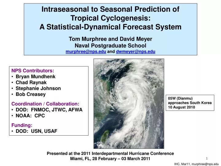
Intraseasonal to Seasonal Prediction of Tropical Cyclogenesis: A Statistical-Dynamical Forecast System Tom Murphree and David Meyer Naval Postgraduate School murphree@nps.edu and dwmeyer@nps.edu • NPS Contributors: • Bryan Mundhenk • Chad Raynak • Stephanie Johnson • Bob Creasey • Coordination / Collaboration: • DOD: FNMOC, JTWC, AFWA • NOAA: CPC • Funding: • DOD: USN, USAF 05W (Dianmu) approaches South Korea 10 August 2010 Presented at the 2011 Interdepartmental Hurricane Conference Miami, FL, 28 February – 03 March 2011 1 IHC, Mar11, murphree@nps.edu
Long Range Forecasting of Tropical Cyclones 05W (Dianmu) 05-12 August 2010 • 05W formation on • 05 Aug 2010 A great deal of operational planning requires long range forecasts (LRFs) of TC activity with lead times out to several seasons. We have developed an experimental system for providing LRFs of TC formations. Our system is a first step toward LRFs of TC tracks and intensites. Western North Pacific first, then N Atlantic, then other basins. 2 IHC, Mar11, murphree@nps.edu
Long Range Forecasting of Tropical Cyclone Formations NPS TC Formation Probability Forecasts 90 Day Lead Valid 05 Aug 10 Forecasts based on NPS statistical-dynamical forecast system. Contours: ensemble mean forecasted probabilities. Minimum contours indicate threshold for formation, with very little chance of a TC forming outside this contour. All plotted contours are greater than maximum observed probabilities. Hit: formation (JTWC 1st position) occurs on valid date inside or within 2.5o of threshold contour. Red dot northeast of Luzon: formation of 05W (Dianmu) on 05 Aug 10. Note forecast consistency with lead time, and highest probabilities outside main formation region. 60 Day Lead Valid 05 Aug 10 30 Day Lead Valid 05 Aug 10 3 IHC, Mar11, murphree@nps.edu
Long Range Forecasting of Tropical Cyclogenesis in the Western North Pacific NPS Statistical-Dynamical Forecast System: Development and Operation 1. Build logistic regression model based on relationships between TC formations and LSEFs** (use JTWC best track and NCEP R2 reanalysis data) 3. Create NPS statistical-dynamical forecast system with parameterized TC formations. 4. Produce statistical-dynamical, ensemble based long range forecasts of TC formation probabilities (NPS TC LRFs, 4-90 day lead times) 2. Force statistical model with dynamical, ensemble-based, long range forecasts of LSEFs** (use NCEP Climate Forecast System v1) • ** LSEFs = large scale environmental factors: SST, ζ850, shear200-850, div200, f • Inputs and outputs are all on a daily, 2.5° scale (high resolution for LRFs). • Extensive ensembling based on multiple initial conditions and multiple lead times (e.g., 184 members for 90 day lead LRFs). • Statistical model verified via hindcasting of 1980-2006, with very good results (e.g., reliability, BSS, ROC). 4 IHC, Mar11, murphree@nps.edu
4 Day Lead TC Formation Probability Forecast Valid 06 August 2009, Issued 02 August 2009 Formation of 10W (Etau) on 06 Aug 2009 Long Range Forecasting of Tropical Cyclogenesis in the Western North Pacific • Daily forecasts issued at leads of 0, 4, 7, 14, 21, 30, 60, and 90 days.* • Weekly and monthly forecasts issued at leads of 1 week to 3 months. • Forecasts have skill at all leads, including high apparent reliability. • NPS 1 and 2 week forecasts provided to CPC/NCEP for use in producing CPC forecasts (GTBH 1 and 2 week outlooks). 5 5 5 * Maximum lead: 30 days for 2009; 90 days for 2010 IHC, Mar11, murphree@nps.edu
Long Range Forecasting of Tropical Cyclogenesis in the Western North Pacific 30 Day Lead TC Formation Probability Forecast Valid 11 September 2009, Issued 12 August 2009 Formation of 15W (Choi-Wan) on 11 Sep 2009 Formation of 16W (Koppu) on 11 Sep 2009 • Number of ensemble members used increases with lead time. • Extensive ensembling is critical for skill and temporal consistency. • No other forecasts available with comparable resolutions, lead times, and verification. 6 6 6 IHC, Mar11, murphree@nps.edu
Skill in Predicting Non-Formation of TCs Skill in Predicting Formation of TCs PC: proportion correct. POD: probability of detection. FAR: false alarm ratio. HSS: Heidke Skill Score. Skill of TC Formation Forecasts for Western North Pacific: 30 Day Lead, 2009 Non-formation forecasts requested by long range operational planners. Forecasts of TC formation and non-formation have good skill at 30-day leads. Formation POD of 0.81 is very good, but FAR of 0.46 is higher than we’d like. Additional indicator of good skill: positive Brier skill score (BSS). 7 IHC, Mar11, murphree@nps.edu
Skill of TC Formation Forecasts for Western North Pacific: 30-90 Day Leads, 2010 Final skill results for 2010 forecasts will be calculated after 2010 JTWC best track data set is released. Preliminary results are encouraging. Increased skill at longer leads related to greater ensembling at longer leads (e.g., 184 members for 90 day lead forecasts). 8 IHC, Mar11, murphree@nps.edu
Modeled TC Formation Probabilities, Jul-Oct x10-3 El Nino Southeastward shift in high probabilities during El Niño years. x10-3 La Nina Northwestward shift in high probabilities during La Nina years. Long Range TC Formation Forecasts: Climate Variations Regression model based probabilities for EN and LN conditions: • Consistent with prior observational studies model verification • Useful products for long range planning IHC, Mar11, murphree@nps.edu
TC Formations in Western North Pacific: 2009 and 2010 TC Formation Locations, Jan – Dec 2009 28 TC formations in 2009*, with moderate-strong El Nino conditions during the most active TC period, Jul-Oct 2009 Note NW-ward shift in formation locations from 2009 to 2010. * Approximate locations IHC, Mar11, murphree@nps.edu
TC Formations in Western North Pacific: 2009 and 2010 TC Formation Locations, Jan – Dec 2010 19 TC formations in 2010*, with strong La Nina conditions during the most active TC period, Jul-Oct 2010. Lowest number of formations in last 41 years. Note NW-ward shift in formation locations from 2009 to 2010. 11 * Approximate locations; will be updated after release of 2010 best track data IHC, Mar11, murphree@nps.edu
90 Day Lead Issued 17Mar10 Valid 15Jun10 90 Day Lead Issued 16Apr10 Valid 15Jul10 90 Day Lead Issued 17May10 Valid 15Aug10 90 Day Lead Forecasts: Early Indications of TC Formation Anomalies in 2010 • NPS 90 day lead forecasts issued in Mar-May 2010 and valid in Jun-Aug 2010 consistently showed: • Probabilities much lower than for 2009, indicating 2010 would have a relatively few TCs. • Probabilities highest to north and west of main formation region. • These forecasts were consistent with expectations for La Nina periods --- but were issued up to three (five) months prior to the first La Nina watch (advisory) issued by CPC/NCEP. • Good overall correspondence between these forecasts and observed TC formations in 2010. IHC, Mar11, murphree@nps.edu
Forecast Consistency: Same Lead Times and Consecutive Valid Dates 4 Day Lead, Valid 31 Jul 2010 • Notes From a Forecasting Perspective • The most likely location for TC formation is E of Taiwan. 13 IHC, Mar11, murphree@nps.edu
Forecast Consistency: Same Lead Times and Consecutive Valid Dates 4 Day Lead, Valid 01 Aug 2010 • Notes From a Forecasting Perspective • Increase in probabilities E of Taiwan merits attention. 14 IHC, Mar11, murphree@nps.edu
Forecast Consistency: Same Lead Times and Consecutive Valid Dates 4 Day Lead, Valid 02 Aug 2010 • Notes From a Forecasting Perspective • Stability of probabilities E of Taiwan merits continued attention. 15 IHC, Mar11, murphree@nps.edu
Forecast Consistency: Same Lead Times and Consecutive Valid Dates 4 Day Lead, Valid 03 Aug 2010 • Notes From a Forecasting Perspective • Sharp increase in probabilities E of Taiwan merits extra attention. • High do not guarantee formation but are reliable indicators. • Conversely, a formation outside a contoured region would be unusual. 16 IHC, Mar11, murphree@nps.edu
Forecast Consistency: Same Lead Times and Consecutive Valid Dates 4 Day Lead, Valid 04 Aug 2010 • Notes From a Forecasting Perspective • Area E of Taiwan merits continued extra attention, especially given the persistent indications in the prior 4 forecasts. 17 IHC, Mar11, murphree@nps.edu
Forecast Consistency: Same Lead Times and Consecutive Valid Dates 4 Day Lead, Valid 05 Aug 2010 05W (Dianmu) forms 05 Aug 2010 • Notes From a Forecasting Perspective • 05W forms in area that was consistently forecasted as favorable in six consecutive 4 day lead forecasts, and especially in the immediate three prior 4 day lead forecasts. System appears capable of capturing evolution of TC favorable and unfavorable conditions, and providing temporally consistent forecasts. 18 IHC, Mar11, murphree@nps.edu
Forecast Consistency: Different Lead Times But Same Valid Date 90 Day Lead Forecast, Valid 06 Sep 2010 • Notes From a Forecasting Perspective • At 90 day lead: area just S of Taiwan merits attention. • Meranti formed just outside this area 90 days later. 11W (Meranti) forms 06 Sep 2010 19 IHC, Mar11, murphree@nps.edu
Forecast Consistency: Different Lead Times But Same Valid Date 30 Day Lead Forecast, Valid 06 Sep 2010 • Notes From a Forecasting Perspective • At 30 day lead: area just S and E of Taiwan merits attention. • Meranti formed inside this area 30 days later. 11W (Meranti) forms 06 Sep 2010 20 IHC, Mar11, murphree@nps.edu
Forecast Consistency: Different Lead Times But Same Valid Date 21 Day Lead Forecast, Valid 06 Sep 2010 • Notes From a Forecasting Perspective • At 21 day lead: area just S and E of Taiwan merits continued attention. • Meranti formed just inside this area 21 days later. 11W (Meranti) forms 06 Sep 2010 21 IHC, Mar11, murphree@nps.edu
Forecast Consistency: Different Lead Times But Same Valid Date 07 Day Lead Forecast, Valid 06 Sep 2010 • Notes From a Forecasting Perspective • At 7 day lead: broadened area centered near Taiwan merits attention. • Meranti formed near the center of this area 7 days later. 11W (Meranti) forms 06 Sep 2010 22 IHC, Mar11, murphree@nps.edu
Forecast Consistency: Different Lead Times But Same Valid Date 04 Day Lead Forecast, Valid 06 Sep 2010 • Notes From a Forecasting Perspective • At 4 day lead: area S and E of Taiwan merits continued attention. • Meranti formed in the center of this area 4 days later. 11W (Meranti) forms 06 Sep 2010 Forecasts show evidence of temporal consistency and reliability [i.e., more (less) formations in high (low) probability areas]. 23 IHC, Mar11, murphree@nps.edu
NPS TC Long Range Forecasting System: Summary and Future Work • Statistical-dynamical system with extensive ensembling provides long range forecast (LRF) products for which there are few or no alternatives: • Daily, 2.5 degree resolution • Skill at leads of 4 to 90 days • Consistent, reliable • On-going and planned R&D: • Upgrade system using CFSR and CFSv2 • Extend verification (e.g., consistency, reliability, BSS, false alarms compared to invests/TCFAs/OLRA) • Increase leads to 6 months. Increase ensembling at all leads. • Continue / extend system to: • North Atlantic and other basins • Track and intensity • Extend climate variation assessments (e.g., ENLN, MJO, IOD) • Consider alternate dynamical model for short-medium leads • Continue & expand coordination / collaboration: CPC, FNMOC, JTWC, NHC. • Continue and expand interactions with forecast customers. • On-Going Questions • Who are the customers for operational TC LRFs, and what do they need? • Who will produce operational TC LRFs? 24 24 IHC, Mar11, murphree@nps.edu
Long Range Forecasting of Tropical Cyclones: Contact Information • Tom Murphree, Ph.D. • Research Associate Professor • Department of Meteorology • Naval Postgraduate School • 254 Root Hall • 589 Dyer Road • Monterey, CA 93943-5114 • 831-656-2723 office • 831-402-9603 cell • 831-656-3061 fax • murphree@nps.edu • David Meyer • Operations Research Analyst • Department of Meteorology • Naval Postgraduate School • Monterey, CA 93943-5114 • 831-233-8438 cell/office • dwmeyer@nps.edu 25 IHC, Mar11, murphree@nps.edu
Prediction of Tropical Cyclogenesis in the Western North Pacific: Statistical Model Skill Reliability Diagrams and Bin Histogram Reasonably reliable and skillful hindcasts. Model overwhelmingly predicts very small probabilities, which aligns well with the rarity of TCs Skillful, but slightly underpredictive. 26 IHC, Mar11, murphree@nps.edu
Prediction of Tropical Cyclogenesis in the Western North Pacific: Statistical Model Skill Relative Operating Characteristic (ROC) Curve Diagonal represents zero resolution (no discrimination). Fair discrimination and potential utility to the user. ROC skill score of 0.68; “1” is a perfect forecast and “<0” is worse than the sample climatology 27 IHC, Mar11, murphree@nps.edu
Forecast Verification Methods Verification done for both formation and non-formation forecasts. Standard 2 x 2 contingency table verification metrics (e.g., Wilks 2006)used to allow ready interpretation and comparison with other forecasts (e.g., CPC one and two week forecasts). Also calculate Brier skill score. Observed Forecasted • Proportion correct (PC) = (a+d)/(a+b+c+d) • Basic proportion correct (BPC) = a/(a+b) • Hit rate (HR) = probability of detection (POD) = a/(a+c) • False alarm ratio (FAR) = b/(a+b) • False alarm rate (FAR) = b/(b+d) • Threat score (TS) = critical success index (CSI) = a/(a+b+c) • Heidke skill score (HSS) = [2(ad-bc)] / [(a+c)(c+d) + (a+b)(b+d)] 28 IHC, Mar11, murphree@nps.edu
TC Formations in Western North Pacific: 2009 and 2010 2010 ~ TC Origins 2009 TC Origins 28 TC formations in 2009, with moderate-strong El Nino conditions during the most active TC period, Jul-Oct 2009 19 TC formations in 2010, with strong La Nina conditions during the most active TC period, Jul-Oct 2010 Note NW-ward shift in formation locations from 2009 to 2010. 29 Note: 2010 TC formation locations are approximations pending release of JTWC best track data for 2010 IHC, Mar11, murphree@nps.edu
TC Formations: Long Term Mean Patterns Red dots: TC formations from JTWC best track data set, Jan 1970 – Dec 2007. 30 IHC, Mar11, murphree@nps.edu
TC Formations: LTM Patterns Region of highest long term mean probability of TC formation Red dots: TC formations from JTWC best track data set, Jan 1970 – Dec 2007. 31 IHC, Mar11, murphree@nps.edu