Download
1 / 33
330 likes | 698 Views
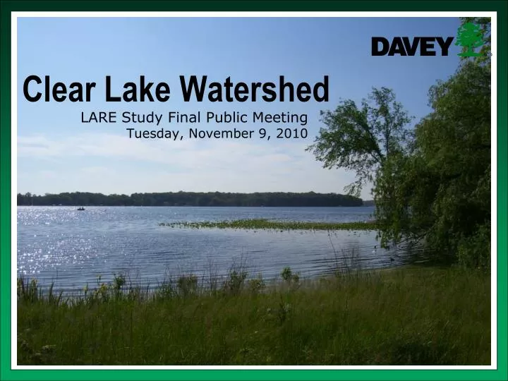
Clear Lake Watershed. LARE Study Final Public Meeting Tuesday, November 9, 2010. Why are we here?. Clear Lake Township Land Conservancy applied for a grant to complete an Engineering Design and Natural Resources Assessment in the Clear Lake Watershed

E N D
Clear Lake Watershed LARE Study Final Public MeetingTuesday, November 9, 2010
Why are we here? • Clear Lake Township Land Conservancy applied for a grant to complete an Engineering Design and Natural Resources Assessment in the Clear Lake Watershed A grant was awarded by the Indiana Department of Natural Resources Lake and River Enhancement Program (LARE) • Boat license tax Davey Resource Group was selected to conduct the study along with its subconsultant Engineering Resources.
What is a watershed? The total area of land that drains into a particular water body.
Cyrus Brouse Ditch Hoosier Riverwatch Data • Cyrus Brouse Ditch Outlet Qualitative Observations: • Increased sediment deposition • Increased algae and weedy plant growth
What were the Components of the Study? • Locate critical areas in the Cyrus Brouse Ditch Subwatershed that may be contributing to a degradation in water quality • Evaluate the feasibility of projects that could address critical areas in the Cyrus Brouse Ditch Subwatershed • Produce engineered designs for feasible projects • Identify potential critical areas in other subwatersheds • Conduct an inventory and assessment of critical wetlands and natural areas that may influence water quality in the Clear Lake Watershed
Feasibility Study • CLTLC with input from local stakeholders identified potential projects for engineering design to reduce sediment prior to the start of the study • CLTLC along with Davey conducted a windshield survey and walk of Cyrus Brouse Ditch as part of the study • Additional potential practices requiring engineering design as well as numerous, simple and often more cost effective Best Management Practices (BMPs) were identified
Evaluated Engineered Practices • Grade Stabilization Structure–Oberst Property • A grade stabilization structure is a structure built across a drainageway to prevent gully erosion • Suspected little sediment and nutrients entering the ditch from upstream sources in this location • Streambank stable in this location • Structure had potential to do more harm than good Not Feasible Example grade stabilization structure photographhttp://www.wi.nrcs.usda.gov/programs/solutions/gradestabil.html Stable Cyrus Brouse Ditch streambanks
Evaluated Engineered Practices • Water Level Control Structure–Eichler Property • Purpose to pond water in the wetlands for a slightly longer duration and increase stormwater filtration and denitrification rates • Topographic survey data showed that a structure in this location could exacerbate flooding on CR 500 N Not Feasible
Evaluated Engineered Practices • Wetlands–Salsbury Property • Not suitable topographic location for wetlands • Wetlands–Ireland Property • Divert additional water into the wetlands from Cyrus Brouse Ditch Lateral 5 for further filtration and increased denitrification rates • Topographic survey data concluded not feasible Not Feasible
Evaluated Engineered Practices • Wetlands/Sediment Pond–Moore Property • Not enough physical area to treat water from upstream watershed • Sediment Pond–Jackson Property • Expensive practice, located mid-way in watershed • Determined not to provide enough benefit for the expense • Smaller, less expensive measures can be implemented to reduce sediment from upstream sources Not Feasible
Evaluated Engineered Practices • Two-Stage Ditch–Salsbury Property • Good location in the watershed • Pros: • Less maintenance than traditional ditches (lower long-term expense) • Reduce bank scour • Allow for filtration of sediment and nutrients from storm flow • Improves habitat for wildlife • New practice and funding is comparably readily available • Cons: • Significant excavation may be required • Some loss of tillable land • Landowners not interested at this time Not Feasible Two-stage ditch diagramwww.nature.org Scour on Cyrus Brouse Ditch bank
Evaluated Engineered Practices Feasible • Streambank Stabilization – Marbo Farms Property • Originally evaluated as a BMP assuming minimal design by Steuben County Surveyor’s Office • Later determined engineered design necessary • Design was produced • Necessary permits havebeen obtained • Work expected to beginanytime by the SteubenCounty Surveyor’s Office
Recommended BMPs • BMP = Best Management Practice • Simple, effective, often inexpensive ways to minimize environmental degredation • Grass waterways • Vegetated drainage swales in farm fields where gully erosion is a recurring problem • Scharlach property • DeWitt property • Filter strips • Bands of sod-forming grasses panted adjacent to waterways that retard transportation of pollutants • Salsbury property Erosion is occurring along the south side of County Road 500 North and east of County Road 725 East.
Recommended BMPs • Road and roadway ditch repair and improvements • CR 500 North • CR 450 North and 725 East • WASCOB • Water and sediment control basin • Reduce gully erosion by controlling flow • Trap water and sediment • Connected to the tile system • Scharlach Property Sediment and fine particulate matter washes from CR 500 North into the Cyrus Brouse Ditch subwatershed drainage system.
Recommended BMPs • Streambank erosion control • Salsbury property – hard armor bank • Scharlach property – geotextile fabric • Tile repairs and inlet filters • Tile blowouts and riser inlets without grass buffers allow sediment and nutrients to enterthe tile system
Recommended BMPs • Potential funding sources and cost-share programs for each recommended BMP are included in the study report
Survey of Critical Areas in Subwatersheds • A critical area is an area defined as a source of an identified water quality problem that one is trying to correct • Other areas identified as possible areas that could degrade water quality, but not associated with an identified problem were labeled as an area of concern
Problems identified from Hoosier Riverwatch data • High turbidity • Harry Teeters Ditch • Alvin Patterson Ditch • Peter Smith Ditch • High nitrates • Peter Smith Ditch • High E. coli concentrations • Alvin Patterson Ditch • Harry Teeters Ditch
Critical Areas • Tile inlet risers without grass buffers • Contribute sediment and nutrients • Possible gully erosion (not field evaluated) in a field west of CR 700 East and north of SR 120 • Contribute sediment and nutrients
Critical Areas • Horse pasture on East CR 700 North • May be a contributor to elevated E. coli concentration in the Alvin Patterson Ditch
Areas of Concern • Horse pasture with tile riser inlets south of SR 120 • Dumping of yard wastes in wetlands areas around Clear Lake • Sediment built-up within Koeneman Lake which serves as a settling basin on Harry Teeters Ditch
Inventory and Assessment of Critical Wetlands • Wetland benefits • Detain and retain stormwater • Attenuate flooding • Filter sediment and nutreints from water • Keep surface water flowing during dry periods • Recharge groundwater aquifers • Necessary for many plant and animal species • Benefit tourism and recreational industries among others
Inventory and Assessment of Critical Wetlands • Conducted a remote sensing inventory • Aerial photographs • Soil series data • NWI wetland maps • Conducted a remote sensing assessment • ORAM Categories 1-3 • Field evaluations were conducted in some wetlands to verify accuracy of mapping and assessments
Field Evaluations • Hydrology sources and patterns • Documented presence of unique vegetation species • Generally scanned areas around lake for the presence of invasive species • Occasional GPS points taken on wetland boundaries
Conclusions • General knowledge helps improve our overall understanding and interconnectedness of the area in which we live and operate • Gives baseline data for making educated decisions in relation to future land development • Approximately 336 acres of wetlands • 99 total wetlands • Mapped boundaries have an estimated accuracy of ±50 feet • 14 wetlands are Category 3, best wetlands • 7 wetlands have a direct surface connection to the lake • 15 wetlands are connected to the lake via a county tile
Conclusions • No new imminent invasive species threats discovered • 2 wetlands contained numerous uncommon, high-quality vegetation species and have high conservation potential
A portion of Wetland 11 is a sedge meadow dominated by Carex stricta (uptight sedge).
Wetland 90 had some unique wetlands species including Betula allegheniensis (yellow birch), Larix laricina (American larch), and Toxicodendron vernix (poison sumac).
Wetland 97 contained numerous unique wetlands species having high coefficient of conservatism values including Betula allegheniensis (yellow birch) and Osmunda cinnamomea (cinnamon fern).
This photograph depicts Vaccinium corymbosum (highbush blueberry) that was observed in Wetland 97.
Final Report • Further details on potential project funding sources, water quality data interpretation, critical areas, areas of concern, and the inventory and assessment of wetlands can be found in the project report • Draft report is currently available • http://www.in.gov/dnr/fishwild/3303.htm • Final report will be available soon • DNR website • CLTLC website
Thank you for coming and for your support in maintaining and improving water quality in the Clear Lake Watershed! Questions?