Download
1 / 20
200 likes | 623 Views
Suggested Shoreline Management Policy Guidelines for Future Development of Lake Anna Shoreline and Watershed Lake Anna Civic Association Land Use Committee Presentation to the Lake Anna Advisory Committee Tom Nyman 27 October 2004 <nyman@alum.mit.edu> Printed: 10/18/2004 2:21

E N D
Suggested Shoreline Management Policy Guidelinesfor Future Development of Lake Anna Shoreline and Watershed Lake Anna Civic Association Land Use Committee Presentation to the Lake Anna Advisory Committee Tom Nyman 27 October 2004 <nyman@alum.mit.edu> Printed: 10/18/2004 2:21 Created by Tom Nyman 16 Oct 2004; Updated 31 Oct 2004
What I Will Cover • Committee Goals • Committee Membership • Approach to Guideline Development • Summary of Suggested Guidelines • What Next • Recommendations
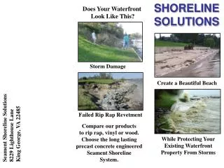
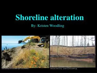
Committee Goals The LACA Land Use Committee Guidelines support five key principles for future “safe growth” • Ensure Safe Navigation by providing reasonable watercraft access lanes away from the shoreline • Establish Shoreline Stabilization techniques that prevent erosion and dissipate wave action while maintaining existing shoreline boundaries • Maintain Natural vegetative Buffers that provide Erosion Control and reduce sediment accumulation • Eliminate Dredging and excavation activities that adversely affect the environmental ecosystem • Develop Good Neighbor Policies that preserve water views, aid water access, reduce shoreline clutter, and protect water quality by ensuring proper handling of waste
Land Use Committee MembersInvolved in Creating the Guidelines Primary Members • Chair, Joe Weatherton, Spotsylvania County • Member, Joe Bailey, Spotsylvania County • Member, Herb Distefano, Spotsylvania County • Member, Gerald Root, Louisa County • Member, Mary Johnson, Louisa County • Member, Tom Nyman, Louisa County • Member, Larry Zemke, Louisa County Advisors • George O’Connell, Dominion Virginia Power (Reservoir Mgt) • Herb White, WW Associates (STPs) • Rae Jones, Orange County (Farmer View on Biosolids) • Curtis Moore, M&M Soil Consultants (Sanitary Systems) • Gary Rice, VA Health, Region Supervisor/Environmental Coordinator (Sanitary Systems)
Approach to Guideline Development Seek out Shoreline development guideline examples from similar Lakes • Claytor Lake, Pulaski County, VA • Smith Mountain Lake, VA (American Electric Power) • Lake Gaston and Roanoke Rapids Lake, NC & VA • Duke Power, NC (16 lakes Charlotte area) • Richland-Chambers Lake, TX Compare and assess – select appropriate principles and guidelines for Lake Anna • Compare to exiting county ordnances (Spotsylvania, Louisa, Orange) • Debate appropriate guideline metrics for Lake Anna shoreline and watershed • Select guidelines that are “middle of the road” centrist • Recommend strawman to LACA BoD for review/adoption as beginning for community discussions LACA BoD Adopted Strawman on 8 Sep 2003
Summary of Suggested Guidelines (1 of 3)[for new development only] • Ensure safe navigation by providing reasonable watercraft access lanes away from shoreline • No dock, pier, or boat shelter should protrude more than 100 feet into the water from the normal waterline • A minimum of 33% of a cove (a minimum of 40 feet) must be left open for safe watercraft passage • Establish shoreline stabilization techniques that prevent erosion and dissipate wave action while maintaining existing shoreline boundaries • All shoreline with up slope greater than 4 to 1 (more than 12” vertical rise within 48 inches horizontal upslope from the water line) within the first 10 feet landward from normal water level must be stabilized as a condition for issuance of a dock, pier, or boat shelter permit • Bulkhead fill must be clean material with fabric cloth and gravel placed landward of the bulkhead prior to clean fill placement. Preserve right of appeal and allow for exceptions based on certified need
Summary of Suggested Guidelines (2 of 3)[for new development only] • Maintain natural vegetative buffers that provide erosion control and reduce sediment accumulation • No healthy treeswith diameter measure of 6 inches or greater at chest height may be cut within the first 100 feet landward from the normal waterline • Selective clearing of trees with diameter measure of 6 inches or greater measure at chest height may be allowed to facilitate dock construction (not allowed in Spotsylvania County) • Eliminate dredging and excavation activities that adversely affect the environmental ecosystem • All dredging and excavationis by permit from Dominion Power • Excavation is not allowed for channeling to create additional shoreline or to materially alter the normal waterline Preserve right of appeal and allow for exceptions based on certified need
Summary of Suggested Guidelines (3 of 3)[for new development only] • Develop good neighbor policies that preserve water views, aid water access, reduce shoreline clutter, and protect water quality by ensuring proper handling of waste • A dock, pier, or boat shelter must maintain a side setback of 15’ from the water access extension line (extended into the water). Where a water access extension line is not specified the setback will be from the property lines extended. • A waterfront lot must have a minimum of 55 feet of shoreline (as measured at the waterline at normal pool – 250’ AMSL on public waters and 251’ AMSL on the waste heat treatment facility waters) to have a dock, pier, or boat shelter. • Private community common areas with multiple boat slips shall have sanitary facilities • The covered area for all boat shelters must not contain more than 8SF for every foot of shoreline owned (as measured at the waterline at normal pool – 250’ AMSL on public waters and 251’ AMSL on the waste heat treatment facility waters) • Placement of subdivision common area boat ramps must be well away from sharp bends, bridges, dikes, and other passage choke points. Preserve right of appeal and allow for exceptions based on certified need
Next Steps • Brief other stakeholders in the Lake Anna Community • LAAC Principals • County Planning Directors (Louisa, Spotsylvania, Orange) • POA BoDs for Lake Anna Subdivisions • Lake Anna Economic Development and Tourism Partnership • Staff of Regional Planning Districts • Staff of Regional Soil and Water Conservation Districts • Selected Louisa Supervisors • Dominion Virginia Power • Members Lake Anna Roundtable (Lake Anna Watershed Land Use Plan) • Find out which guidelines are strongly supported, and which ones are highly controversial • Identify guidelines that are controversial for the near term • Publish revised suggested guidelines of consensus views and items which LACA is strongly committed to • Present to county governments with plea to adopt as Ordnances common and uniform to the three Lake Anna stakeholder counties
Recommendations • A copy of the LACA Suggested Guidelines is offered to each LAAC member • After reflection, we encourage LAAC members to provide feedback on those provisions they most strongly support, and those they feel are least desirable • Adopt most favored provisions as part of Lake Anna Roundtable Lake Anna Watershed Land Use Plan • LACA/LAAC introduce most favored provisions to county governments as “common universal tri-county” standards for placing in Shoreline Development and Watershed Best Practices Ordnances 1 Please send comments to laca@lakeannavirginia.org attention Land Use Committee
Other LACA Land Use Committee Publications • LACA Land Use Committee, “Guidelines for Sanitary Waste,” 4 Feb 2003 • LACA Land Use Committee, “Position Paper on Biosolids,” 4 Mar 2003 • LACA Land Use Committee Position Paper, “Summary Statement: Sewage Treatment Plants,” updates thru 5 Mar 2003 • LACA Land Use Committee Best Practices, “Lawn & Garden Care -- Fertilizers and Soil Conditioners,” updates through 16 Apr 2003 • LACA Land Use Committee Best Practices, “Lawn & Garden Care -- Nutrient Management and Implications for Water Quality,” updated 12 May 2003 • LACA Land Use Committee, “Position Paper on Erosion and Sediment Control,” 24 Aug 2003
Suggested Guidelines (1 of 3) • Ensure safe navigation by providing reasonable watercraft access lanes away from shoreline • No dock, pier, or boat shelter should protrude more than 100 feet into the water from the normal waterline • A minimum of 33% of a cove (a minimum of 40 feet) must be left open for safe watercraft passage • Establish shoreline stabilization techniques that prevent erosion and dissipate wave action while maintaining existing shoreline boundaries • All shoreline with up slope greater than 4 to 1 (more than 12” vertical rise within 48 inches horizontal upslope from the water line) within the first 10 feet landward from normal water level must be stabilized as a condition for issuance of a dock, pier, or boat shelter permit • Bulkhead or rip-rap material shall be placed channelward of the side extension property lines and positioned in a reasonable alignment of normal lake level elevation, for the sole purpose of bank stabilization • Bulkhead fill must be clean material with fabric cloth and gravel placed landward of the bulkhead prior to clean fill placement.¹ • Shoreline stabilization that alters the shoreline boundary by more than five feet landward or channelward from normal water level is not permitted • Debris (except broken concrete), tires, car bodies, etc. are not acceptable for banks stabilization activity along Dominion Power’s shoreland¹
Suggested Guidelines (2 of 3) • Maintain natural vegetative buffers that provide erosion control and reduce sediment accumulation • No healthy treeswith diameter measure of 6 inches or greater at chest height may be cut within the first 100 feet landward from the normal waterline • Selective clearing of trees with diameter measure of 6 inches or greater measure at chest height may be allowed to facilitate dock construction (not allowed in Spotsylvania County) • A developer, contractor, or residentmay apply by permit to the county for an alternate clearing plan. A professionally engineered site plan must be prepared for the proposed alternate clearing plan. The plan must provide erosion control through the use of vegetative or structural sediment buffers. • Eliminate dredging and excavation activities that adversely affect the environmental ecosystem • All dredging and excavationis by permit from Dominion Power • Dredging and/or excavation exceeding 150 cubic yards requires permit from Dominion Power and the Corp of Engineers. Dredging and excavation can only be done in front of applicant’s property within the property water extension lines or property lines extended • Double handling of materials is not allowed • An adequate upland disposal sight a minimum of 100’ from the normal shoreline is required and must be clearly defined in request for permit • Excavation is not allowed for channeling to create additional shoreline or to materially alter the normal waterline • Reclamation of eroded shorelineto the originally surveyed boundary will be allowedbased on validation from a professional surveyor to a maximum reclamation of 10 feet perpendicular to the normal shoreline
Suggested Guidelines (3 of 3) • Develop good neighbor policies that preserve water views, aid water access, reduce shoreline clutter, and protect water quality by ensuring proper handling of waste • A dock, pier, or boat shelter must maintain a side setback of 15’ from the water access extension line (extended into the water). Where a water access extension line is not specified the setback will be from the property lines extended. • A waterfront lot must have a minimum of 55 feet of shoreline (as measured at the waterline at normal pool – 250’ AMSL on public waters and 251’ AMSL on the waste heat treatment facility waters) to have a dock, pier, or boat shelter. • Maximum height of all private recreational facilities located over the water is not to exceed 18’ above normal water level. No enclosed second story room is allowed. • The covered area for all boat shelters must not contain more than 8SF for every foot of shoreline owned (as measured at the waterline at normal pool – 250’ AMSL on public waters and 251’ AMSL on the waste heat treatment facility waters) • Boat docks, piers, or boat shelters constructed in a community common area for off-water lot owners must comply with water access lane requirements (maximum protrusion and minimum safe passage lanes) and maintain 30-foot side setbacks from the water access extension lines or property lines extended where water access extension lines are not specified. Common area refers to properties and/or facilities owned and managed by a property owners association. • If boat docks, piers, or boat shelters are provided for subdivision off-water lots they can only be constructed in the waters abutting the designated community common area. • Placement of subdivision common area boat ramps must be well away from sharp bends, bridges, dikes, and other watercraft passage choke points. Wherever possible boat ramps should be placed in protected areas where wave action from passing watercraft will have minimal effect on safety of launching and recovery operations. • Private community common areas with multiple boat slips shall have sanitary facilities, VDH required and approved dump and/or pump-out facilities, and fire department approved dry hydrant facilities as prescribed by state and local code.
Claytor Lake, Pulaski County, VA Claytor Lake, a 4,475-acre impoundment of the New River, stretches northeastward across the Pulaski County countryside for 21 miles. Near Blacksburg, VA. Created by Appalacian Power, recently replaced by
Lake Norman is an "inland sea" with 520 miles of shoreline and a surface area of more than 32,475 acres. Named after former Duke Power president Norman Cocke, Lake Norman is nearly as large as the other 10 lakes on the Catawba combined. Duke Power Lakes, NC 3 Nuclear sites (Catawba, McGuire, Oconee) 8 Coal based sites (Allen, Belews Creek, Buck, Cliffside, Dan River, Lee, Marshall, Riverbend, Lincoln, Mill Creek) 12 Hydroelectric sites (Bridgewater, Rhodhiss, Oxford, Lookout Shoals, Cowans Ford, Mountain Island, Lake Wylie, Fishing Creek, Great Falls & Dearborn, Rocky Creek & Cedar Creek, Wateree, Keowee) Source: <http://www.dukepower.com/aboutus/plants/nuclear/oconee.asp>
Lake Gaston and Roanoke Rapids Lake, NC/VA Roanoke Rapids Lake Reservoir: (Characteristics at 132 feet dam)Length of reservoir: 8 milesLength of shoreline: 47 milesMaximum width: 1.25 milesStorage: 77,000 acre-feetReservoir surface: 4,600 acres Lake Gastonbegins at Kerr Dam, a lake built in 1953 for flood control. And, below Lake Gaston is Roanoke Rapids Lake, a smaller lake built in 1955 for hydroelectric power. The Gaston Dam was completed in 1963. It is over 20,000 acres of "high quality" water, 34 miles long, and approximately one and one half miles wide at the lower end of the lake. It has over 350 miles of shoreline.
Surface Area - 44,752 acresSpillway - 447 feetMiles of Shoreline - 330 Maximum Depth - 75 feetAverage Depth - 25 feetDam - 6.5 miles long, 120 feet high Richland-Chambers Lake, Texas
Smith Mountain Lake Smith Mountain Lake is 40 miles long, covers 20,600 surface acres, with 500 miles of shoreline. It is nestled within the mountains of southwestern Virginia. Smith Mountain Lake was created to generate electricity, and to help manage water flows downstream and nearby. The damming of the Blackwater and Roanoke Rivers formed Smith Mountain Lake in a filling process that began September 24, 1963 -- and took nearly three years to complete on March 7, 1966.