Download

1 / 19
200 likes | 346 Views
Soil Atlas of Europe. What are we trying to produce? . Topical and Timely Publication Soil protection legislation Enlargement of the EU Collaborative pan-European effort. Who will read the atlas? . Reference work on European Soils for EU citizens Not aimed at soil scientists

E N D
What are we trying to produce? • Topical and Timely Publication • Soil protection legislation • Enlargement of the EU • Collaborative pan-European effort
Who will read the atlas? • Reference work on European Soils for EU citizens • Not aimed at soil scientists • Informative, Easy • to read, graphically • stimulating • Quality Product
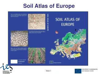
Format of Atlas A book of 128 A3 Pages (Portrait Format ) Open A2 Landscape Spread Mix of text, maps, pictures and diagrams Easily readable
Support for Atlas Preface by EC Commissioners • Environment, JRC, Agriculture • Forward by Director General of JRC • Contributions from ESB Network • Enthusiastic response from DG Environment
Overview 7 Major Sections • Introduction • WRB • European Maps • International Section • Soil Database • Threats to soils • Supporting information
An Atlas Needs Maps! • 1:1M Soil Geographical Database of Europe is the heart of the atlas. • Dominant STU assigned to each polygon. • WRB Reference Group and FAO Label attached > Legend + Colours. • “Generalizing procedures”. • Individual page spreads clipped.
Soils of Europe Overview Map
Regional Page Spreads 20 regional map sheets
Regional Page Spreads • Scandinavia: north & Iceland (2.5) • Denmark, S. Sweden, S. Norway (2.5) • Baltic States (1.5) • UK & Eire (2.5) • Germany and Switzerland (2.5) • Poland (2.5) • France & Benelux (2.5) • Czech Republic & Austria (1.5) • Hungary & Slovakia (1.5) • Spain & Portugal (2.5) • Italy, Malta, Slovenia & Croatia (2.5) • Romania (& Moldova) (1.5) • Greece / Albania (1.5) • Turkey & Cyprus (4) • Belarus (1.5) • Ukraine (2.5) • Russia
International Context - World Updated FAO World Soils Data Base Atlas WRB Legend
International Context – Northern Soils Transformation of US Taxonomy to WRB
Soil Properties Maps and Use of DB Texture Triangle % Sand, % Silt, % Clay Depth to rock Available Water Capacity Bulk Density Parent Material Cation Exchange Etc…. Soil Organic Matter
0-0.1mgL-1 0.1-0.5mgL-1 >0.5mgL-1 Use of SGDB Risk from pesticide leaching N2O from soils Soil Erosion Risk