Download

1 / 49
520 likes | 1.31k Views
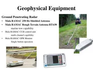
SOUTHWEST GEOPHYSICS. GEOPHYSICAL SERVICES. Presented By: Hans van de Vrugt, CEG, RGp Patrick F. Lehrmann, PG, RGp. Site Evaluation Direct Methods. Boreholes/Probes Test Pits/Trenches Cores. Geophysical Techniques Indirect Methods. Ground Penetrating Radar (GPR)

E N D
SOUTHWESTGEOPHYSICS GEOPHYSICALSERVICES PresentedBy: Hans van de Vrugt, CEG, RGp Patrick F. Lehrmann, PG, RGp
Site Evaluation Direct Methods • Boreholes/Probes • Test Pits/Trenches • Cores
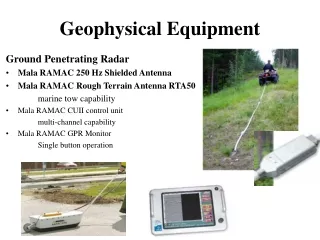
Geophysical Techniques Indirect Methods • Ground Penetrating Radar (GPR) • Electromagnetics (EM) • Magnetics • Utility Locating • Seismics • Electrical Resistivity • Gravity • Very Low Frequency (VLF)
Advantages: Geophysical Techniques Indirect Methods • Non-Destructive • Cost Effective • Provides Preliminary or Supplemental Information
Ground Penetrating Radar System Geophysical Methods SIR 3000 – 400 MHz SIR 3000 – 100 MHz
Stratigraphy Survey GPR Data
Common GPR Antennas 1500 MHz .5 m Structure Evaluation 900 MHz 1 m Structure Evaluation, Void Detection 400 MHz 4 m Engineering, Environmental, Void Detection 200 MHz 7 m Geotechnical, Engineering, Environmental 100 MHz 20 m Geotechnical, Environmental, Mining
Geophysical Methods Electromagnetic Conductivity: EM-61 and EM-31 Field Survey Equipment EM-31 EM-61
Electromagnetic Conductivity Survey GROUND SURFACE PRIMARY FIELD GROUND SURFACE INDUCED CURRENT IN SUBSURFACE OBJECT SECONDARY FIELD
UST Search Electromagnetic (EM61) Survey Data
Geophysical Methods Magnetics - Magnetometer Equipment Gradiometer Magnetometer
Magnetometer Survey Data 10,000 Gallon UST
Magnetometer Survey Data Abandoned Oil Well
Magnetometer Survey Data Lost Culvert
Geophysical Methods Seismic Refraction System
Depth To Bedrock Study Seismic Refraction Velocity Model
GeophysicalMethods Sting/Swift Earth Resistivity System
Landfill Investigation Earth Resistivity Profiling
Instrument List • Sir 3000 GPR W/ 400, 900 & 1600 MHz Antennas • Geonics EM61 Time Domain EM Metal Detector • Geonics EM31 Terrain Conductivity Meter • Geometrics 858 Cesium Magnetometer • Schonstedt GA 52 Magnetic Gradiometer • RD4000, RD500 & Metrotech 9860 Utility Line Locators • Fisher M-Scope TW-6 Pipe Locator • Fisher M-Scope M-100 Rebar and Cable Locator • Instantel Blastmate III Vibration Monitor • Geometrics StrataView 24 Channel Seismograph • AGI Super Sting R8 Resistivity Meter • Trimble Pro XRS GPS
Advantages/Limitations Advantages • Non Destructive • Quick Data Collection • Cost Effective • Limitations • Depth of Penetration v. Resolution • Non Unique Solutions • Undesirable Signals/Noise
Illegal Drum Burial GPR Data
Illegal Drum Burial Pay Dirt