Download
1 / 37
410 likes | 550 Views
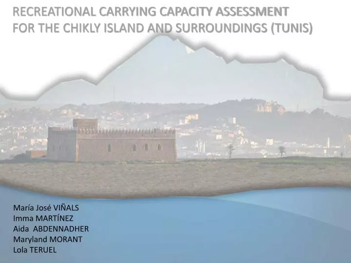
RECREATIONAL CARRYING CAPACITY ASSESSMENT FOR THE CHIKLY ISLAND AND SURROUNDINGS (TUNIS). María José VIÑALS Imma MARTÍNEZ Aida ABDENNADHER Maryland MORANT Lola TERUEL. 1 INTRODUCTION AND OBJECTIVES 2 RESEARCH SOURCES AND METHODS Field inspections (two field trips)

E N D
RECREATIONAL CARRYING CAPACITY ASSESSMENT FOR THE CHIKLY ISLAND AND SURROUNDINGS (TUNIS) María José VIÑALS Imma MARTÍNEZ Aida ABDENNADHER Maryland MORANT Lola TERUEL
1 INTRODUCTION AND OBJECTIVES 2 RESEARCH SOURCES AND METHODS Field inspections (two field trips) Collecting data Infrastructures and facilities analysis. Analysis of the current activities developed in the site. In-depth interviews with stakeholders Analysis of comparative studies of the Spanish sites. 3 DEVELOPMENT OF THE RECREATIONAL CARRYING CAPACITY ASSESSMENT Lagoon, Island and Fortress Spatial Analysis Study of the natural, cultural and scenic resources involved Critical revision of the recreational activities planned Visitors’ profile and behaviour study. 4RESULTS AND DISCUSSION Results from the Physical Carrying Capacity study Results from the Real Carrying Capacity study Results from the Effective Carrying Capacity Determining the Recreational Carrying Capacity and related-indicators. 5 CONCLUSIONS AND MANAGERIAL GUIDE 6REFERENCES 7ANNEXES
8,13 KM 2,80 KM 1,16 KM 1,39 KM 6,45 KM 1,43 KM
SCENIC RESOURCES: PANORAMIC VIEWS NORTH-WEST VIEW SOUTH-WEST VIEW
SOUTH-EAST VIEW NORTH-EAST VIEW
SUITABLE RECREATIONAL ACTIVITIES 1/Interpretative Route in the Natural Reserve of the ChiklyIsland 2/InterpretativeVisit of the Fort of Santiago 3/Birdwatching in the NorthernLagoon of Tunis
INTERPRETATIVE ROUTE IN THE NATURAL RESERVE OF CHIKLY INTERPRETATIVE STATIONS 1/ Roman sites 2/ Brackish Marsh areas 3/ La Digue 4/ Façade of the Fort
INTERPRETATIVE VISIT FORT OF SANTIAGO
BIRDWATCHING NORTHERN LAGOON
“The best place for hosting the planned activity” 1.PHYSIOGRAPHIC UNITS MAPPING 4. AVAILABLE SURFACE FOR RECREATIONAL PURPOSES 2. NATURAL HAZARDS MAPPING 6. TERRITORY COMPETENCE MAPPING 3. ACCES INFRASTRUCTURES MAPPING 5. RESOURCES INVENTORY AND APPLIED ASSESSMENT ZONNING Spatial considerations
Inventory and Assessment Intrinsic Values: significance, representativeness and singularity Recreational Criteria: attractiveness, accessibility, fragility/vulnerability, feasibility, availability, educational values, and increasing awareness values
ZONING OF THE PHYSIOGRAFIC UNITS OF THE CHIKLY ISLAND Circular Trail: 850 m x 2-3 m width Visitor Spatial Standard: 4 m2 850 m x 2.5 m / 4 = 531.25 Coefficient of Land Use: 10% 531.25 /10= 53Visitors
ZONING OF THE ACCESIBILITY OF THE FORT OF SANTIAGO Access floor Mainfloor and court Terrasse Tower
EXHIBITION ROOMS IN THE MAIN FLOOR 6 Exhibition rooms about 8,00 m2 each one Visitor Spatial Standard: 1,2 m2 8 m2 / 1,2 m2 = 6,66 Tower: 17,4 m2 / 1,2 m2 = 14.5
“The best place for hosting the planned activity”… …where causes the least impacts Ecosystems and Habitats to conserve Mapping TERRITORY COMPETENCE MAPPING Physical and ecological, cultural and social Impact Analisys due to the activity or users Vulnerability Mapping SUITABILITY FOR USE MAPPING • LimitingFactors • Analysis of thesiteconditions (spacelimitingfactors) • Physical and ecologicalfactors (Impactsstudy) • Social factors (Visitors’ PsychologicalComfort)
NESTING AREAS ZONING (Ecologicallimiting factor) Visitor Spatial Standard: 10 m2 (instead 4 m2) in order to protectnests close to the trail. 850 m x 2.5 m / 10 = 212.50 Coefficient of Land Use 10%: 212.50 / 10= 21 Visitors
ISLAND VISUAL IMPACTS ZONING (siteconditionslimiting factor) High Visual Fragility of the Island 20 Visitorsis a large number of people to beheld in an interpretation station (Group size: maximum 10 people) Visitorsthemselves cause visual impacts (2 groups can’tvisit at the same time the Island) 1 group visiting the Island 1 group visiting the Fort
EXHIBITION ROOMS (siteconditionslimiting factor) Reading focal length: 0,70 m Windows Safety distance: 0,70 m Final Available Surface: 2,00 m2 Visitor Spatial Standard: 1,2 m2 2 m / 1,2 m2 = 1,66
TOWER OF THE FORT OF SANTIAGO (Siteconditionslimitingfactors) PhCC: Tower surface: 17,4 m2 VisitorSpatial Standard: 1,2 m2 17,4 / 1,2 = 14,5 people RCC: Activitylimitingfactors: SpaceAvailability in thefront line Spatialreference: availableperimeter: 3,5 m VisitorSpatial Standard: 1,0 m 13,5 / 1,0 = 13,5 birdwatchers
Standarsindicatetheminimal • acceptableconditionsforthesite. • Fauna / Vegetation / Water / • Landscape / Hitoricalbuilding An Indicatoris a type of performance measurement used by the administration to evaluate the established conservation standards
EFFECTIVE CARRYING CAPACITITY RECOMMENDATIONS • Determining the Conservation Standards • Reinforce the preventive protection measures • Establishaccess restrictions in specialperiods (nesting, etc.) • Set up physicalbarriers in order to protect roman remains • Write a Ethical Code • Prepare a Management Plan • Implement an Interpretative Programme • Control the boat speed • Improve site facilities • Develop an integratedsignage system • Facilitate the basic services (first aids, telephone, chemical WC, drinkable water, etc.) • To provide the site with 2 wardens (1 day / 1 night) + 1 guide-interpreter (ToR must bewriten) • Economic and materialneeds for conservation purposes and for recreational uses must beevaluated • Finantialstrategies must bestudied • Public-privatpartnershipimplemented