Download
1 / 18
200 likes | 502 Views
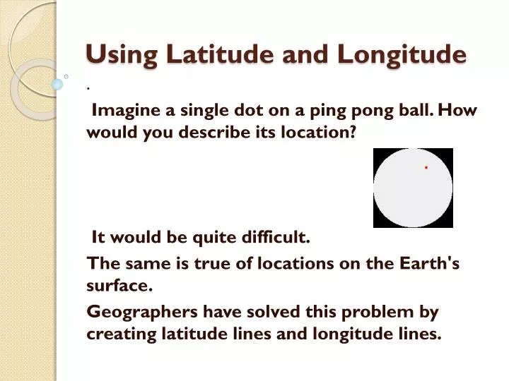
Using Latitude and Longitude . . Imagine a single dot on a ping pong ball. How would you describe its location ? It would be quite difficult. The same is true of locations on the Earth's surface. Geographers have solved this problem by creating latitude lines and longitude lines.

E N D
Using Latitude and Longitude . Imagine a single dot on a ping pong ball. How would you describe its location? It would be quite difficult. The same is true of locations on the Earth's surface. Geographers have solved this problem by creating latitude lines and longitude lines.
Content Objective: Today you will be able to identify, define and apply lines of latitude and longitude.Language Objective: Students will use content knowledge to find the location of a sinking ship on a world map so they can send out a rescue team to help the survivors. .
Using Latitude and Longitude - Lesson 1 How can I remember which lines are which? . Latitude lines are imaginary lines on the earth's surface. They run east and west around the globe and tell you your distance north or south of the Equator. Think of latitude like the rungs of a ladder (ladder sounds a lot like latitude). Latitude lines run east and west, but they tell how far up (north) you can go or how far down (south) you can go.
Using Latitude and Longitude - Lesson 1 How can I remember which lines are which? . Longitude lines are imaginary lines on the earth's surface that run from pole to pole around the globe and tell you your distance east or west from the Prime Meridian. When you think of longitude, think of long, tall telephone poles (because longitude lines run from pole to pole). Longitude lines run north and south, but they tell how far east you can go or how far west you can go.
Using Latitude and Longitude Why are latitude and longitude measured in degrees? In the field of mathematics, circles are measured in degrees. There are 360 degrees in a circle. Since the earth is basically circular, it was decided to measure latitude and longitude in degrees also. The first latitude line was the Equator (equally distant between the north and south poles). It is the largest of all latitude lines. All other latitude lines are measured in degrees north or south of the Equator. There are a maximum of 90 degrees of latitude to the north or the south of the Equator.
The first longitude line was the Prime Meridian. Any meridian could have been chosen as the Prime Meridian because they are all exactly the same. The Prime Meridian was selected by international agreement at the International Meridian Conference called by President Chester Arthur in October of 1884. Representatives from 25 nations met in Washington, D.C. All other longitude lines are measured in degrees east or west of the Prime Meridian. There are a maximum of 180 degrees on longitude to the east or the west of the Prime Meridian. It is approximately 70 miles between two latitude lines. For more accuracy in location, degrees can be divided into smaller parts. One degree can be divided into 60 minutes (') and one minute can be divided into 60 seconds ("). We will not use minutes or seconds of latitude and longitude in this course.
Using Latitude and Longitude How do I use latitude and longitude? If someone asked you the location of the local town bank, you may say "It is on the corner of Main and Third streets." Latitude and longitude are like imaginary streets on the earth. It is customary to give the latitude of a place first, and the longitude second. For example, you would say "35 degrees north, 77 degrees west". This eliminates the need to say the words latitude and longitude. Make sure that you give a direction with the number. If you simply say "66 degrees latitude", there are two of them - one in the north and one in the south. To find a latitude line such as 60 degrees north latitude, you must do three things:1. Go to your starting line (the Equator).2. Determine which direction you must go (north or south).3. Determine the distance in degrees you must go (60). This will give the location of one of your streets. To find a longitude line such as 40 degrees east longitude, you must do three things:1. Go to your starting line (the Prime Meridian).2. Determine which direction you must go (east or west).3. Determine the distance in degrees you must go (40). This will give the location of one of your second street.
Using Latitude and Longitude How do I use latitude and longitude? If you find the intersection of these two imaginary streets, you have found the exact (absolute) location of a particular place on the earth's surface (shown by the red "X" on the map below. Important: The Equator is neither North nor South of the starting line, so it is simply 0º latitude (no direction needed). The Prime Meridian would be 0º longitude (no direction needed). Notice this on the two diagrams.
Longitude & Latitude Practice • Directions: For each question below, select which letter matches the correct latitude and longitude coordinates on the map above. Indicate your choice. • 1. 20º South, 20º East - Letter F or Letter H • 2. 20º South, 100º East - Letter A or Letter F • 3. 20º North, 40º East - Letter F or Letter H • 4. 60º South, 40º West - Letter D or Letter J • 5. 10º South, 40º West - Letter C or Letter J • 6. 0º, 140º West - Letter B or Letter C • 7. 40º North, 100º West - Letter E or Letter G • 8. 80º North, 0º - Letter B or Letter E • 9. 40º North, 60º East - Letter E or Letter G • 10. 50º North, 120º East - Letter E or Letter I
Using Latitude and Longitude - Lesson 4When would I ever use latitude and longitude? In real life, there are several instances where you would need to know how to find latitude and longitude. For example, when weather forecasters are tracking hurricanes, they note the absolute location on a periodic basis to see the path of the storm and try to predict the future path based partially on these findings. Another example would be in the military. Suppose you were at war and you wanted to blow up an ammunition factory, but not the hospital nearby. Using minutes and seconds of latitude and longitude, you can launch a missle from hundreds of miles away and strike only that particular bulding. If you wanted to license a CB base station, or even license 5-mile range walkie talkies, you need to provide the latitude and longitude of your home to the Federal Communications Commission to get such a license.
In an emergency situation, like a plane crash or a ship sinking, you can relay your coordinates of latitude and longitude to assist rescue teams when time may be very important. If you are in the middle of an ocean, there are no landmarks to use, so you had better know your latitude and longitude. With today's GPS (Global Positioning Systems) and a satellite network above the earth, locating your latitude and longitude is much easier than it has been in the past. GPS will be taught in a future lesson.
Application Quiz • 1. Lines of latitude can be thought of like telephone poles. (5 points)True/ False2. Latitude tells you the distance east or west of the Prime Meridian. (5 points)True/ False • 3. When stating the absolute location of a place, you always give the longitude first. (5 points)True/ False • 4. Latitude and longitude are measured in: (5 points)A. miles B. kilometers C. degrees D. hours • 5. The starting line for measuring latitude is the: (5 points)A. Prime Meridian B. Arctic Circle C. International Dateline D. Equator
Quiz - continued • 6. When finding longitude, what is your first step? (5 points)A. Determine the direction B. Locate the Equator C. Determine the distance D. Go to the starting line • 7. Which lines run north and south along the earth's surface? Choose all that correct answers that apply. (8 points)A. latitude lines B. longitude lines C. Equator D. Prime Meridian • 8. Degrees of latitude and longitude can be divided into: Choose all that correct answers that apply. (8 points)A. hours B. Minutes C. seconds D. days • 9. What are some of the ways in which we use latude and longitude in everyday life? Choose all that correct answers that apply. (8 points)A. To aim missles in the military B. To locate the survivors of a plane crash • C. To license CB raido base stations D. To determine the height of a skyscraper
Quiz - continued • 10. The Prime Meridian Conference was called by President____________ . (5 points) • 11. The intersection of a particular latitude line with a given longitude line is known as_____________ . (5 points) • 12. _______________is the correct terminology for describing the location of the Equator. (5 points) • 13. What is the total number of degrees of longitude east or west of the Prime Meridian? (answer in numbers only) (6 points)
14. Use the map below to answer the remaining questions: Which letter is located at 50 degrees north and 120 degrees east
Survivor Quiz How did you do? Could you survive? Check your answers ……. • If you can answer all of the following questions correctly, you would have a good change at surviving. However one incorrect answer in a real survival situation might result in death.
1. 2. 3. 4. 5. 6. 7. 8. 9. 10. 11. 12. 13. 14. 15. 16. 17. 18.
What lesson can we learn from trying to survive in a situation that is strange to us? What navigational tools can we use out on the Open Waters?