Download
1 / 21
220 likes | 375 Views
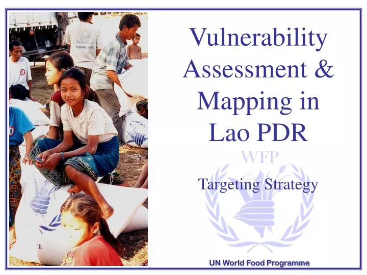
Vulnerability Assessment & Mapping in Lao PDR Targeting Strategy. UN World Food Programme. Vulnerability.

E N D
Vulnerability Assessment & Mapping in Lao PDR Targeting Strategy UN World Food Programme
Vulnerability • To best understand the nature of food insecurity and vulnerability among the hungry poor, WFP operations depends on timely, accurate and relevant information collected and analysed by the Vulnerability Assessment & Mapping (VAM) unit • Vulnerability is an important concept in relation to food security. It is defined as ‘the probability of an acute decline in food access or consumption levels below minimum survival needs • Vulnerability = exposure to risk + inability to cope • The overall goal of VAM is to improve WFP’s capacity to identify specific target groups who could benefit from food aid interventions
VAM in Lao PDR • As early as 1997, a Vulnerability Analysis Mapping (VAM) exercise was undertaken in Lao PDR to analyze the status of food security/insecurity. Alongside this a preliminary analysis of vulnerability was undertaken. A substantial undertaking, however, only came in 2000, with the establishment of a “representative office” and so a vulnerability analysis was undertaken at the district level (2001)
District Level Vulnerability Analysis In order to keep the vulnerability index simple and easy to understand, considerable efforts were made to select a small number of relevant indicators. Through discussions with the government and development agencies (international donors and NGO’s), and alongside an extensive literature review on poverty, 6 indicators for vulnerability to food (in)security were finally selected.
6 Indicators of Vulnerability Initial quantitative analysis: Six key indicators linked to ‘chronic’ vulnerability in Lao PDR – selection made according to extensive in-country discussions with key agencies in conjunction with the availability of high quality data at the district level, as follows: 1. Rice production per capita (Ag. Census 98/99) 2. Livestock (cattle & buffalo) per hh (Ag. Census 98/99) 3. Forest area index (hectares) per hh (MRC 1977) 4. % of villages within 6 km of main road 1998)– (UXO 1998) 5. % population with no education (Census 1995) 6. Crude death rate (Census 1995)
Rice Production per Capita • Rice self-sufficiency is the primary indicator of household poverty in Lao PDR (CPC/ADB 2000) • A total of 24 of the 134 districts (red) have access to less than 8 months of rice per capita (180 kg rice requirement per capita) • 62 districts produce less than the average annual requirement (red and orange) • Only in the last couple of years has the estimated national rice production met the national rice requirement. This is a very recent development, as the eight years prior to that, lao PDR was not self-sufficient at national level.
Livestock per Household • Owning livestock (especially large animals such as cattle and buffalo) is a key indicator of a rural household’s wealth. It is mainly used as a ‘savings mechanism’ rather than as a consumption resource Income from livestock in upland areas ranges from 25-50% of the total income • The national average is 2.6 cattle and buffaloes per household. In Xieng Khuang and large parts of Savannakhet each household owns more than 3.5large animals on average • Over 70% of agricultural holdings have chickens, 48% buffalo, 49% pigs and only 31% have cattle
Forest Area per Household • Forested areas are calculated as the hectare equivalent of high-density forest per household. This figure includes a range of land cover classes as over 75% of NTFP are collected in and around villages (paddy fields, shrubs, river, etc.). Approximately 25% are collected from “conventionally” defined forests • Non-timber forest products (NTFPs) such as bamboo and rattan shoots, fish, wild animals and vegetables are important sources of food, especially for rural households in poor and remote areas • NTFPs are often collected when other sources of food/income are not sufficient; they are an important coping mechanism especially for the poorest of the poor. A field survey in 1996 showed that 90 % of income is derived from NTFPs among the poorest households (IUCN/DoF 1996)
Village Access to Roads • 60% of the villages in the North and 54% of the villages in the South are “inaccessible” in the rainy season (LECS 97/98). • Road access is a significant indicator of poverty. 50% of the population is poor in areas not accessible by road, while the percentage drops to 25% in areas accessible by roads (NSC-WFP 2000, not published).
Population with No Education • Overall, 37 % of the population have never attended formal or informal classes (LRSH 2001) • Education and the crude death rate across districts are highly correlated • Over 55% of the villages do not have a “complete primary school”. In some Provinces (Phongsaly, Luang Namtha, Oudomxay, Sekong) as much as 80-90% of villages do not have a complete primary school (LECS 97/98) • Education of the head of the household is correlated to poverty (LECS 97/98) while education of mother is correlated to levels of child malnutrition (Kaufmann, 1997)
Crude Death Rate • The crude death rate is the only countrywide health indicator available at district level • Infant mortality rate is 82 per 1,000 live births while the under five-mortality rate is 107 per 1,000. Maternal mortality is 530 per 100,000 (LRHS 2001). Note there are high rural-urban disparities within this figure • Over 89 % of villages claim that Malaria is the major health problem (LSIS 1993) • Immunization programmes have been carried out in 87 % of the villages. In some provinces, the figures (LECS 97/98) are as high as 100 % (Xayaboury and Champasack) and as low as 34 % (Sekong)
Developing the Vulnerability Index Having selected the indicators, a comparative study was undertaken to determine the most appropriate technique for reducing the indicators down into one single index to best represent vulnerability across the entire country. Four different reduction techniques were undertaken in the selection of the WFP District Vulnerability Index, as follows; û“Below/Above Mean” Vulnerability Index û “Standard Deviation” Vulnerability Index û “Weight and Threshold” Vulnerability Index û “Factor Score Analysis” Vulnerability Index
Factor Score Analysis A factor analysis or Principal Component Analysis is a data reduction technique that reduces a high number of components (in our case six indicators) to a smaller numbers of meaningful “components” (in this case one index). Based on internal discussions, meetings with government officials, donors and the local community, this index was deemed as most representative of the poorest areas in Lao PDR. This is because this methodology compares and finds relationships amongst the indicators to create a new composite index of best fit
Factor Score Vulnerability Index • The Factor Score Analysis is a statistical analysis that simplifies a large number of indicators into a smaller number of components. It strives to find the best fit among all indicators. In this case, the final index or component explains more than 50 % of the variance within all 6 indicators • Six indicators are used for this index: rice production (net), large animal per household, access to road, access to forested land, education and health • This index results in 34 districts being deemed as most vulnerable, it principally highlights the districts bordering Vietnam on the South East Region of the Countries and the Northwest region • Rice: 427 kg/per capita • Large animals per hh: 3.40 • Forest ha per hh: 26 • % villages < 6km of road: 94% • % people no education: 24% • Crude death rate: 6.04/1000 • Rice: 296 kg/per capita • Large animals per hh: 2.77 • Forest ha per hh: 27 • % villages < 6km of road: 20% • % people no education: 88% • Crude death rate: 30/1000
Comparison to Poverty Studies To determine the validity of, or how representative the results of the WFP vulnerability analysis was, comparisons with other in-country studies on poverty (at the district level) were undertaken. The factor score index results were compared to the following: ûPoor districts as identified by the provincial committees û Poor districts as identified by the LECS study
Poverty in Lao PDR • A total of 25 districts in 11 Provinces are identified as poor or vulnerable by all three analyses. There is a high correlation between districts in Attapeu, Saravane, Sekong, Pongsaly and Oudomxay. Correlation between districts is lower in Xiangkhuang, Bokeo and Huapanh • 10 districts have been identified as vulnerable according to the WFP index, but these have not been selected by either the LECS poverty line or Provincial Committees • Regardless which set of analysis was used, a total of 83 Districts out of 134 Districts in all Provinces (except Vientiane Municipality) are classified as poor
Re-mapping Exercise 2002 • District borders continue to change in Lao PDR, and updated spatial files were released by UXO in late 2002 • In light of the new configuration at the district level, the vulnerability maps were updated accordingly • Whereas previously there were 134 districts, now (2003) there are 142 districts in Lao PDR • Advances in mapping and GIS technologies have significantly improved to the quality and scope of maps now produced by the VAM unit, Lao PDR
VAM 2003 • Village Level Vulnerability Analysis – using a variety of vector and raster data (census, land use/cover, slopes, elevation, average rainfall variation, distance to main road/towns, city lights, UXO et al), undertake a new village level analysis using advanced spatial analysis techniques (grid and prepare raster data using Idrisi, analyze results in SPSS) • District Level Vulnerability Analysis – taking the aggregated results of the village vulnerability analysis, revise the DVA 2001 in light of new data/information that has come into the public domain. Look at livelihoods in terms of (upland, lowland et al agricultural production). Revise indicators, statistical methodology, maps, and deliver according to SAF guidelines (VIP + CVA + CFSP)