Download
1 / 1
10 likes | 126 Views
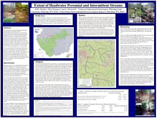
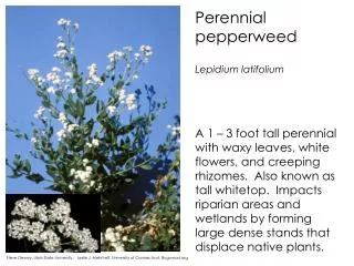
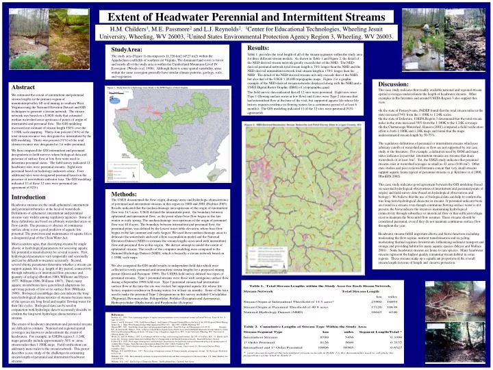
H.M. Childers 1 , M.E. Passmore 2 and L.J. Reynolds 2 . 1 Center for Educational Technologies, Wheeling Jesuit University, Wheeling, WV 26003, 2 United States Environmental Protection Agency Region 3, Wheeling, WV 26003. Extent of Headwater Perennial and Intermittent Streams. Results:

E N D
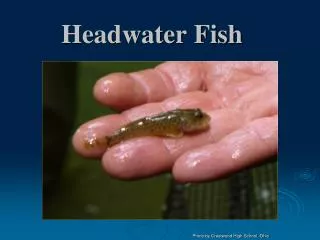
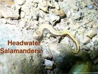
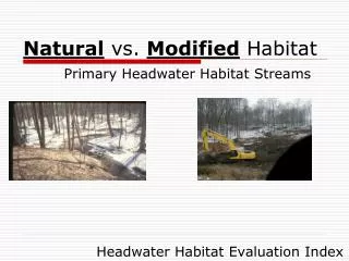
H.M. Childers1, M.E. Passmore2 and L.J. Reynolds2. 1Center for Educational Technologies, Wheeling Jesuit University, Wheeling, WV 26003, 2United States Environmental Protection Agency Region 3, Wheeling, WV 26003. Extent of Headwater Perennial and Intermittent Streams • Results: • Table 1. provides the total length of all of the stream segments within the study area for three different stream models. As shown in Table 1 and Figure 2, the detail of the NED-derived stream network greatly exceeds that of the NHD. The NED-derived perennial network total stream length is 70% longer than the NHD and the NED-derived intermittent network total stream length is 158% longer than the NHD. The detail of the NED-derived streams not only exceeds that of the NHD, but also that of the USGS 1:24,000 topographic maps. Figure 2 is a graphic example of the NED-derived stream networks displayed along with the NHD and a USGS Digital Raster Graphic (DRG) of a topographic quad. • The field survey data indicated that all 12 sites were perennial. Eight sites were Type 1 (flowing surface water at low flow) and 4 sites were Type 2 (streams that had intermittent flow at the time of the visit, but supported aquatic life whose life history requires residence in flowing waters for a continuous period of at least 6 months). The GIS modeling indicated 11 of the 12 sites were perennial (92% agreement). • StudyArea: • The study area (Figure 1) encompasses 11,726 km2 (4527 mi2) within the Appalachian coalfields of southern est Virginia. The dominant land cover is forest and nearly all of the study area is within the Cumberland Mountains Level IV Ecoregion (Woods et al. 1996). Although there is some spatial variability, areas within the same ecoregion generally have similar climate patterns, geology, soils, and vegetation. Discussion: This case study indicates that readily available national and regional stream spatial coverages underestimate the length of headwater streams. Other examples in the literature and around USEPA Region 3 also support this view: • In the state of Pennsylvania, PADEP found that the total stream miles in the state increased 54% from the 1:100K to 1:24K scales. • In the state of Delaware, USEPA Region 3 determined that the total stream miles in the state increased 58% from the 1:100K to the 1:24K coverage. • In the Chattanooga Watershed, Hansen (2001) compared a field verification effort to both 1:100K and 1:24K maps and found that the maps underestimated stream length by 50-75%. The regulatory definitions of perennial or intermittent streams which use arbitrary cutoffs of watershed area or flow are not supported by our case study or the literature. For example, a definition used by OSM and many states indicates in part that intermittent streams are streams that drain watersheds of at least 1mi2. Yet, the USGS study indicates that perennial streams exist at watershed acreages as small as 41 acres (0.06 mi2). Other state studies and peer reviewed literature concur that very small streams support aquatic fauna typical of perennial streams (e.g. Kirchner et al 2000, OhioEPA 2002). This case study indicates good agreement between the GIS modeling (based on seasonal hydrological observations of intermittent and perennial points of origin) and field survey data (based on hydrological observations and biology). We believe that the use of biological data can help to confirm the true long term hydrological character in streams. If perennial indicator biota are found in a stream, even though continuous flowing surface water is not present, the biota indicate the stream is maintaining hydrological connectivity through subsurface or intersticial flow or that sufficient refugia exist to maintain the biota until flow resumes. These streams should be considered perennial, even if they do not maintain continuous surface flow throughout the year. Headwater streams fulfill important abiotic and biotic functions including moderating the flow regime, nutrient transformation and recycling, moderating thermal regimes downstream, influencing sediment transport and storage and providing habitat for many aquatic species (Meyer and Wallace 2001) . Some headwater streams are home to rare species. Many headwater streams represent the highest quality remaining stream habitat in some regions. These streams make up a significant proportion of the overall stream length in terms of length and deserve protection. Abstract We estimated the extent of intermittent and perennial stream lengths in the primary region of mountaintop/valley fill coal mining in southern West Virginia using the National Elevation Dataset and GIS techniques to generate a stream network. The stream network was based on a USGS study that estimated median watershed areas upstream of points of origin of intermittent and perennial flow. The GIS modeling increased our estimate of stream length 158% over the 1:100K scale mapping. Thirty-four percent (34%) of the total stream resource was designated as intermittent by the GIS modeling. Thirty-one percent (31%) of the total stream resource was designated as 1st order perennial. We then compared the GIS intermittent and perennial designations to field surveys where biological data and presence of surface flow at low flow were used to determine perennial status. The field survey indicated 12 headwater sites were perennial streams. Eight were perennial based on hydrology indicators alone. Four additional sites were designated perennial based on the presence of invertebrate indicator taxa. The GIS modeling indicated 11 of these 12 sites were perennial (an agreement of 92%). Introduction Headwater streams are the small ephemeral, intermittent and perennial tributaries at the head of watersheds. Definitions of ephemeral, intermittent and perennial streams vary widely among regulatory agencies. Some of these definitions are based on arbitrary watershed areas or flow cutoffs. The presence or absence of continuous surface alone is not a good predictor of aquatic life potential. The protection and maintenance of aquatic life is a designated goal of the Clean Water Act. Most scientists agree that classifying streams by single abiotic or hydrological parameters for assessing aquatic life potential is unsatisfactory for several reasons. First, hydrological parameters vary temporally and seasonally and can be difficult to measure accurately. Second, several abiotic parameters determine whether a stream can support aquatic life (e.g. length of dry period, connectivity through subsurface or intersticial flow, presence and quantity of refugia) (Boulton 1989, Williams and Hynes 1977, Williams 1986, Williams 1987). Third, many aquatic invertebrates have generalized adaptations for surviving periods of low or no surface flow (Williams 1996). Biological assemblage data can indicate the long term hydrological characteristics of streams because many of the species are long lived and require flowing water for their life cycles. Biological data can be used in conjunction with hydrologic data to accurately describe or confirm the long term hydrologic characteristics of streams. The extent of headwater intermittent and perennial streams are difficult to estimate. National and regional spatial coverages are known to underestimate the extent of headwaters. For example, in USEPA region 3, 1:24K maps generally include approximately 50% or more stream miles than 1:100K maps. Field verification can add many more miles to the stream network. This poster describes a case study of the challenges in estimating stream length of perennial and intermittent headwater streams. Methods: The USGS documented the flow origin, drainage areas and hydrologic characteristics of perennial and intermittent streams in this region in 2000 and 2001 (Paybins 2003). Results indicated that the median drainage area upstream of the origin of intermittent flow was 14.5 acres. USGS defined the intermittent point, the boundary between ephemeral and intermittent flow, as the point where base flow begins in the late winter or early spring.The median drainage area upstream of the origin of perennial flow was 40.8 acres. The boundary between intermittent and perennial flow, the perennial point, was defined by the lowest water table elevation, where base flow begins in the late summer and early August. We used these median drainage areas to delineate the watersheds and used a flow accumulation model and the National Elevation Dataset (NED) to estimate the stream lengths associated with intermittent flow and perennial flow in this region. We did not attempt to model the extent of ephemeral streams. The results of the computer modeling were compared to the National Hydrology Dataset (NHD), which is basically a stream network based on 1:100K scale maps. We also compared the GIS model results to independent field data which were collected to verify perennial and intermittent stream lengths for a proposed mining permit (Green and Passmore 1999). The USEPA field survey defined two types of perennial streams. Type 1 perennial streams were those with contiguous surface flow during a September 1998 field visit. Type 2 perennial streams had intermittent surface flow at the time the site was visited, but supported aquatic life whose life history requires residence in flowing waters for at least six months. Some of the taxa used to make the perennial Type 2 designations in this survey included: Corydalidae (Nigronia), Pteronarcyidae, Peltoperlidae, Perlidae (Eccoptura and Acroneuria), Hydropsychidae (Diplectrona), and Psephenidae (Ectopria). References: Boulton, A.J. 1989. Over-summering refugees of aquatic macroinvertebrates in two intermittent streams in Central Victoria. Trans. R. Soc. S. Aust. 113:23-34. Green, J. and M. Passmore. 1999. Field Survey Report: An Estimate of Perennial Stream Miles in the Area of the 1997 Proposed Hobet Mining Spruce No. 1. Mine (West Virginia Surface Mine Application #5013-97). July 1999. USEPA, Wheeling, WV. Hansen, W.F. 2001. Identifying stream types and management implications. Forest Ecology and Management. 143:39-46. Kirchner, R.F., B. Stout and B. Wallace. 2000. A Survey of Eight Major Aquatic Insect Orders Associated with Small Headwater Streams Subject to Valley Fills from Mountaintop Mining (in draft). US Army Corps of Engineers, Apple Gove, WV. Jesuit University, Wheeling, WV. University of Georgia, Athens, GA. Meyer, J.L. and J.B. Wallace. 2001. Lost linkages and lotic ecology: rediscovering small streams. Pp. 295-317 in Press, M.C., J.J. Huntly, and S. Levin, eds. Ecology: Achievement and Challenge The 41'st Symposium of the British Ecological Society. Blackwell Science. Oxford. Paybins, K.S. 2003. Flow origin, drainage area, and hydrologic characteristics for headwater streams in the mountaintop coal-mining region of southern West Virginia. Water Resources Investigation Report 02-4300. USGS, Charleston, WV. Ohio EPA. 2002. Field evaluation manual for Ohio's primary headwater habitat streams. Final version 1.0. Division of Surface Water, Columbus, Ohio. Williams, D.D. and H.B. Hynes. 1977. The ecology of temporary streams: II.General remarks on temporary streams. Int. Revue ges. Hydrobiol. 62(1):53-61. • Williams, D.D. 1996. Environmental constraints in temporary fresh waters and their consequences for the insect fauna. J.N. Amer. Benthol. Soc. 15(4):634-650. • Williams, D.D. 1987. The Ecology of Temporary Waters. The Blackburn Press, Caldwell, New Jersey