Download
1 / 44
440 likes | 582 Views
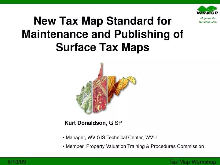
New Tax Map Standard for Maintenance and Publishing of Surface Tax Maps. Kurt Donaldson, GISP. Manager, WV GIS Technical Center, WVU Member, Property Valuation Training & Procedures Commission.

E N D
New Tax Map Standard for Maintenance and Publishing of Surface Tax Maps Kurt Donaldson, GISP • Manager, WV GIS Technical Center, WVU • Member, Property Valuation Training & Procedures Commission 6/10/09 Tax Map Workshop
TITLE 189PROCEDURAL RULEPROPERTY VALUATION TRAINING AND PROCEDURES COMMISSIONSERIES 3 STATEWIDE PROCEDURES FOR THE MAINTENANCE AND PUBLISHING OF SURFACE TAX MAPSNew Standard Effective February 2009http://www.wvgis.wvu.edu/resources/standardsGuidelines/189-03.pdf WVAGP Tax Map Workshop
New Standard (189 CSR 3) WV Secretary of State http://apps.sos.wv.gov/adlaw/csr/index.aspx WVAGP Tax Map Workshop
Finished “Surface” Tax Maps • Show the property and lot lines, set forth dimensions and/or areas, and other cadastral and cultural features that assessors are required by state law to maintain and publish for the public. • Created by either manual or automated methods in accordance with standards approved by the Property Valuation Training and Procedures Commission • Cartographic Design / Layout Specifications • Map Content • Maintenance Procedures / Map Currency • Submission Requirements / County Monitoring WVAGP Tax Map Workshop
Example - Finished Tax Map Manually drafted or computer generated WVAGP Tax Map Workshop
Tax Map History in WV WVAGP Tax Map Workshop
Primary map tiles Nested Grid True Grid Modified Grid Random Orientation true north Y Y Y N Uniform tile size Y Y N N 100 scale nested within 400 scale Y N N N Map Tile Reference System Counties have different reference systems based on the original mapping Map Tile Reference System: The parcel reference system for each county is subdivided into rural tax districts and corporations, which are further subdivided into map tiles / map sheets. The type of parcel reference system is determined by the primary map scale (usually 1”=400’ scale) configuration for rural maps and its relationship to urban areas (usually 1”=100’ scale). WVAGP Tax Map Workshop
Random Grid – Pendleton County Random Orientation, No uniform tile size, No nesting of 100’ and 400’ scale maps WVAGP Tax Map Workshop
Modified Grid - Wetzel County True North Orientation, No uniform tile size, No nesting of 100’ and 400’ scale maps WVAGP Tax Map Workshop
TITLE 189 Procedural Rules (1990) These guidelines are obsolete and have been superseded by the new standard effective 2009 SERIES 3 Guidelines for Neat, Final Manual Drafting of Surface Tax Maps • SERIES 4Statewide Procedures • for the • Manual Maintenance • of • Surface Tax Maps WVAGP Tax Map Workshop
Why revise 1990 Tax Map Standard? • More Current: Provides guidelines for digital mapping technologies which have become prevalent in the past decade. • Clarification: Enhances the previous rules that define the uniform statewide procedures for the maintenance and publishing of surface tax maps. • National Standards: Conforms to national cadastral mapping standards set forth by the International Association of Assessing Officers and Federal Geographic Data Committee. WVAGP Tax Map Workshop
Tax Map Advisory Committee(2007) • PURPOSE: Provide recommendations for updating the WV Code of State Rules relative to the maintenance, publishing, and sale of surface tax maps. • RECOMMENDATION: Repeal and replace existing procedural rules with new guidelines for both manual and digital mapping Report Link: http://www.wvgis.wvu.edu/resources/standardsGuidelines/Tax_map_committee_report_7Jan07.pdf WVAGP Tax Map Workshop
Committee Members (2006-07) • Assessors • Deputy Assessors • County Mappers • WVDTR Tax Personnel • WV GIS Coordinator • Geospatial Professionals WVAGP Tax Map Workshop
Guidelines used by Committee to draft New Standard • 1990 Code of State Rules (Standards) • 1990 Property Valuation Training & Procedures Commission (189 Series, Rules 3 & 4) • International Association of Assessing Officers (IAAO) • 2003 Standard on Digital Cadastral Maps and Parcel Identifiers. • 2004 Standard on Manual Cadastral Maps and Parcel Identifiers. • Federal Geographic Data Committee’s (FGDC) Cadastral Data Subcommittee. • 2006 Cadastral NSDI Reference Document WVAGP Tax Map Workshop
IAAO Standards http://www.iaao.org/ WVAGP Tax Map Workshop
FGDC Cadastral Standard http://www.nationalcad.org/ WVAGP Tax Map Workshop
Committee Report (FAQ) Will the revised tax map rules mandate that all counties create digital tax maps? No. The revised tax mapping rules allow county assessors to create tax maps using either manual or automated procedures. WVAGP Tax Map Workshop
Committee Report (FAQ) Will the revised tax map rules cost the counties more money? No. If county assessors are in compliance with the existing tax map rules, then the newly revised rules should not cost the counties any additional funds. Counties may choose to incur additional costs when upgrading their mapping systems, such as transitioning from a manual to digital system. WVAGP Tax Map Workshop
Committee Report (FAQ) In the revised rules are parcel dimensions still required to be displayed on surface tax maps? Yes. In accordance with WV Code §11-1C-7(e), property and lot lines and their respective identifiers, dimensions or areas, and other parcel information must be properly annotated on every tax map. WVAGP Tax Map Workshop
Committee Report (FAQ) Will the revised tax map rules change the procedures defining the map content, annotation, symbols, or map design that have been the standard for “finished” printed maps since 1990? No. The map content, design, and layout for printed tax maps or print-ready images of tax maps will remain the same. The same uniform standard for maintaining and publishing “finished” printed tax maps is still applicable, whether the maps are created manually or electronically. WVAGP Tax Map Workshop
Digital Landbase Reference • A finished tax map is a digitized reference to the legal cadastre, specifically, a reference to the source documents that describe the intent of the on-ground cadastre • A finished tax map is not the official cadastre of record – only a reference to it. A digital landbase does not define land tenure boundaries. • Example: Assessor's Parcel Map used for taxation. These maps should not be used as the basis for engineering and construction which determines the location of built features ("fixed works") WVAGP Tax Map Workshop
New Standard (189 CSR 3) WV Secretary of State http://www.wvsos.com WVAGP Tax Map Workshop
County Digital Cadastral Mapping Program Geographic Information Systems (GIS) WVAGP Tax Map Workshop
Surface Tax Mapping Status WVAGP Tax Map Workshop
WV DTR Mineral Parcel Mapping Project (1995) WVAGP Tax Map Workshop
Mineral Parcel Mapping Project • Can be a starting point for digital tax map conversions • Not all surface parcel related features collected • Not continually updated WV DTR Collection State Mapping Project Local Tax Map WVAGP Tax Map Workshop
What Constitutes a GIS Program? • Parcel and base map layers referenced to a common coordinate system (i.e., State Plane, UTM, Lat./Long.) • Map layers have topology (i.e. mathematically closed polygons). Important for spatial analysis and linking to parcel attribute data. • Linked to a copy of external databases (e.g. CAMA/IAS). Important for attribute queries. • Seamless (countywide) • Parcel splits / maintenance in a digital environment (contracted / outsourced or in house) • Print-ready tax map books (JPEG, PDF format) submitted to WV DTR and available to public WVAGP Tax Map Workshop
Table of Contents shows 3 layers 2 Layers displayed – They match! All three match in space Same Geographic Space WVAGP Tax Map Workshop
Parcel Layers Parcel Related Features • Geo-Referenced Tax Map • Digitized Parcel Lines • Parcel IDs • Interior Lot Lines and IDs • Land Hooks and Buildings • Parcel Dimensions Reference Datasets • Road and Water Layers • Aerial Photography Integration (spatial compatibility) of data layers is more difficult if compiled from different sources or assembled at varying time intervals WVAGP Tax Map Workshop
Related data layers Structures Boundaries Streets Parcels LandUse Environmental Considerations • Data is organized by layers, with each layer representing a common feature. • Layers are integrated using explicit location on the earth’s surface, thus geographical location is the organizing principal. “The Real World” WVAGP Tax Map Workshop
Access to WV Spatial Data Infrastructure Access to over $50 million dollars worth of spatial data WVAGP Tax Map Workshop
Other Reference Data – Building Footprints WVAGP Tax Map Workshop
Other Data - FEMA Flood Layers WVAGP Tax Map Workshop
Linked to Assessment Database A GIS links locational (spatial) and database (tabular) information + Spatial Information Tabular Information Database links to parcels via: (1) parcel identifier or (2) standardized address WVAGP Tax Map Workshop
GIS = Parcel Features + Database • GIS are a combination of geographic data and attribute data • Parcel polygons are the spatial features • CAMA/IAS records are the attributes • GIS allow two key types of functionality • Point at a graphic feature and retrieve attributes • Query attributes and see graphic result of query on a map WVAGP Tax Map Workshop
Topology (spatial relationships) • How to model spatial relationships • Parcels cannot overlap one another • Building footprints must not overlap parcels • Parcel lines cannot have dangles Error / Validation Checks WVAGP Tax Map Workshop
Topology – Define Relationships Define Spatial Relationships among different layers WVAGP Tax Map Workshop
Seamless Seamless Not Seamless WVAGP Tax Map Workshop
Seamless - countywide Seamless between rural districts and corporations WVAGP Tax Map Workshop
Electronic Map Books WVAGP Tax Map Workshop
Surface Tax Mapping Status WVAGP Tax Map Workshop
Challenges – digital conversion • Maintaining two systems (manual and digital) • Expense • Time • Technical Issues • Organizational Issues - Sharing resources and expenses with other entities can minimize redundancy, ensure interoperability, and maximize benefits. - Conduct pilots to resolve critical issues. WVAGP Tax Map Workshop
Best Practices • Tax Map Standards / Guidelines • Monitoring • County Map Examples • Continuing Training / Technical Support • Best Practices WVAGP Tax Map Workshop
Resources / Questions? Contact: Kurt Donaldson WV GIS Technical Center, WVU Web: http://wvgis.wvu.eduPhone: (304) 293-9467E-mail: kdonalds@wvu.edu Tax Map Resource Link: http://www.wvgis.wvu.edu/resources/standardsGuidelines/TaxMapResources.pdf WVAGP Tax Map Workshop


![enTaxr [ nj ] - Tax Maps of New Jersey](https://cdn1.slideserve.com/2642837/entaxr-nj-tax-maps-of-new-jersey-dt.jpg)