Download
1 / 14
160 likes | 473 Views
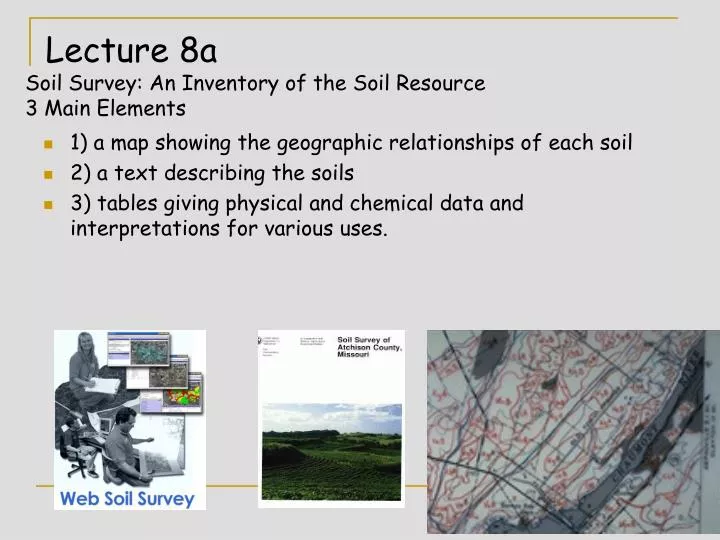
Lecture 8a Soil Survey: An Inventory of the Soil Resource 3 Main Elements. 1) a map showing the geographic relationships of each soil 2) a text describing the soils 3) tables giving physical and chemical data and interpretations for various uses. Soil Survey. House. A soil survey:

E N D
Lecture 8aSoil Survey: An Inventory of the Soil Resource 3 Main Elements • 1) a map showing the geographic relationships of each soil • 2) a text describing the soils • 3) tables giving physical and chemical data and interpretations for various uses.
Soil Survey House • A soil survey: • describes the characteristics of the soils in a given area, usually a county is the unit of publication. • The survey classifies the soils according to a standard system of classification, • plots the boundaries of the soils on a map, the map uses an aerial photo as the base • Makes predictions about the behavior of soils, Tree soil boundary Trees
Soil Survey • The different uses of the soil and how management affects them are considered, • The information collected in a soil survey helps in the development of land-use plans, • The Survey evaluates and predicts the effects of land use on the environment.
Map Scale Topographic Map Scale = 1:24,000 • Soil maps differ in their scale: • Map scale refers to how many inches on the map represents inches on the ground - • Scale of 1:24,000 says 1 inch on map = 24,000 inches on the ground. • Or 1” map = 24,000” ground 24,000”/12”/ft.=2000 ft. • Or 1 inch = 2000 ft & /5280ft/mile = 0.38 miles. • Note:1 mile =63,360 inches • 3 in x 24000 /12 = 6000ft (----3IN--)
Making a Soil Map • 1. Soil maps are not road maps • - soils boundaries are interpreted and the line is placed on the map by the soil scientist • -the lines on the map represent their interpretations of where the soil boundary changes. • - these lines are determined by investigating the soil with a hand auger or power auger • - the use of remotely sensed data ( air photo) will also help in determining where these lines are placed.
2. Thus the only accurate soil map has a scale of 1:1 but that is not possible. • 3. Soil maps are approximations of the soil boundary location - road maps have more precise accuracy. • 4. Soil maps are checked for accuracy by running transects (red & blue lines) across the mapping units. Transects in red & blue
Soil Mapping Units – 2 kinds-Consociation & Complexes • PwA = Port Byron soil on A slope (0-2%) • Soil maps done in the recent past use numbers for the map unit – ie 285A = Port Byron on 0-2% slope • SdC2 = Surrey & Dim soils on C slope (6-12 %) • Consociation - 75% named soil & 25 % inclusions • Complexes - 2 or 3 named soils = 75% & 25 % inclusions of unnamed soils
Rectangular Legal Land Description US Meridans and Base Lines • Metes and Bounds Description– describe the property by noting the location of known objects (tree, rock, river)– Can be a problem when the object is no longer there. 13 original states and Spanish land grants • Rectangular – describe the property from the intersection of a meridian and base line using Townships of 6 square miles. Each section in a township is one square mile or 36 sections in a township. T1NR1E
Legal Land Description • Every property has a legal land description that give the location of the property from smallest to largest. • Largest = Town and Range – location from principal base line and meridian T6NR4E. • Section 1-36 each a square mile or 6x6 • Location in Section as NW1/4 of the SE1/4 LEGAL LAND DESCRIPTION: NE¼, SEC 22, T2 North; R3 East of 4th Meridian
Largest = Town and Range – location from principal base line and meridian by townships, T6NR4E. • Section 1-36 each a square mile or 6x6 • Location in Section as NW1/4 of the SE1/4
Orders of Soil Survey • Order 1 soil survey - very detailed • Order 2 = regular soil survey • Order 3 = US forest survey • Order 4 = general soil map of county • Order 5 = soils of Minnesota Map
DYAD • Have you ever used Legal Land Description? • If so where? • What about metes and bounds? • If answer is no to the above two, describe your seat in this classroom from the front door of Borlaug Hall using Mets and Bounds.
NRCS Web Based Soil Survey Information System • WEB SSIS provides the information in the soil survey via the internet. • Thus it is easy to quickly check the capability of the soil for a specific use. • Web Soil Survey found at http://websoilsurvey.nrcs.usda.gov/app/ • Sample from Lab; Sec 8, T114 R 28W- 5th pm - Maintenance Schedule for Web Soil Survey 2.2 Web Soil Survey is unavailable nightly between 1:00 AM and 5:00 AM Eastern time for soil survey data updates. Web Soil Survey may be unavailable on Tuesdays and Thursdays between 8:00 PM and 10:30 PM Eastern time for scheduled maintenance and software updates. Web Soil Survey may also be unavailable the third weekend of each month, and the second Sunday of each month, for scheduled maintenance. It may also be necessary from time to time to bring Web Soil Survey down for unscheduled maintenance.