Download
1 / 14
140 likes | 261 Views
Clarus: The National Surface Transportation Weather Observing and Forecasting System. Roemer M. Alfelor FHWA Office of Transportation Operations Washington DC. December 1, 2004 MnDOT Regional Traffic Management Center Roseville, MN. FHWA Road Weather Management.

E N D
Clarus: The National Surface Transportation Weather Observing and Forecasting System Roemer M. Alfelor FHWA Office of Transportation Operations Washington DC December 1, 2004 MnDOT Regional Traffic Management Center Roseville, MN
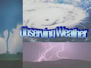
FHWA Road Weather Management Objectives: To better understand the impacts of weather on highways, and develop and deploy strategies that can mitigate those impacts, through the following activities: • Partnership and Collaboration • Customer Service and Outreach • Tools and Technologies • Maintenance Decision Support • Weather-Responsive Traffic Management • Road Weather Observing/Forecasting Systems • Program Management and Evaluation
Clarus Observing System • What • Demonstration of a regional road weather observation and forecasting system, and partnership to establish a nationwide road weather observation network. • Why • To reduce the impact of adverse weather on all road and transit users and operators.
Clarus Use Case Scenario Provide ESS Data Collect, Check, Flag and Send RWIS Data Traffic Operations Center Clarus Provide Nowcast and Forecast ESS Data Collector/RWIS ESS Equipment Provide Vehicle Data Collect, Check, Flag and Send Vehicle Data Provide Other DecisionSupport Info Transfer Quality Controlled Data Patrol or Maintenance Vehicle Service Provider Vehicle Data Collector Network Operator Collect External Weather Data Compare RWIS and Vehicle Data with External Weather Data Integrate and Transform Service Provider Data External Weather Data Sources
Clarus System Applications Spawn New technologies (in vehicle, PDA) Add Detail to HAR & VMS Route Specific Radio,TV and Internet Broadcasts of Travel Conditions Clarus Enhance decision making tools Credible & Precise Travel Advice Create New and More Effective Ways to Convey Surface Transportation Weather Information
Benefits of Clarus • A stable and reliable access to integrated surface transportation weather related observations • Continuous quality control with feedback to customers • Data available in one common format with full metadata • Data provided without post-processing, ready to be incorporated into value-added products including weather and traffic models as well as decision support systems • Support for the inclusion of new technologies such as vehicle-based sensing technologies, surface visibility information from traffic cameras, and remote sensing technologies
Clarus Roadmap FY04 FY05 FY06 FY07 FY08 FY09 Stakeholder Coordination Track 1 System Design Track 2 Multi-State Regional Demonstration Track 3 Final Design and Deployment Track 4
Clarus Roadmap - Status • Stakeholder Coordination – ICC established and first meeting held in Sept. 04 • Concept of Operations • User Needs and Use Case Drafts(on website) • ICC Meeting/ConOps Review 03/02/05 • Final Draft 05/06/05 • System Design • RFP issued 11/19/04 • 20 Months beginning on or about 06/01/05 • Systems Engineering stages following Concept of Operations • Proof-of-Concept
Clarus ICC - Membership • Who is this open to? • Open to all -- Meteorological and Transportation Communities. • What level of activity is expected? • Up to the individual. ICC is meant to provide the stakeholders a voice. • Is everything left to consensus? • The ICC Management Team makes final decisions with input from ICC.
Clarus ICC - Organization Clarus Initiative Management Team DOT Consultant • USDOT • AMS Team • NOAA • ITE • ITS America • AASHTO • TRB Clarus Initiative Coordinating Committee (ICC) Project Task Project Task Project Task Force Force Force
Clarus Applied Research • Vehicle Infrastructure Integration and Data Collection Enhancement • CCTV Technologies for Road Condition and Visibility • Phased Array Radar for Near Surface Observing • Remote Sensing from NASA Satellites
Related FHWA Activities • ESS Siting Guidelines • Missouri DOT Weather Response System for Traffic Management • Integration of Weather Information in TMC’s and TOC’s • Maintenance Decision-Support System (MDSS) Technology Transfer and Pooled Fund Study • Empirical Studies on Weather and Traffic • Integrating RWIS Data into MADIS
Contact Info • Paul Pisano • Team Leader, Road Weather Management Program • paul.pisano@fhwa.dot.gov, 202-366-1301 • Roemer Alfelor • Transp. Specialist, Road Weather Mgmt. Program • roemer.alfelor@fhwa.dot.gov, 202-366-9242 • James Pol • Transp. Specialist, ITS Joint Program Office • james.pol@fhwa.dot.gov, 202-366-4374 • Program Web Sites • http://www.fhwa.dot.gov/weather/ • http://www.its.dot.gov/ • http://www.clarusinitiative.org