Download
1 / 48
480 likes | 551 Views
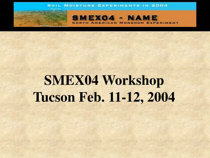
SMEX04 Workshop Tucson Feb. 11-12, 2004. Workshop Objectives. Provide potential participants with an overview of the primary experiment goals, needs, and products Identify and engage additional complimentary projects Understand the local realities that impact the idealized experiment design

E N D
SMEX04 Workshop Tucson Feb. 11-12, 2004
Workshop Objectives • Provide potential participants with an overview of the primary experiment goals, needs, and products • Identify and engage additional complimentary projects • Understand the local realities that impact the idealized experiment design • Design the insitu, regional and watershed scale sampling • Select a soil moisture sampling technique • Resolve some logistics issues through a visit to the Walnut Gulch Watershed
Workshop Agenda Wednesday Feb. 11 8:30 am Intros (Jackson, Moran, Lobl) 8:45 am Overview of NAME (Gochis, Emmanuel) 9:15 am Overview of SMEX04 (Jackson+) 10:00 am Insitu Networks and Study Regions Walnut Gulch (Moran+) Sonora (Watts+) 11:00 pm Aircraft and Instruments P-3 (Easmunt) PSR (Gasiewski) 2DSTAR (LeVine) 12:00 pm Lunch (Onsite) 12:45 am AMSR and other Satellite Products AMSR (Njoku) TMI (Gao) 1:45 pm Data Resources and Archival NSIDC DAAC (Marquis) JOSS (Williams) 2:15 pm Complimentary Research Activities LDAS in Tier 1 (Lettenmaier) Lower Atmosphere Observations During SMEX04 (Barros) Remote Sensing and Tower Flux Studies (Kustas, Anderson) Opportune Landing Site Soil Moisture and Soil Strength Assessment (Ryerson) Predicting Microbially Mediated Processes in Surface Soil (Reynolds) INIFAP (Lopez+) SWRC+ (Goodrich) NAME Supplemental Raingage Network (Shuttleworth) Vegetation water content with MODIS and AVIRIS (Hunt)
Workshop Agenda Thursday Feb. 12 8:15 Field Campaign Planning Regional sampling; strategy, site selection, schedule, logistics Sites for complimentary studies Soil moisture sampling method Flightlines Project integration Telecon scheduling 11:00 Trip to Tombstone WG Site Visit HQ, hotel locations, SCAN, Lucky Hills and Kendall
SMEX04: Soil Moisture Remote Sensing Field Experiment in the Context of the North American Monsoon Experiment (NAME)
Overview • NAME objectives and why Terrestrial Hydrology should be interested • What SMEX04 can do for NAME • How SMEX04 benefits the supporting programs (THP, AMSR-E, GWEC, ….) • SMEX elements • SMEX04 implementation • Detailed description of SMEX04 elements • Additional studies • Planning
NAME objectives and why Terrestrial Hydrology should be interested • A major science question involving soil moisture One of the main objectives of NAME is to improve prediction of warm season precipitation. Warm season precipitation is highly dependent on convection which, in turn, is controlled, at least in part, by soil moisture and surface temperature. Therefore, an accurate characterization of spatial and temporal variability of soil moisture is critical to NAME.
NAME objectives and why Terrestrial Hydrology should be interested • A major science question involving soil moisture • Challenge the soil moisture remote sensing community to provide useful and timely products • Success could broaden support
Overview • NAME objectives and why Terrestrial Hydrology should be interested • What SMEX04 can do for NAME • How SMEX04 benefits the supporting programs (THP, AMSR-E, GWEC, ….) • SMEX elements • SMEX04 implementation • Detailed description of SMEX04 elements • Additional studies • Planning
What SMEX04 can do for NAME • Over much of the NAME region soil moisture observations are sparse: new stations will be added and available resources enhanced • Remote sensing provides an alternative means of observing spatial and temporal variations in surface wetness over the region • Frequent derived estimates of soil moisture over much of the NAME region should be made possible through recently launched satellite microwave sensors, including the Advanced Microwave Scanning Radiometer (AMSR) both on Aqua as well as the TRMM Microwave Imager
Examples of Aircraft and Satellite Soil Moisture Products • Aircraft based Polarimetric Scanning Radiometer (PSR) from SMEX02. Uses the same C band channel as AMSR. Spatial resolution of 2 km. • Satellite based TRMM Microwave Imager brightness temperature images for a sequence of days over the Tier 1 region.
SMEX02 (Iowa) Soil moisture Products from the Aircraft Based PSR Northing (m) Easting (m) Soil moisture (%)
TMI Brightness Temperature Images of NAME Region (10.7 GHz H)
Overview • NAME objectives and why Terrestrial Hydrology should be interested • What SMEX04 can do for NAME • How SMEX04 benefits the supporting programs (THP, AMSR-E, GWEC, ….) • SMEX elements • SMEX04 implementation • Detailed description of SMEX04 elements • Additional studies • Planning
How SMEX Benefits the Supporting Programs • Field experiments have been very successful at addressing a broad range of science questions in terrestrial hydrology • The data have been used in studies that went well beyond the algorithm research • Priorities set by support program science: AMSR, GWEC, THP • Elements of the experiment are validation of AMSR brightness temperature and soil moisture retrievals, extension of instrument observations and algorithms to more challenging vegetation and other surface conditions, integration of land surface and boundary layer measurements, and the evaluation of new instrument technologies for soil moisture remote sensing.
How SMEX04 Benefits the Supporting Programs By Addressing Priorities • Development and validation of retrieval algorithms in regions with moderate to significant topographic variation • Validation of soil moisture products from the Aqua AMSR instrument • Establishing long-term in-situ soil moisture validation sites for satellite based retrievals • Evaluation of new sensor technologies and algorithms for soil moisture and support of future missions (HYDROS, SMOS) • Understanding the feedback mechanisms of surface soil moisture on weather and climate • Development of methods to assimilate surface soil moisture observations in models and exploring applications
Overview • NAME objectives and why Terrestrial Hydrology should be interested • What SMEX04 can do for NAME • How SMEX04 benefits the supporting programs (THP, AMSR-E, GWEC, ….) • SMEX elements • SMEX04 implementation • Detailed description of SMEX04 elements • Additional studies • Planning
Regional study areas 50 by 75 km linked to Ease-grid 25 km cells
Regional study areas 50 by 75 km linked to Ease-grid 25 km cells
Arizona Arizona Walnut Gulch Region Walnut Gulch Region Shrub Dominated Grass Dominated Landsat 5 Landsat 5 June 8, 1997 June 8, 1997
Walnut Gulch Regional Study Area (WG) Red markers are the corners of the 25 km Ease Grid cells
Mexico Mexico Sonora Region Sonora Region Landsat 5 Landsat 5 June 8, 1997 June 8, 1997
Mexico Regional Study Area (MX) Red markers are the corners of the 25 km Ease Grid cells
SMEX04 Elements • In-situ soil moisture networks • Aircraft and satellite mapping • Intensive sampling concurrent with aircraft mission • Complimentary projects
SMEX04 Elements: In-situ soil moisture networks • Modeled after current AMSR Cal/Val project 12 or more long term in-situ sites • All sites have 5 cm soil moisture and temperature (Vitel Hydraprobe) and precipitation • Existing Walnut Gulch network and other projects in AZ region (SCAN, SALSA, ..) • Establish a network in the SO region
Standard SCAN SiteConfiguration • Precipitation • Air temperature • Relative humidity • Wind speed and direction • Solar radiation • Barometric pressure • Snow water content and depth • Soil moisture and temperature Vitel Hydraprobe
SMEX04 Elements: Aircraft mapping • NASA P-3B • PSR-CX, 2DSTAR, and GPS • July 12 – August 12, 2004 • Mission • 15 flight dates, 5 hours per day • Daily sequence for drydown • Walnut Gulch and Mexico sites (50 by 75 km) • 4 flightlines per site • Other?
Aircraft provide a critical link between points and satellite footprints NASA P-3B SMEX03 Alabama
SMEX03 NASA P-3 Flightlines Tucson Airports
SMEX04 Elements: Satellite Products • Satellite sensors • AMSR-E, Coriolis, TMI, SSM/I, Envisat,… • EASE-grid 25 km • Available over an extended period
SMEX04 Elements: Intensive sampling concurrent with aircraft mission • Design based upon model used in previous campaigns modified by local considerations and interests of participants • Calibration of networks • Fills in the spatial domain • Two independent teams for AZ and SO • Plan: science based design, logistics, access, leadership and organization, techniques, facilities
Regional Sampling Strategy in SMEX02 Sampling Scheme SMEX02 Regional Study Area Theta Probe (TP) Sampling Points 0 ¼ ½ - row ¼ Gravimetrically-based Volumetric Soil Moisture (GVSM) Sampling Point
Overview • NAME objectives and why Terrestrial Hydrology should be interested • What SMEX04 can do for NAME • How SMEX04 benefits the supporting programs (THP, AMSR-E, GWEC, ….) • SMEX elements and SMEX04 overview • Detailed description of SMEX04 elements • Additional studies • Planning
Workshop Action Items • Regional study areas finalized • Insitu networks installed and operating • Selection of sites for intensive regional sampling • Secure access to sites • Choose a soil moisture sampling method • Identify and integrate complimentary projects • Develop a vegetation mapping protocol • Define teams, identify priorities, schedule telecons
Regional study areas finalized • Arizona Issues • Local interest in shifting box west • Airspace issues suggest shifting east • Are the EASEgrids that important? • Adding a flightline on the west? • Most likely…we’ll stick w/ the initial concept • Final decision: The box impacts the intensive sampling design, which we need to start ASAP-March 15?
Regional study areas finalized • Sonora Issues • The only concern at this point is road access • Shifting west is out of the question • Are the EASEgrids that important? • Most likely…we’ll stick w/ the initial concept • Final decision: TODAY (this impacts the network design!)
Insitu networks installed and operating • Arizona Issues • Walnut Gulch is ready • Make sure all projects (in particular flux towers) include a 5 cm Vitel probe • Are there any other locations in the region where we might add the Vitels?? • Final decision for additional Vitels by March 15
Insitu networks installed and operating • Sonora Issues • Draft plan developed and equipment delivered • Network should be installed and operating by May 1 • Approve design or specify changes by: TODAY • Provide a team list and procedures for data collection and reporting • The network impacts the field campaign design. It should be completed as soon as possible so we can focus on the field campaign issues.
Selection of sites for intensive regional sampling • Arizona Issues • Number of sites (iterative w/ design and human resources) • Permissions • Vehicle access • Will there be more intensive sampling in the watershed (such as raingage sites)? • Final decision: Airspace issues may impact this. Proceed with current box. Selections by April 1, permissions by May 15?
Selection of sites for intensive regional sampling • Sonora Issues • Number of sites (iterative w/ design and human resources) • Human resources??? Vehicles??? • Site access considerations • Must include insitu sites • Consider transects • Final decision: Selections by April 1, permissions by May 15?
Team Issues: AZ • Leadership and infrastructure • Site PI: TK • Insitu network: TK • Regional sampling: site access (TK), sampling team management (HRSL), sampling tools (HRSL), data processing (HRSL) • Vegetation: TBD • Field campaign participants • List of potential people • Costs • Resource plan by April 1
Team Issues: SO • Leadership and infrastructure • Site PI: CW • Insitu network: • Regional sampling: site access ( ), sampling team management ( ), sampling tools ( ), data processing ( ) • Vegetation: • Field campaign participants • List of potential people • Costs • Resource plan by April 1