Download

1 / 10
100 likes | 232 Views
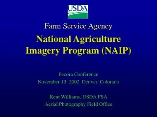
National Agriculture Imagery Program NAIP Informational Meeting. July 19, 2006 Washington DC Jim Mauck U.S. Geological Survey, 511 National Center, 12201 Sunrise Valley Drive, Reston, VA 20192-0002 Ph: 703 648-5561 jmauck@usgs.gov. U.S. Geological Survey. USGS/USDA NAIP Partnership

E N D
National Agriculture Imagery ProgramNAIP Informational Meeting July 19, 2006 Washington DC Jim Mauck U.S. Geological Survey, 511 National Center,12201 Sunrise Valley Drive, Reston, VA 20192-0002Ph: 703 648-5561 jmauck@usgs.gov
U.S. Geological Survey USGS/USDA NAIP Partnership Agency’s have a long history of partnering for aerial photography and orthophotos Mid 1980s – 2000: DOQ production • USGS/USDA developed agreement to funding preliminary production of large quantities of DOQs by USGS • Partnered on development of DOQ specs • Creation of the National Digital Orthophoto Program • Produced over 168,000 DOQs over 10 years: approx $100m program
U.S. Geological Survey USGS/USDA NAIP Partnership Agency’s have a long history of partnering for aerial photography and orthophotos • Archive and Dissemination • Agreements on data storage • Data exchanges • Technical exchanges • ortho specifications • QC and other technical issues • Federal leads in IFTN development
U.S. Geological Survey Shared OMB Performance Metric • Outcome measure • Outcome goal: Geographic Information System users……will have timely access to current orthoimagery to collect, maintain, and utilize crop and land use information, accurately document disaster events, support policy and program implementation and compliance decisions, and maintain cartographic base mapping programs.
U.S. Geological Survey Shared OMB Performance Metric Performance measure for FSA and USGS: • % of the area of 11 Western States for which orthoimagery have been acquired in partnership with FSA and other entities to achieve a 5-year cycle for 1-meter NAIP imagery. Annual Cumulative 2006 36% 36% 2007 20% 56% 2008 0%* 56% 2009 14% 70% 2010 30% 100%
U.S. Geological Survey Shared OMB Performance Metric Performance measure for FSA and USGS: • % of total cost FSA and USGS saved through partnering with other entities for imagery acquisition of 1-meter NAIP orthoimagery. 2006 40% 2007 36% 2008 0%** 2009 31% 2010 44%
U.S. Geological Survey Shared OMB Performance Metric FY 2006
U.S. Geological Survey Shared OMB Performance Metric FY 2007 FY2008 No Western States to be flown FY2009 Idaho, Utah, part of Texas FY2010 Oregon, California, Colorado
U.S. Geological Survey Other FY06 NAIP Partnerships (non-DOI) Alabama $354,506.00 Kansas $378,512.00 Tennessee $100,250.00
U.S. Geological Survey Contact info: Jim Mauck USGS - Geographic Information Integration & Analysis - National Geospatial Programs Office 703.648.5561 jmauck@usgs.gov Dave Roberts, USGS National Orthoimagery Program Coordinator USGS - Geographic Information Integration & Analysis - National Geospatial Programs Office 703.648.4730 drobert1@usgs.gov 7/17/06 USGS_USDA NAIP Partnership.ppt