Download
1 / 21
210 likes | 314 Views
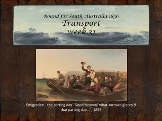
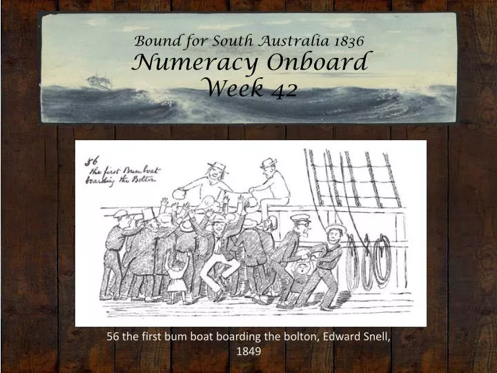
Bound for South Australia 1836 Numeracy Onboard Week 42. 56 the first bum boat boarding the bolton , Edward Snell, 1849. Overview.

E N D
Bound for South Australia 1836Numeracy OnboardWeek 42 56 the first bum boat boarding the bolton, Edward Snell, 1849
Overview Between February and July 1836 nine ships left Britain bound for the newly created province of South Australia. On-board the ships were passengers who over many long months braved the perils of the ocean, including some of the most treacherous seas in the world to begin a new life on the other side of the world. This resource uses the stories from these nine ships as recorded by the passengers and crew in their personal journals.
Contents • Introduction • Journal entries • Inquiry Questions • Relevant images • Glossary of Terms
Introduction Over the past eight months we have read many journal entries, diaries and letters describing the experiences, thoughts, ideas and feelings of those onboard the nine ships. We have followed the authors as they navigate ships, measure distances, organise daily life and make decisions. We have read many examples of the important place numeracy skills and understandings had on these voyages and in the early development of the colony. We can also examine the way numeracy has been used in these 1836 experiences and compare this to the types of numerical thinking we do now. This week we will look closely at some primary sources and think about the role of numeracy in the lives of those onboard the ships in our story.
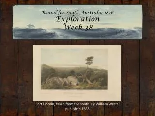
Journals from settlers in South Australia:Sunday 4 December 1836 William Light, who arrived in South Australia on board the Rapid wrote: 4 December-After many shifts of wind, sudden gusts, and a great deal of trouble, we came to an anchor at ten a.m. in seven fathoms water, under Grantham’s Island; the Cygnet was seen at anchor in the bight of the Harbour; at eleven Captain Lipson came on board and remained with us about an hour; he spoke most highly of this harbour and the land, and thought there could be no doubt of its being the best situation for the capital. I certainly was much pleased to find we had so many good places in this part of the world, for should this prove the fittest place for the capital, still the eastern shore of Gulf Saint Vincent would always be an extensive corn and grazing country; however, it was determined we should go on shore together and examine it; we had strong gusts of wind with occasional rain all the afternoon. I will now insert a copy of my letter the Commissioners: Brig Rapid, Port Lincoln,
5 December, 1836.Gentlemen…The necessity of getting fresh provisions increases daily: at Rapid Valley nine labourers out of fifteen are hardly able to do any thing from scorbutic sores on their feet and ankles; another has a finger which I fear must eventually come off having pricked it with a fish bone; one of my boat’s crew on 26 November hurt his fingers between two pigs of ballast, and his hand is now so bad that I much fear he will suffer some months; and out of a small ship’s company there are five with swelled feet and ankles, besides a number at Holdfast Plain suffering from the same cause. These cases will, I hope, convince the Commissioners that I have only acted for the best in sending for fresh stock from Hobart Town. The Cygnet had been sent here from Gulf Saint Vincent with Captain Lipson, to await the arrival of the Governor, and I was sorry on our arrival yesterday at seeing the Cygnet at anchor alone, for I was full of hopes that by this time the Governor had arrived. It is very odd that every time I write I have to report the bad state of the weather; it has been blowing hard occasionally since 26 November, and now a perfect gale, with thick rainy weather. I am decidedly of opinion that Port Lincoln is no harbour for merchant ships; looking at it as a port for men of war well-manned, plenty
of boats, &c. it is very well; it is capacious, and there is excellent holding ground, but the strong gusts of wind shifting all round compass renders the entrance not altogether so safe as the plan of it on paper would indicate. When Captain Lipson came here in the Cygnet, they had fine light easterly breezes all the way; we, however, found that coming into this harbour was more troublesome than anything we have met with since our arrival in South Australia.
Sunday 4 December 1836 Dr John Woodforde, who arrived in South Australia on board the Rapid wrote: The heat is again oppressive having had yesterday and today one of the hot northerly winds which appear to be very frequent. A sealing cutter anchored in our Bay and disposed of a ton and a half of potatoes to us with chease (Colonial) and mutton and bird’s eggs which are very fine. I have today recommended a distribution of potatoes to the labourers as they are showing a disposition to scurvy. We were alarmed last night by observing a light in the offing which had the appearance of a vessel on fire, but which from not altering its bearing we were happily convinced was a conflagration on the opposite side of the Gulf. For the last week we have had fires on all sides of us, it being the season at which the natives set fire to the grass.
Monday 5 December 1836 William Light, who arrived in South Australia on board the Rapid wrote: 5 December-At eight a.m. we reached in between Boston Island and Cape Donington; at this moment the gusts of wind were so strong we were obliged To [take] in top-gallant sails, lower the topsails on the caps, up courses, and down jib. A merchant vessel bound for this port not expecting anything like this after a long passage, may here have her rigging rather slack and not think it necessary to set it up before coming into so fine an harbour; a ship thus situated would have most certainly been dismasted, gone on shore, and on a rocky coast. Trading vessels coming here must anchor at least one mile from the shore, and then landing goods is by no means easy. I much doubt the safety of Gulf Spencer altogether, whether the season of the year was better when Flinders and the French navigators were here I cannot say, but from the little I have seen I think if this be the principal port many ships will be lost. I will now compare the two Gulfs:
GULF SPENCER1st.The mouth of the Gulf has many obstructions by rocky Islands and Reefs, and during the prevalence of the westerly gales a most tremendous sea must be thrown there if we may judge by the high swell we had in crossing it in fine weather.2nd. (Query) Can a strange ship, making Thistle Island, Wedge Island, or any other part just before dark, and a gale coming on, with thick weather, shape her course and run without danger into the Gulf? I say no, for the winds may, and most likely would baffle at the most critical part, that is, between two Islands; her safest plan therefore would be to run for Investigator’s Straits if she could fetch it, if not, she must lay to, and the flood tide in such case being much stronger, she might be drifted into a very unsafe situation. If unfortunately she should be driven upon any of the rocks or shoals it would be destruction to all.3rd. Port Lincoln is certainly a fine capacious harbour, but a great part of it is open to the N.E. and the mouth of it is surrounded, as the chart will show, by islands and reefs, and if we had so much trouble in getting in, and sudden shifting gusts of winds at this season of the year, what may we expect in winter. The westerly gales that would bring a ship up to its mouth would prevent its getting in, when there, and she runs, as I said before, great risk of carrying away her masts.
4th. Merchant vessels after getting in must land their cargoes at a distance of one or two miles from the ships; and in blowing weather, would not be able to land them at all-and I believe it blows hard full half the year round. From what I have seen these two days here, nothing could have been landed even if lighters were prepared, therefore I have reason to say that in this port many days in the year would be entirely lost to trading vessels. GULF SAINT VINCENT 1st. There are no obstructions whatever, and it is certainly much more sheltered from westerly winds than Gulf Spencer.2nd. If a ship be bound to Gulf Saint Vincent she would make the land at the S.W. end of Kangaroo Island, or go the other passage, in either case a westerly gale coming on she is soon out of danger and under shelter. In the next place should the vessel be at the mouth of Gulf Saint Vincent when a gale comes on, she may steer right up the Gulf even in the night by compass, and the farther she goes the less sea she will have, and finally may let go her anchor in seven, six, five, four, or three fathoms water, where, if well found in ground tackle she will most likely ride out well (I speak this from experience), and should even the last disaster happen of going ashore, lives and property would be saved, and most likely the ship herself.
3rd. The harbour in Gulf Saint Vincent is long and more like a river, and sheltered from every wind. The heaviest gale from any quarter can never hurt; and when the entrance is properly buoyed down there is no difficulty whatever; but the material point in favour of this harbour is that in Gulf Saint Vincent there is no fear from any winds except westerly from N.W. to S.W., and these are all fair to run into the harbour with, the only fault is that ships must wait for the tide; but with two of the mud vessels for deepening channels, the shallow parts could easily be made free for ships drawing from 16 to 18 feet water, as they extend but a short distance, and over these shallow parts there is now three fathoms at high water, spring tides. 4th. In the harbour above Holdfast Bay a ship once in may lay alongside a wharf when it is erected, and until that time land her cargo in boats in perfectly smooth water, in the heaviest gale, and not one day lost in any season of the year.
Tuesday 6 December 1836 John Brown, who arrived in South Australia on board the John Pirie wrote: …Unfortunately 2 of our So DownEwes, and 1 Leicester Ewe died this Morng, which I canattribute to no other cause but the want of substantial Food,for the Grass they have been living upon since Thursday lastis so Dry & burnt by the Sun, that very little nourishmentindeed, can be obtain’d from it, and several of our Sheephave become uncommonly Weak in consequence of being solong confined on such miserable stuff, as we hourly expectthe Boats arrival ever since that Day, to take them fromthis place of starvation.
Tuesday 6 December 1836 William Light, who arrived in South Australia on board the Rapid wrote: 6 December-Went on shore with Captain Lipson, Mr Morphett, and Mr Pullen; Captain Lipson had before told me the land here was rich and abundant. We landed at the S.E. end of the port, and walked in a southerly direction for some distance, until we could plainly see the ocean; but I was much disappointed at finding nothing but hard rocks and she-oak. After looking about for some time, we descended into the plain at the head of the Gulf, and here we found some tolerable land, but only in small patches, and some pools of fresh water-high hills surrounding the plain, which might be about four miles in circumference, but in which I do not suppose there were a thousand acres of tolerable land; at the bight a sand runs out a long way, and on the southern side a bed of flat stone extends into the harbour for nearly half a mile. I was much disappointed altogether with the place; at five p.m. we returned on board. I must decidedly say it cannot be thought of as a first settlement; some years hence it may be made a valuable sea port, but can only be after the colony has increased considerably.
Friday 9 December 1836 John Brown, who arrived in South Australia on board the John Pirie wrote: We left Kingscote early YestdyMorng andarrd in Rapid Bay this Eveng, at which place 9 WedderSheep were landed for Colnel Light. One of the LeicesterEwes died Yestdy and a Merino Ewe is uncommonly Weak
Journals from passengers at sea:Saturday 10 September 1836 Young Bingham Hutchinson, on board the Buffalo wrote: Saturday, Decr 10. Fresh breezes & fine. Head E.b N. Wind WestEmployed cleaning ship: bent larboard chain cable.Miles run, 181 + 14680 = 14861. Lat. 36E5′ So. Longe 114E25′ Et.P.M. Mode & cloudy. No bottom 100 fms of line at 11.30.
Inquiry Questions • In what ways did passengers and crew need to use numeracy skills onboard the ships and during the early days of establishing the colony of South Australia? • How did numeracy skills and understandings vary between passengers? How can we use the primary sources to learn about the numeracy skills of the authors? • How does the use of number in this week's journal entries compare to the ways number is used to measure and describe events, ideas and experiences today?
Images Basket of Potatoes, Vincent van Gogh, 1885
"Cheviot Ewe" and "Black-Faced Heath Breed" anonymous artist/engraver. Published by A & C Black, 1853. Ref E8037
Glossary of Terms Brig • A sailing vessel with two square-rigged masts. Fathoms • A fathom is a measure of depth in the imperial system. One fathom is equal to six feet or 1.83 metres. Jib • A triangular sail carried on a rope stay running between the foremast and the jib boom, an extension of the bowsprit. Larboard • The old term for the left hand side of a ship looking forward. The right hand side is starboard. To avoid mis-hearing an order, it is now referred to as ‘port’. Latitude • Latitude is the distance of a point north or south of the equator as measured in degrees. The poles are at 90 degrees north and south. Longitude • Longitude is the distance, measured in degrees, of the meridian on which a point lies to the meridian of Greenwich. On the other side of the earth to Greenwich is a point with a longitude of both 180 degrees east and 180 degrees west. Return to Journal Entries
Scorbutic • caused by scurvy Return to Journal Entries