Download
1 / 30
300 likes | 481 Views
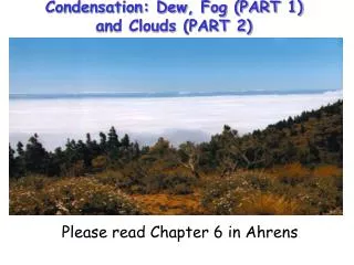
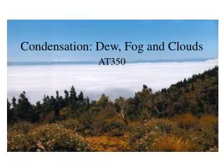
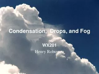
6. Condensation, Dew, Fog and clouds. 6.1 Formation of dew and frost 6.2 Condensation nuclei 6.3 Haze and fog 6.4 Clouds. • Dew: water condensed onto grass and other objects near the ground below the dew point

E N D
6. Condensation, Dew, Fog and clouds 6.1 Formation of dew and frost 6.2 Condensation nuclei 6.3 Haze and fog 6.4 Clouds
•Dew: water condensed onto grass and other objects near the ground below the dew point more likely to form on nights that are clear and calm than on nights that are cloudy and windy Frozen dew (언 이슬): Below freezing point, the dew will freeze.
•Frost(서리): when dew-point temperature is at or below freezing water vapor change directly to ice without becoming a liquid
Haze(연무):Particles suspendend in air, reducing visibility by scattering light dry haze wet haze: when the relative humidity reaches about 75%, condensation begin on the most active hygroscopic nuclei, producing a wet haze
Fog Fog: water droplet suspended in the atmosphere in the vicinity of the earth’s surface that lowers the visibility to less than 1km. How does fog form? • By cooloing (냉각) - • air is cooled below its saturation point • radiation fog, advection fog, upslope fog 2) By evaporation and mixing (증발과 혼합) •water vapor is added to the air by evaporation and the moist air mixes with relatively dry air evaporation fog
Radiation fog: Fog is produced by the earth’s radiational cooling Forms on clear nights Advection fog: It forms as warm moist air moves over a cold surface
Evaporation fog: It forms as cold air moves over warm water. Warm water supplies water vapor. Mixing two unsaturated air • reach saturation
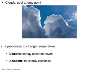
Clouds A visible aggregate of tiny water droplet or ice crystals suspended in the air Classifications of clouds
Cloud identification (구름 식별) High clouds : consist of ice crystals generally form above 6km Cirrus( 권운) Cirrostratus(권층운) Cirrocumulus(권적운)
Middle clouds: composed of water droplet and some ice crystals have bases between 2km and 7km in the middle latitude Altocumuls clouds (고적운) Altostratus clouds(고층운)
Low clouds: almost composed of water droplet have bases below 2km Nimbostratus(난층운)
Stratocumulus(층적운) Stratus(층운)
Clouds with vertical development Cumulus( 적운) Cumulonimbus( 적란운)
Some unusual clouds Lenticular clouds (렌즈운) moist air crossing a mountain Barrier often forms into waves
Mammatus clouds (유방운) : Forms in sinking air Mammatus most frequently form on the underside of cummulonimus (possible beneath cirrocumulus, altocumulus, Altostratus, and stratocumulus) Large-scale anvil subsidence -> instability -> overturning
Contrail (condensation trail) (비행운) • The condensation may come • directly from the water vapor added • to the air from engine exhaust gases • with the cold air to produce saturation. • The release of particles in the • exhaust may even provide nuclei on • which ice crystals form. • Contrails evaporate rapidly in • low relative humidity.
Billow cloud • Created from Kelvin-Helmholtz instability • Kelvin-Helmholtz instability: instability associated with • air flows having marked vertical shear and weak thermal • stratification Cushman-Roisin and Becker, 2007
Nacreous clouds (자개구름) • Form in stratosphere at altitude above 30km • Best viewed in polar latitude during The winter month
Noctilucent clouds (야광운) • Upper mesosphere at altitude above 75km • Best viewed in polar regions at twilight
Cloud observations • Sky conditions: cloud coverage divided into eighths and each amount associated with term such as scattered clouds. • Observations: cloud ceilings • Ceilometer used at airports to determine height from clouds by light or laser striking clouds and then amount and speed of reflected light recorded.
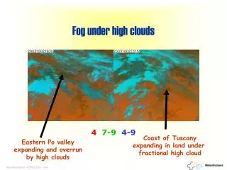
Satellite Observations • Geostationary, polar orbiting • Visible light provides a black and white picture of clouds • Infrared approximates cloud temperature which infers height • Satellites measure many other variables: sea surface temperatures, ozone, upper level features, snow cover, land cover
Geostationary satellites Orbit the equator at the same rate the earth spins Allows continuous monitoring of a specific region Distorted pictures in polar regions due to the low angle
Polar-orbiting satellites • Closely Parallel the meridian lines • Circle the earth at a much lower altitude (about 850km) than • Geostationary satellite (36000km) • Provide sharp pictures in polar regions
IR VIS 출처: 기상위성센터
Imager:provide satellite picture Sounder: gives a more accurate profile of temperature and moisture at different levels in the atmosphere