Download
1 / 24
340 likes | 794 Views
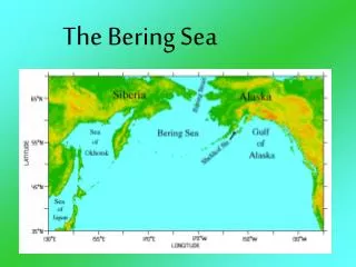
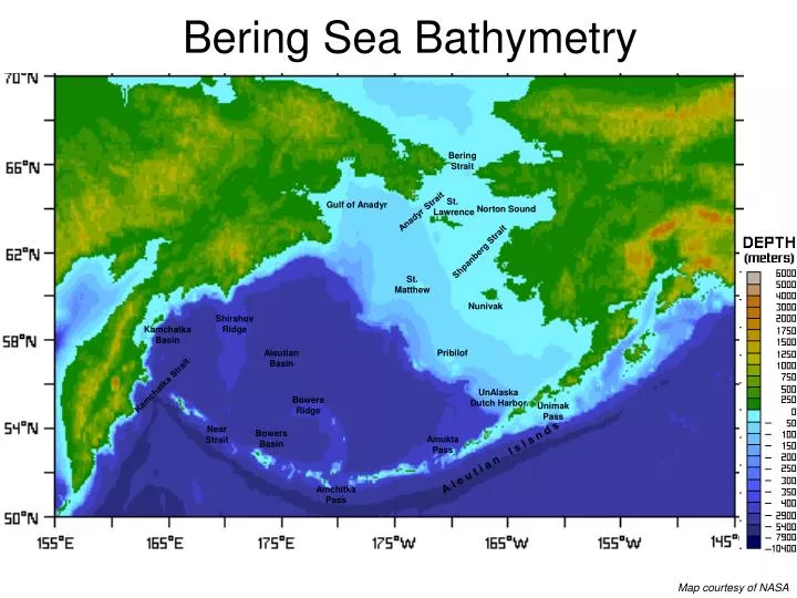
Bering Sea Bathymetry. Bering Strait. St. Lawrence. Gulf of Anadyr. Norton Sound. Anadyr Strait. Shpanberg Strait. St. Matthew. Nunivak. Shirshov Ridge. Kamchatka Basin. Aleutian Basin. Pribilof. Kamchatka Strait. UnAlaska Dutch Harbor. Bowers Ridge. Unimak Pass. Near

E N D
Bering Sea Bathymetry Bering Strait St. Lawrence Gulf of Anadyr Norton Sound Anadyr Strait Shpanberg Strait St. Matthew Nunivak Shirshov Ridge Kamchatka Basin Aleutian Basin Pribilof Kamchatka Strait UnAlaska Dutch Harbor Bowers Ridge Unimak Pass Near Strait Bowers Basin Amukta Pass A l e u t i a n I s l a n d s Amchitka Pass Map courtesy of NASA
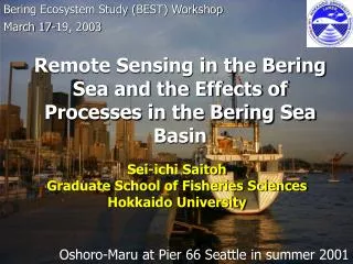
Bering Sea – as an oceanographer would see it OUTFLOW TO ARCTIC Seasonal Sea-ice Bering Strait COASTS - polynyas? - riverine input? St. Lawrence Gulf of Anadyr Norton Sound Anadyr Strait SHALLOW SHELF < 200m - atmosphere driven - mixing - canyons for upwelling Shpanberg Strait St. Matthew Nunivak SLOPE - topographic steering? Shirshov Ridge Kamchatka Basin DEEP BASIN ~ 3500m - nutrient source? Aleutian Basin Pribilof Kamchatka Strait UnAlaska Dutch Harbor FRESHWATER FROM ALASKAN COASTAL CURRENT Bowers Ridge Unimak Pass Near Strait Bowers Basin Amukta Pass A l e u t i a n I s l a n d s Amchitka Pass PACIFIC INPUT – through a leaky Ridge Map courtesy of NASA
Ice coverage on the Southeast Bering Sea shelf, 1972-2006 • Decreased ice cover since late 1970s • Very little or no ice in recent years (increase in 2006) Courtesy of Jim Overland, PMEL
Feb 2001 observed Feb 1999 observed Feb 2001 modelled Feb 1999 modelled
2006 Sea Ice Extent 2006, 2007? Courtesy of Jim Overland, PMEL
Main Currents in the Bering Sea BERING STRAIT THROUGHFLOW Anadyr Strait Shpanberg Strait KAMCHATKA CURRENT ~ 10 Sv, variable (7-15 Sv) - may recirculate BERING SEA SHELF BERING SLOPE CURRENT - turns into meanders and eddies ALASKA COASTAL CURRENT - fresh!!!, but ~ 2 Sv (Alaska ..not Alaskan ..) Aleutian North Slope Current ALASKAN STREAM ~ 20 Sv Stabeno et al, 1999
AMCHITKA Net ~ 2-3 Sv North (-4 to + 4 Sv) UNIMAK ~ 0.3 Sv North NEAR > 10 Sv (6-12) North SEGUAM ~0.4 Sv North AMUKTA ~ 4 Sv North AKUTAN ~ 0.1 Sv North BULDIR ???? TANGA ???? TOO SHALLOW TO MIX NUTRIENTS TOO DEEP TO MIX NUTRIENTS GOOD TO MIX NUTRIENTS Aleutian Passes– “a porous boundary for fluxes of water, heat, salt and nutrients” Stabeno et al, 2005 ALEUTIAN NORTH SLOPE CURRENT ~ 10 Sv (4Sv > 1000m) ACC~ 2 Sv Shallow Fresh Seasonal ALASKAN STREAM ~ 20 Sv SAMALGA ???? KAMCHATKA ~ 12 Sv (5-15) South but northward deep flow to Bering Sea Deep Water
Aleutian Passes– “a porous boundary for fluxes of water, heat, salt and nutrients” Stabeno et al, 2005 NUTRIENTS?? FRESH = Flow can be bidirectional within a Pass = Barotropic important (geostrophic estimates too low) = Maybe seasonal, wind-driven?, = Meanders of Alaskan Stream = Tidal mixing very strong = (at least ) 10 passes = deeper in the west = medium depth channels source for bottom nutrients
Exit route! Anadyr waters (colder, saltier, nutrient-rich) Alaska(n) Coastal Current (warm, fresh, seasonal) Bering Shelf Waters (in between!) By providing an exit, Bering Strait influences flow over the Bering Sea Shelf (although the deep Bering Sea Basin may not care) The Bering Sea/Bering Strait Relationship ANSF= Aleutian North Slope Current BSC = Bering Slope Current From Stabeno, Schumacher & Ohtani, 1999
et al., JGR, 1988 CSR, 1993 Anadyr and Shpanberg Straits Generally Northward? Must be comparable to Bering Strait Anadyr Stronger Summer and Winter “modes” different Strongly related to wind - thus highly variable NOT WELL MEASURED – what about models??
23 year mean flow field from a model Clement et al, 2005, DSR .. but really need data to verify it (NB simulation of Bering Strait flow ok in some senses, not ok in others)
Weingartner et al, Website Compared to observations?(not many observations) Overland et al, 1996, JGR - drogue-less buoy (thus wind and current driven) - 2 months from Cape Navarin to Bering Strait
Johnson et al, JPO, 2004 Stabeno and Reed, 1994, JPO Herman et al, 2002 adapted from Stabeno et al, 2001 Evidence from drifter tracks Bering Slope Current = fed from Aleutian North Slope Current = initially follows slope, then appears to leave it = meandering with eddies = upwelled waters/eddies for productivity
, JPO, 1975 Very tricky to get something meaningful if - eddies are important (THEY ARE!) - barotropic is important (IT IS!)
Bering Sea Greenbelt Shumacher and Stabeno, http://www.pmel.noaa.gov/np/pages/wnew_bioprod.html
14th June 2000 27th June 2000 18th May 2000 15th May 2002 18th June 2001 7th June 2001 23rd May 2002 SeaWiFs false color image of Chlorophyll-A Okkonen et al, DSR, 2004
Best Science Plan, from Kachel Regimes and Fronts of the Bering Sea Shelf COASTAL DOMAIN - inshore of 50m depth contour summer = well mixed/weakly stratified ------Inner or Structural Front (5-30km wide)------- MIDDLE SHELF DOMAIN - between 50m and 100m depth contours summer = strongly stratified 2 layer - top – wind mixed - bottom – tidal mixed T diff > 8 deg, density set by T ------Middle Transition Zone (~ 50 km wide)--------- OUTER SHELF DOMAIN - between 100m and 200m depth contours summer = 3 layers - top – well mixed (wind) - middle – increasing density - bottom – well mixed (tides) --------------------Slope Front------------------------------- SLOPE WATERS - in water depths > 200m over the slope Stabeno et al, 2001, Kachel et al, 2002 Hunt et al, 2002
Tides important!!e.g. Kowalik and Stabeno, 1999, JGR Mean Circulation ~ 5 cm/s Tidal circulation ~ 30 cm/s Rectification and trapping
Many SST fronts Belkin and Cornillon, 2005 = complex = fronts align with topography = mostly over shelf
Best Science Plan, from Kachel COLD POOL =Cold (< 2 deg C) Water at depth, covered by warmer surface waters = Variable year to year = Important for fish!! The Cold PoolStabeno et al, 2002 WINTER - ice melt - ice formation SPRING/SUMMER - surface warming - stratification M4 M2
Depth Averaged Temperature (°C) at M2: 2 deg C increase in winter after 2000: above freezing point. Summer 2005 warmest temperature Data from Stabeno, courtesy of Overland
PDOPacific Decadal OscillationMantua et al, 1997 WARM PHASE COLD PHASE Typical wintertime Sea Surface Temperature (colors), Sea Level Pressure (contours) and surface windstress (arrows) anomaly patterns during warm and cool phases of PDO leading principal component of North Pacific monthly sea surface temperature variability (poleward of 20N for the 1900-93 period) courtesy JISAO
PDO important VP important .. recently also need Victoria PatternBond et al, 2003 SST = PC1(t)* EOF1(x,y) + PC2(t)* EOF2(x,y) + .. PDO Victoria Pattern = different pattern of SST variability = now second EOF more important