Download
1 / 22
220 likes | 322 Views
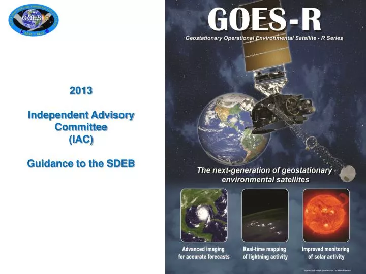
2013 Independent Advisory Committee (IAC) Guidance to the SDEB. 2013 Independent Advisory Committee (IAC) Guidance to the SDEB. March, 2013 Independent Advisory Committee Members David Byers Brant Foote Jim Gleason John Le Marshall Paul Menzel Rolf Stuhlmann

E N D
2013 Independent Advisory Committee (IAC) Guidance to the SDEB
2013 Independent Advisory Committee (IAC) Guidance to the SDEB March, 2013 Independent Advisory Committee Members David Byers Brant Foote Jim Gleason John Le Marshall Paul Menzel Rolf Stuhlmann Alexander Trichtchenko Tom VonderHaar John Zapotocnyc William Campbell
Introduction GOES-R lightning mapper work has made significant advances since the last meeting and real time application of lightning data is underway. Their has been increased attention given to Satellite Data Assimilation, and potential gains demonstrated in a number of cases for this activity, however this work in many cases still requires a planned transition to operations to ensure the community benefit from this activity. Multichannel RGB image enhancement has made quite significant advances since the last meeting. RGB images however should be complemented by radiances as RGB enhancements can always benefit from fine tuning for local advantage and may also benefit from accompanying quantitative data. Generation of C++ code for Baseline Products is underway and the delivery of the Option 2 (Future Capability) Products is continuing with five priority capabilities funded. Among Option 2 Products for example the Low Cloud and Fog and SO2 detection products are needed for aviation safety . It is important the benefits available from the Option 2 Products are not lost to the community. 3
Introduction There is a need to optimise generation and assimilation of Atmospheric Motion Vectors. This includes improved error characterisation and data assimilation methodologies. There is also a need for direct assimilation of geostationery radiances in operational NWP. These observations should be assimilated in a way that takes advantage of their almost time continuous nature The development of the synergistic processing for Leo and Geo-data is an important step and the use of common software and an Enterprise approach will aid this process. Together with the use of models and data assimilation, the Polar and Geo-satellite applications and products are entering a new era. The development of CALVAL plans continues and needs to be accompanied by a first-light” data plan and related data stewardship and access recommendations. Proving Ground activities are increasing dialogue between forecasters and researchers in a very positive way. These exercises should be sustained and expanded as much as possible. 4
Introduction Quantitative Derived Product Images (DPIs) of satellite products should be inspected along with or in favor of qualitative RGBs in the proving ground exercises. Fog/Low Stratus work is impressive; again proving ground exercises should be continued. Convective Initiation work is progressing; proving ground work should continue to be supported. Merging of geo (ABI & LM), radar and the modelling getting good attention. Overshooting tops and CAT progress is encouraging; an impressive list of publications is available. Continued quantitative investigations and proving ground work should be supported. Cloud height (ACHA) work is impressive; a uniform product from leo and geo is emerging. This product is ready for operational consideration. 5
General Findings Recommendation 1 (1)Scientists must remain closely connected to their algorithms during operational implementation - their role in product generation efficiency, validation, and evolution must be enabled by close communication / collaboration with the vendor of the ground system. However science developers should not be the principal assessors of their own products.
General Findings Recommendation 2 (2) Preparations must be made for rapid software updates with scientist engagement as past experience with real data reveals issues (data striping, rectification issues, geo diffraction effects, missing or saturated data …) and therewillbe situations when the algorithm change processisgoingfrom "broken to working " ratherthanfrom " adequate to better ". Update strategies to be used before Day 1 and after Day 1 need to be drafted. A pre-planned product improvement strategy must be developed for the program. Recommendation:Scientists need early access to the operational GOES-R C++ code and a process needs to be established for rapid day 1 and after changes. 7
General Findings Recommendation 3 (3) The Himawari-8 satellite will carry an Imager very similar to the ABI. As a result preoperational access to Himawari data is currently being arranged by MOA . Recommendation: Scientist access to Himawari data and documentation of differences from GOES-R should be arranged so that working experience with real ABI data can mitigate some issues before GOES-R launch. Interaction with Australian scientists introducing Himawari data into forecast systems is also encouraged. Recommendation 4 (4) Optimal GOES-R scanning and pre-processing scenarios still needs exploration (e.g. scan south to north for more timely NH data, de-striping before rectification). Recommendation: Undertake a study to demonstrate the difference in GOES Perfect Projection of data when destriped then rectified (information about image construction from scanning detector array needs to be made available). 8
General Findings Recommendation 5 (5) Effective and timely CAL/VAL is essential for high quality input data for product generation. A special briefing from the CAL/VAL Team has this provided valuable information. Recommendation: Extended post-launch CAL/VAL campaigns for validation of GOES-R sensor measurements and derived products are essential and must be planned. Post-launch validation must include considerations for field experiments; leveraging and contributing to existing plans for NASA/DOE/NOAA field experiments must be undertaken. The IAC strongly supports GOES-R Science Program Office activity in relation to CAL/VAL and would benefit from a briefing on plans for post-launch validation. The detailed Basis of Estimate should take into account other planned validation campaigns and assets as much as possible. Coordination with other programs requires early commitment.
General Findings Recommendation 6 (6) Preparations for routine production of Option2 (Future Capability) Products (prior to operational production) are underway as part of the Enterprise processing system. Recommendation: This activity should be sustained as much as possible so that affiliated scientists get an opportunity for evaluation with ABI data and the user community gets access and familiarity with the product
General Findings Recommendation 7 (7) The opportunity for a LEO complement to GEO measurements for product generation has been enhanced greatly by the established of the Enterprise processing system. More effort needs be encouraged for combined products where LEO benchmarks are temporally continued with GEO measurements. An example could be LEO day-night band observations of fog can be extended into early morning with GEO visible composites. Caveats are that LEO and GEO must provide coherent depictions hence physics issues need attention (e.g. viewing angle differences, diffraction issues from GEO but not LEO ...). For example, LEO vs GEO Vis/NIR algorithms must account for viewing angle and solar illumination differences characterizing the two systems. Another example already underway is the generation of atmospheric stability fields. 11
General Findings Recommendation 8 (8) Better utilization of temporal continuity for product generation and QC is progressing. Some algorithms are now making good use of the temporal advantages offered by geostationary measurements; Recommendation: All algorithm developers should consider ways to make better use of temporal consistency checks and / or QC. This is important for products such as snow cover, SST and NDVI where time variation may be small. 12
General Findings Recommendation 9 The requirements for data stewardship and access needs better articulation and planning. . Recommendation: In relation to data stewardship there is a requirement for the development of a comprehensive data stewardship plan which includes a strategy for stewardship of level 0 data. With the establishment of the satellite series and subsequently Level 0 data will need to be kept for one year with selected sequences of the downloaded data being kept for future reference. 13
General Findings Recommendation 10 (10) Data assimilation of hourly radiances and products (eg. AMVs) in NWP models requires more attention (eg use of 4DVAR). JCSDA engagement in this direction need to be strengthened. Moreover, use of satellite data over land (surface viewing as well as upper tropospheric / lower stratospheric moisture sensitive measurements) in NWP needs to be enhanced. Overall we need to be prepared for the generation and continuous assimilation of (clear) radiances and hourly winds. Surface emissivity also needs to be updated in the CRTM.
General Findings Recommendation 10 Problems still exist in the treatment of the visible and visible affected IR bands in the CRTM; these have not been adequately validated. This is becoming an increasing issue for operational implementation of all code/algorithms using these spectral bands as we get closer to launch. The CRTM team should be supported in their attempts to resolve these issues. In general NWP readiness for GOES-R needs to be pursued as a high priority activity.
General Findings Recommendation 11 (12) The Satellite Programs and the JCSDA should respond to the rising need for Data Assimilation Impact metrics tailored to Forecaster/Stakeholder understanding including those for regional, high impact DA tests. As a result metrics such as rainfall forecast accuracy, extreme rainfall prediction accuracy, hurricane intensity, track and wind speed forecast accuracy and storm position and timing accuracy need to be estimated. In addition all DA and other Impact studies and results should be respected ; but not widely communicated until they are produced in a study of appropriate length and significance. 16
General Findings Recommendation 12 (11) ABI does not offer a sounding product; ABI offers layer adjustments to a NWP model initial vertical profile estimate. This must be made clear in the product designation. Use of the word “sounding” is totally inappropriate and misleading. Utilization of the LEO high spectral resolution data rendering of moisture vertical and horizontal distributions needs to be encouraged. Recommendation: Regional forecasts and nowcasts necessary for a Weather Ready Nation will have to make better use of the information content from AIRS, CrIS, IASI data and GPS. Between LEO sounding coverage, GOES-R data should be used to monitor temporal profile (atmospheric stability, etc) changes. Recommendation: To pursue the missing continuous viewing essential for capturing the rapidly changing conditions that go with severe weather, the move to a GEO high spectral resolution IR sounder should receive higher priority within NOAA. A Transition Plan and Transition Survey should be completed as soon as possible. 17
General Findings Recommendation 13 (13) In relation to supporting operational forecasting, the value of VIIRS in AWIPS will be dependent on the timeliness of the data. Currently the plan is to use the IDPS at NESDIS as the source, however this will result in upwards of 2 hour latency from observation time. Recommendation: Use should be made of a network of DB sites from CONUS and OCONUS to reduce latency to within 30 minutes. Note this will also improve the availability of CrIS and ATMS data and products and LEO/GEO products. 18
General Findings Recommendation 14 (14) In relation to AWIPS2 and product development, we often need different players with satellite experts, to bring radar and NWP knowledge and skills to product development teams in order to achieve the vision of fused-integrated observations with NWP. Satellite developers don’t usually have understanding of radar and vice versa and we need avoid new stovepipes replacing the old ones. In particular we need this to come together for the Proving Ground. In addition for AWIPS2 RGB images however should be complemented by radiances as RGB enhancements can benefit from fine tuning for local advantage and RGB images can also benefit from accompanying quantitative data. AWIPS2 can also benefit from the availability of derived product images (DPI) and readily accessible tendency displays 19
General Findings Recommendation 15 (15) Because of the importance of training, to the success of the GOES-R program, it is recommended that the application production team subject matter experts be involved in training. This may be done in a number of ways such as provision of material and in training the trainers. It is also important to acknowledge GOES-R Program Science Office support for training and the outstanding work done by COMET and the VISIT Programs in relation to GOES-R education and training. ( COMET/VISIT contact Tony Mostek) 20
General Findings Recommendation 16 (16) In relation to space weather, NGDC has now presented their part of the plan for operational processing of the Level2+ products. For software development, NGDC has taken advantage of software already developed for space weather applications. The issues related to the production of Level 2+ data from Level1 data still needs to be resolved. Recommendation: NWS and NESDIS should consider NGDC's proposed solution to current Level2+ processing issues noting these products are of significant operational benefit. Recommendation 17 It should be noted that NGDC's has an increased role in CAL/VAL and is working closely with the CAL/VAL Working Group planning pre and post launch activity. Recommendation: A CAL/VAL team needs be formed in the short term to support the full set(4) of SWX instruments and ensure their readiness pre launch.
Looking Down Is Looking Up TC LAURENCE - Dec. 2009