Download
1 / 21
230 likes | 384 Views
NOAA Integrated Ocean Observing System (IOOS). Zdenka S. Willis Director, NOAA IOOS Program Office 19 September. Global Earth Observation System of Systems (GEOSS). 70 Member Countries & the European Commission 46 International Organizations A distributed system of systems

E N D
NOAA Integrated Ocean Observing System (IOOS) Zdenka S. Willis Director, NOAA IOOS Program Office 19 September
Global Earth Observation System of Systems (GEOSS) • 70 Member Countries & the European Commission • 46 International Organizations • A distributed system of systems • Improves coordination of strategies and observation systems • Links all platforms: in situ, aircraft, and satellite networks • Identifies gaps in our global capacity • Facilitates exchange of data and information • Improves decision-makers’ abilities to address pressing policy issues • GOOS is the global ocean component of GEOSS
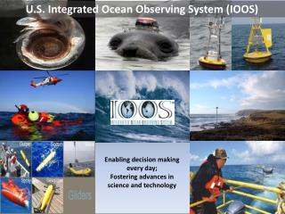
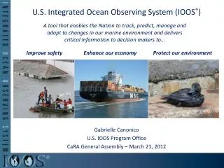
U.S. IOOSVision • Integrated Ocean Observing System (IOOS) • Enable rapid assessments of current states of marine and estuarine systems, and the timely detection and prediction of changes in them, through the continual provision of routine and reliable data and information in forms and at rates specified by the users. • Complex undertaking dependent on federal, regional, state, local, academic, & private sector contributions Example of a regional observing system in Monterey Bay, CA Provide the right information, in the right format, at the right time, to the right people, to make the right decisions.
Background on NOAA’s IOOS Focus NOAA IOOS Definition: The U.S. Integrated Ocean Observing System (IOOS) is a coordinated network of people and technology that work together to generate and disseminate continuous data on our coastal waters, Great Lakes, and oceans. IOOS is our nation’s ocean contribution to an international effort called the Global Earth Observation System of Systems (GEOSS), which is designed to continuously and comprehensively monitor Earth and transmit observations globally. IOOS supports both a coastal and global component of ocean observing. Organize for Success Integrate Data • Establish NOAA IOOS Program Office • Lead and manage NOAA’s IOOS efforts • Support external collaboration • Identify and encourage similar data integration, test and evaluation approach by partners • Develop an Initial Operating Capability: Data Integration Framework (DIF). • Integrate priority IOOS core variables and deliver to end users and models • Quantify product improvements
NOAA’s Organizational Relationships Interagency Connections NOAA IOOS Activities Interagency Committee on Ocean Science and Resource Management Integration (ICOSRMI) NOAA Administrator NOAA Ocean Council IOOS Oversight NOAA Observing System Council NOS Assistant Administrator OAR Assistant Administrator Joint Subcommittee on Ocean Science and Technology (JSOST) Interagency Working Group on Ocean Observations (IWGOO) NOAA IOOS Program Office Director Ocean.US IOOS Program Office IOOS Project Management Program Operations Regional Coastal Component Guidance & Requirements Capacity & Capabilities Observations Data Management&Communications Modeling & Analysis Education Research Leveraging existing NOAA-wide capabilities
IOOS Program Activities Program Operating Plan Strategic Plan • The NOAA IOOS strategic plan will serve as the guiding document to inform business operations and technical planning • IOOS Program Office held strategic planning workshop, which included participants from all NOAA Line Offices, as well as NDBC, CSC, NOAA Budget, and PPI • The draft plan is in the review process and will be finalized late summer – to early fall. • Consistent with IWGOO Strategic Plan Alternatives & Quads Legislation Communication/Engagement • Communication: Distribute Z-grams • Regional: Visited regions • Industry: Briefed 4 Industry Forum • IWGOO: Provides ExSec; IWGOO Strategy • Interagency: USACE/NOAA IOOS wave plan effort • IOOS legislation is proposed in the 110th Congress • The House introduced two IOOS bills • Senate bill S.950 authorizing IOOS was recently reported out of Committee • FY08 Senate Appropriations Language
“Lead the integration of ocean, coastal, and Great Lakes observing capabilities, in collaboration with Federal and non-federal partners, to maximize access to data and generation of information products to inform decision making and promote social, economic, and environmental benefit to our nation and the world.” NOAA’s IOOSMission Example of an integrated ocean observation system Source: Draft NOAA IOOS Strategic Plan
Information Needs IOOS Core Variables Characterize the state of the global climate system and its variability Temperature Salinity Sea Level Surface currents Ocean color Bathymetry Surface waves Ice distribution Contaminants Dissolved nutrients Fish species Fish abundance Zooplankton species Optical properties Heat flux Bottom character Pathogens Dissolved O2 Phytoplankton species Zooplankton abundance Integration Long-term data series, coordinated in space and time Improved models (e.g., hurricane intensity, coastal inundation, and harmful algal bloom model) Improved ecosystem assessmentsUpdated management approaches Improved access to data, and scientific information Integrate Data: NOAA Mission Requirements Drive Data Integration Needs NOAA Decision Tools Problems The global climate is not well understood Hurricane Intensity Model Coastal populations are at risk from weather, climate & natural hazards Coastal Inundation Model Harmful Algal Bloom Model Our ocean, coastal and Great Lakes ecosystems are complex; many are at risk Integrated Ecosystem Assessment Expanding the Marine Transportation System
Core Variable Integration Problem: Temperature (Example) PLATFORM Data Distribution Archive NOAA Ship Synoptic NCDC NOAA Ship Archive NOAA Ships ARGO Delayed data GDAC ARGO Profiling Tropical Moored Buoys Weather Buoys NODC NDBC Drifting Buoys DART C-MAN SWIM NCDDC SWMP NERRS CDMO VOS (xbt) OAR AOML CREIOS NMFS PACIFIC I. FSC NWLON CO-OPS Single Sat. Pass Data CLASS OSDPP Satellites Multiple Sat. Pass Data COAST WATCH
Decision Tools: Integrated Core Variables for Models Process Flow Evaluate NOAA modelsthat impact highest-priority problems Integrate variables needed to achieve benchmarked improvements Quantify progresstoward defined modeling improvements Identify additional source(s) of error within model Identify remaining IOOS core variablesneededto reduce error None? Selectnext set of priority core variablesbased on impacts to NOAA products
NOAAIOOS Data Integration Framework Systems Engineering & Standards Development Hurricane Intensity Model Temperature Salinity Sea Level Currents Color Coastal Inundation Model Harmful Algal Bloom Model Data Access & Exchange Data Standards Integrated Ecosystem Assessment Temperature Salinity Sea Level Currents Color External sources of 5 Core Variables (consistent with NOAA standards) Data Integration Framework (DIF) Months 0-12 Month 18 Month 24 Month 36 Test & Evaluation Benchmarked Product Improvements for Operational Use Integration of 5 IOOS Core Variables Integrated Variable Ingest for Select Data Products NOAA 5 Core Variables Hurricane Intensity Model • Integrated information services for NOAA programs • Identify observation gaps • Validated enhanced data products • NOAA’s Data Integration Framework Enhanced decision support through: • Product Enhancement • Test & Evaluation • Verification & Validation Systems Engineering: Coastal Inundation Model Harmful Algal Bloom Model Integrated Ecosystem Assessment NOAA MISSION OBJECTIVES REGIONAL COASTAL NEEDS • Future State: • Regional-coastal data integration for • Regional scale data and information products and services
Harmful Algal Bloom Data Flow Focus Area Harmful Algal Bloom Transport simulation for the forecast
Common Thread All wanted additional observations and easier access to data Efficiency gains identified as a result of improved data access. Specific Customer Comments Hurricane Intensity Timely access to standardized quality control data Access to regional Observations Harmful Algal Blooms Improved data transport into “HAB” model Standard formats and distribution of currents (NDBC and others) Standard formats and distribution of NOAA ocean model outputs Integrated Ecosystem Assessment Subsetting capability and standard naming units Access to time series data for each of the priority parameters Coastal Inundation Streamlined access to latest bathymetry and topography in common formats Access to timely regional observations Standard data formats and additional water level data to validate the accuracy of their inundation model forecasts Summary of Customer Needs
Data Access & Exchange Temperature Interoperability Test May/ June 2007 DATA NCDDC OGC WFS WFS version 1.0.0 Color NWS OGC WFS WFS version 1. CORMP OPeNDAP Currents OGC WFS Temperature CSC Jim Boyd, John Ulmer, Daniel Martin W3C SOAP Web services Sea level CO-OPS W3C SOAP GoMOOS OPeNDAP OPeNDAP Salinity NERRS/ CDMO W3C SOAP Temp SEACOOS OPeNDAP DRDS Status: Report Complete • Data • Incompatible data formats • Inconsistent Data structures • Different forms of temporal/spatial expressions • Different data dictionaries/vocabularies • Varying formats for lat/long • Metadata • Metadata generally missing • Information Technology • OPeNDAP servers unavailable • Transport protocols generally correct, some outdated
Data Standards Functional Categories DATA Color Currents Sea level Salinity Temp D A T A T Y P E S X = Addressing; P = partially addressing; ? = under review; Remainder of the standards reviewed in following efforts
Standard Processes (All Welcome) NOAA DIF Process IOOS DMAC Process Days STANDARDS SOLICITED 0 IDENTIFY STANDARDS FOR NOAA DIF IMPLEMENTATION DMAC-STNON-TECHNICAL DOCUMENT FOR DMAC-STPROCESS FORMAT SUBMITTED 45 DEPLOY INITIAL NOAA DIF DMAC-STTECHNICAL REVIEW NOAA DIFEXPERIENCE PROPOSED 120 Experience Informs Evaluation PUBLICCOMMENT DMAC-STEVALUATION IMPLEMENTED STANDARDSFOR COMMUNITY REUSE 270+ RECOMMENDED
Version 0.1 Standards: Submitted to NOAA IOOS – in work The system, by Nov 07, will have 3 redundant national servers plus 4 regional servers that feed into the 3 national servers. FY07 IOOS Funds Increased Coverage Requirement in NOAA PPBES FY10-14 (early in the cycle) 85 HFR Sites x 700 Pts/Site = 59500 Data Pts Figure from SCCOOS website National HF Radar Plan
Regional Capacity • Register produced by NOAA CSC and NMSP • 679 platforms registered, 1969 distinct parameters • NOAA NDBC processes 2.5M observations (physical) • Capacity Exists • Integration into National IOOS • Optimization • Operations, Maintenance
Example of ocean and coastal observation data. IOOS Observation Registry - many data sources from around the U.S. IOOS Challenges • Technical • Not easy to integrate data from many sources • Need to provide data in formats and rates that are useful for broad array of applications • Program • IOOS is not “owned” by 1 agency or entity • Difficult to engineer a cohesive and operation system with many stakeholders that contribute to and use the system • Budget • Fiscal constraints always an issue (no one agency can do it all) • Coordinating federal budget requests across agencies is not typical and not easy • Moving from earmarks to merit based awards
Summary • IOOS is maturing, but more work needed to evolve IOOS into a fully operational system. • NOAA IOOS Program Stood Up – focused on execution • In Presidents Budget in FY08 • DIF effort supports NOAA, regional and other federal integration • Standards • Technical Processes • Lessons learned • NOAA engagement with Interagency Partners • Through Ocean.US and IWGOO • E.g. OOI/IOOS Industry Work Shop; USACE • NOAA engaged with Regions • Developing processes for long term sustainability relationship • Integrating Regional capacity into National IOOS