Download
1 / 15
150 likes | 286 Views
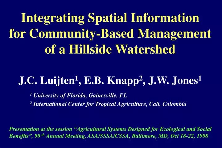
Integrating Spatial Information for Community-Based Management of a Hillside Watershed. J.C. Luijten 1 , E.B. Knapp 2 , J.W. Jones 1 1 University of Florida, Gainesville, FL 2 International Center for Tropical Agriculture, Cali, Colombia.

E N D
Integrating Spatial Informationfor Community-Based Management of a Hillside Watershed J.C. Luijten1, E.B. Knapp2, J.W. Jones1 1 University of Florida, Gainesville, FL 2 International Center for Tropical Agriculture, Cali, Colombia Presentation at the session “Agricultural Systems Designed for Ecological and Social Benefits”, 90 th Annual Meeting, ASA/SSSA/CSSA, Baltimore, MD, Oct 18-22, 1998
The Watershed • Hydrologic perspective: Synonym for drainage basin or catchment area. • Systems perspective: A complex and dynamic ecosystem, with a hydrological basis, and in which natural processes occur, agricultural and/or industrial activities take place, and people interact with each other and with their natural environment.
Watershed Characteristics • Watersheds components (land and water resources, people, farms, industries, organizations, etc.) exist in association with one another and interact with their environment. The human factor is important! • Watersheds have hydrological and ecological functions, and provide communities and their members with human needs and services. • Watersheds provide a vehicle to consider critical linkages between upstream & downstream effects and on-farm & off-farm effects. • A watershed is a useful scale on which to address multiple stakeholders and common property/open access resource issues.
Spatial extent: W 76o36’20” - 76o28’30” N 2o41’16” - 2o52’08” Colombia, South America Rio Cabuyal Watershed (3,245 ha, in Departmento del Cauca) Equator 20 km 14.5 km
Digital Elevation Model 1200-1250 1250-1300 1300-1350 1350-1400 1400-1450 1450-1500 1500-1550 1550-1600 1600-1650 1650-1700 1700-1750 1750-1800 1800-1850 1850-1900 1900-1950 1950-2000 2000-2050 2050-2100 2100-2150 2150-2200 2200-2250 2250-2300 2300-2350 Meters above MSL
Cabuyal watershed, Colombia 20 km S 14.5 km N
Watershed Management • Decision makers and watershed managers aim at minimizing conflicts and guiding future development in directions that are desirable for local communities and the natural resource base. • It has been recognized that environmental and natural resource problems communities face can be addressed effectively through collective action across the entire watershed. • Accurate data on the state of resources and DSS allow decision makers to systematically analyze options for future resource use. Generic Modeling and Simulation Approach
Decision Support System • A suite of GIS-based tools for information supply - water routing; stream and sub-basin delineation. - statistics and indicators on watershed characteristics. • A GIS-based Spatial Water Budget Model A continuous, watershed scale, grid-based simulation model that estimates water supply and demand over space and and time. (a) land unit water balance (b) water flow to streams (c) stream water flow (d) water storage in reservoirs (e) water use (agricultural, industrial, domestic)
Materials • Software - ArcView GIS 3.1 with Spatial Analyst extension - Soil Water Balance Model is entirely written in Avenue • Basic Spatial Data - Digital Elevation Model - Climate, farm and industry locations, communities - Soils, geology, land use (Landsat TM imagery) • Domestic, industrial and agricultural water demand
IR P ET RO Soil Layer 1 (root zone) D Soil Layer 2 LF Soil Layer 3 Impervious Rock bed Land Unit Water Balance P = Precipitation IR = Irrigation ET = Evapotranspiration LF = Lateral Flow RO = Surface Runoff D= Drainage
Land Stream Vj-1,j VLF, j VRO, j VST, j Vj ,j+1 VUSE, j Stream Water Flow Vj,j+1 = daily flow volume from stream cell j to j+1, m3/d VRO,j = surface runoff into stream cell j, m3/d VLF,j = lateral flow into stream cell j, m3/d VUSE,j = water extracted from stream cell j, m3/d VST,j = water stored in stream cell j, m3/d
Water Extraction • Numerous water extraction points anywhere in the stream. • Different water volumes can be extracted each day. • Simulation performed on a daily basis. • Example water uses: • - irrigation • - domestic use • - cassava and coffee processing industries • - reservoir management
m3s-1 Rio Ovejas, measured and simulated stream flow, 1974 100 90 80 70 60 50 40 30 20 10 0 Jan Feb Mar Apr May Jun Jul Aug Sep Oct Nov Dec
Simulated streams and flow rates (minimal 5 l/s), Cabuyal NW flow direction Flow at Outlet 1: 50 l/s (Aug.) 2: 200 l/s (Oct.) 3: 500 l/s (Nov.) 4: 2000 l/s (Jan.) 1 2 3 4
Distance to streams, Rio Cabuyal watershed Meters 0 - 100 100 - 200 200 - 300 300 - 400 400 - 500 500 - 600 600 - 700 700 - 800 800 - 900 900 - 1000 > 1000 0 - 100 100 - 200 200 - 300 300 - 400 400 - 500 500 - 600 600 - 700 700 - 800 800 - 900 900 - 1000 > 1000 Dry season Wet season Mid season